Standing wave south of the Aleutian Islands
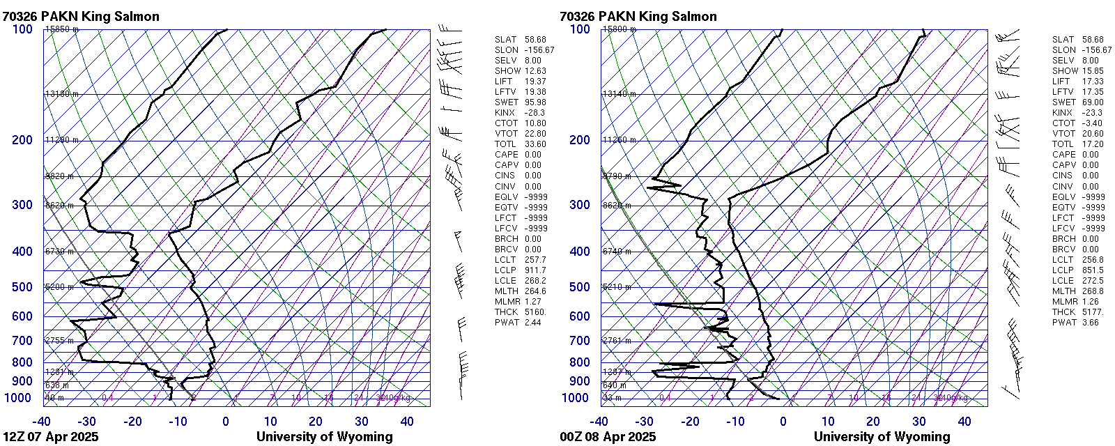
GOES-18 True Color imagery during the day on 7 April, above, shows the development of a standing wave downwind of the elevated topography on the Aleutian peninsula between King Salmon and Perryville. (Note also the faint signal of volcanic ash as discussed here) What atmospheric conditions support the development of these clouds? Soundings from King Salmon AK at 1200 UTC/7 April and 0000 UTC/8 April, below, taken from the University of Wyoming Sounding site, show very strong northerly winds at low-levels and near dry-adiabatic conditions at 1200 UTC. At 0000 UTC, the low-level winds are relaxing but the steep low-level lapse rate persists. By 0000 UTC, Aleutians are starting to be affected by a system dropping down from the north as evidenced by changes in the cloudiness in the animation shown above. The inversion is between 850 and 900 mb, around 1000 m above Sea Level. Only a few peaks in this area of the Aleutians reach above 1 km (link).
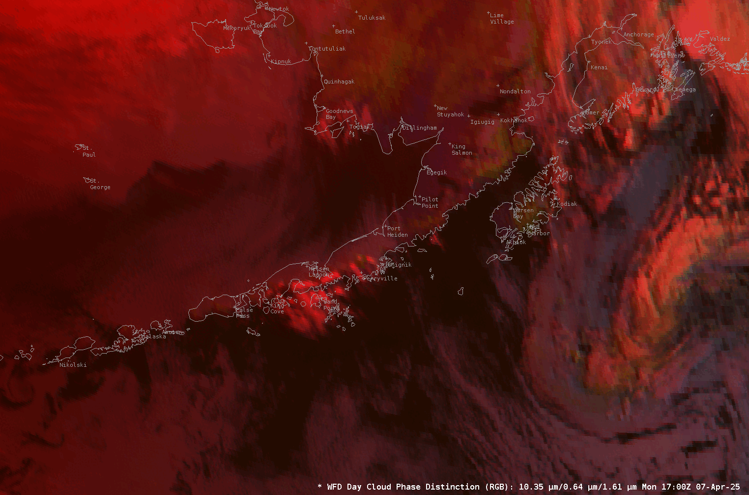
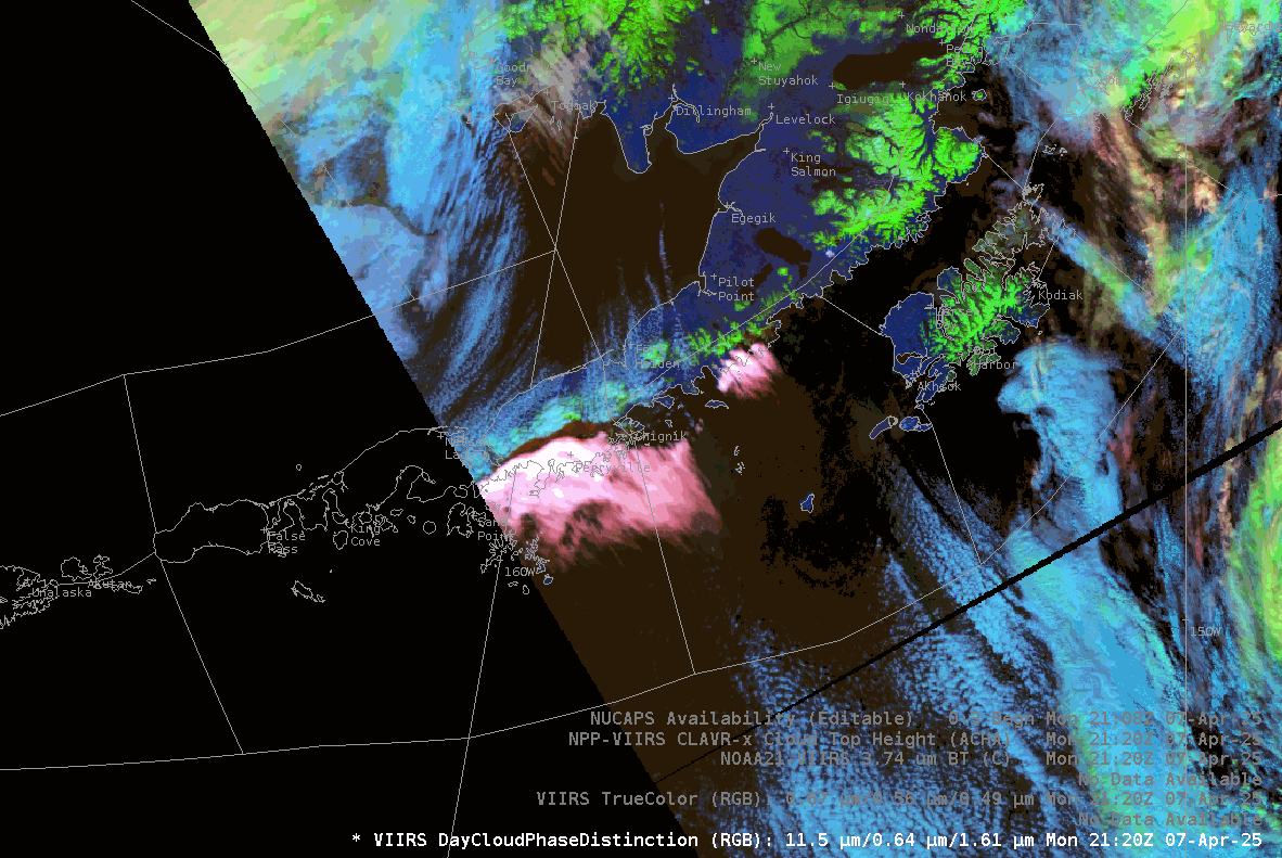
Day Cloud Phase Distinction imagery during the day on 7 April, below, suggests that the standing wave cloud is glaciated.
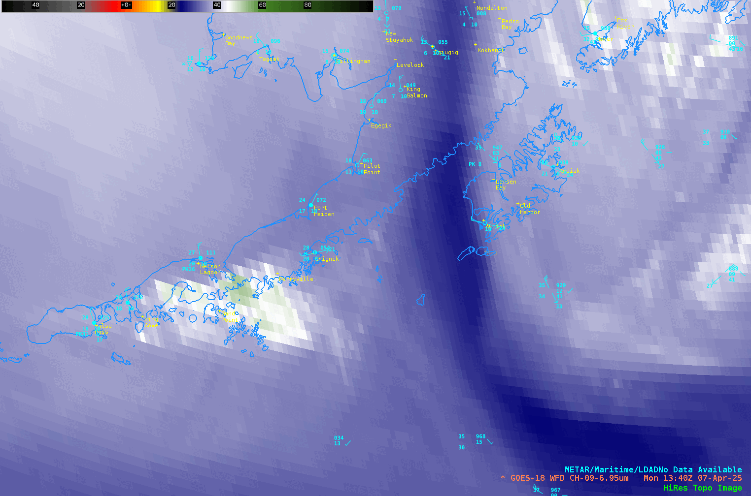
Mid-level Water Vapor infrared imagery (6.95 µm), below, also shows the development of the standing waves. Surface observations show very strong northerly winds off the Bering Sea.
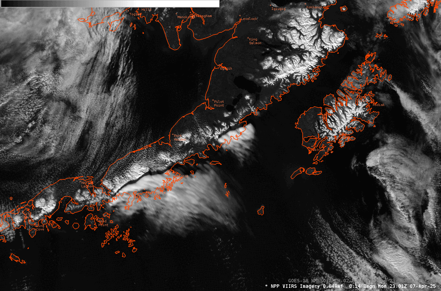
The toggle below between VIIRS and GOES-18 ABI visible (0.64 µm) imagery highlights the importance of VIIRS data at high latitudes. There is a significant parallax shift in the GOES-18 imagery such that the standing wave is shown to be over the mountains, rather than displaced to the south as in the VIIRS imagery (and, likely, in reality). VIIRS data also allows the use to see the shadow of the higher clouds on the terrain below; the oblique view from GOES-18 misses that feature.
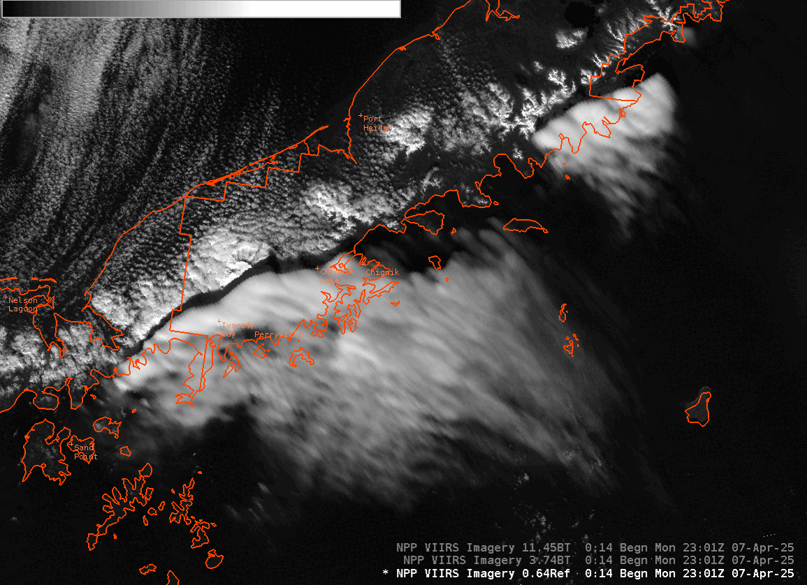
The animation below compares zoomed-in VIIRS imagery from Visible (I01, 0.64 µm), shortwave infrared (I04, 3.87 µm) and longwave infrared (I05, 11.45 µm) channels. Solar reflectance of 3.74 µm energy means the clouds and surface are warm — but note how the shadow of the clouds — where little solar reflection occurs — are relatively cold!
VIIRS data can be used to create Day Cloud Phase Distinction RGBs, as shown in the animation below (courtesy Carl Dierking, GINA), and the multiple JPSS Satellites (Suomi NPP, NOAA-20 and NOAA-21) means excellent temporal resolution.
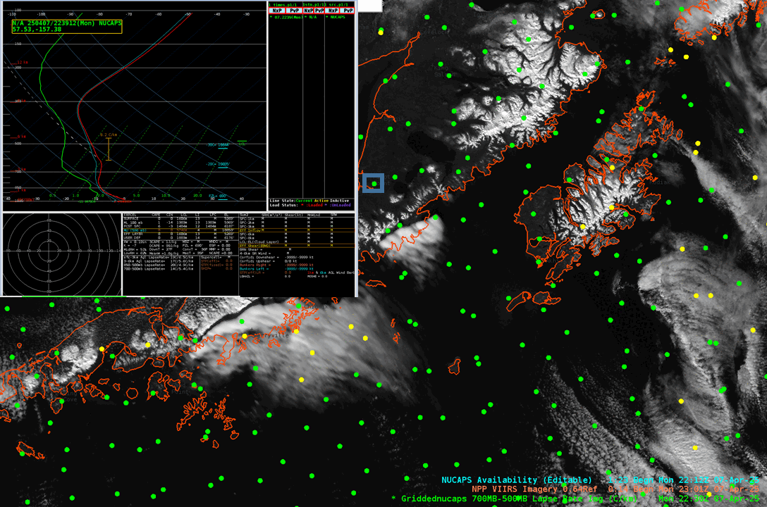
JPSS Satellites carry infrared and microwave sounders, and data from those sounders are used to create vertical profiles of moisture and temperature, i.e., NUCAPS soundings. The animation below shows three soundings near the standing wave. There is a strong inversion upstream of the standing wave cloud, and the inversion is not so pronounced downstream of the cloud. The boundary layer in all three soundings is dry adiabatic.
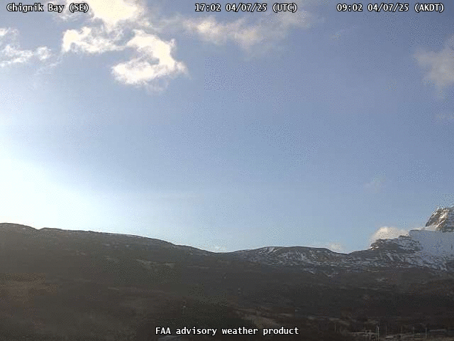
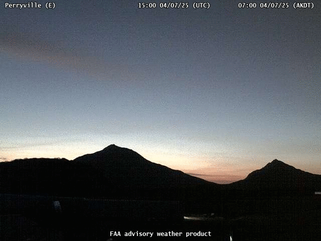
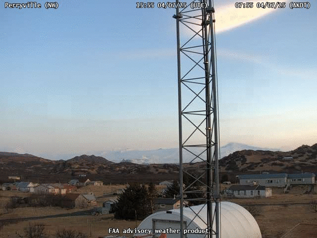
My thanks to Aaron Jacobs, WFO Juneau and Carl Dierking, GINA, for alerting me to this interesting case, and supplying imagery and suggestions. Aaron also forwarded along the following screen captures of FAA Webcams at Chignik Bay and Perryville shown below.