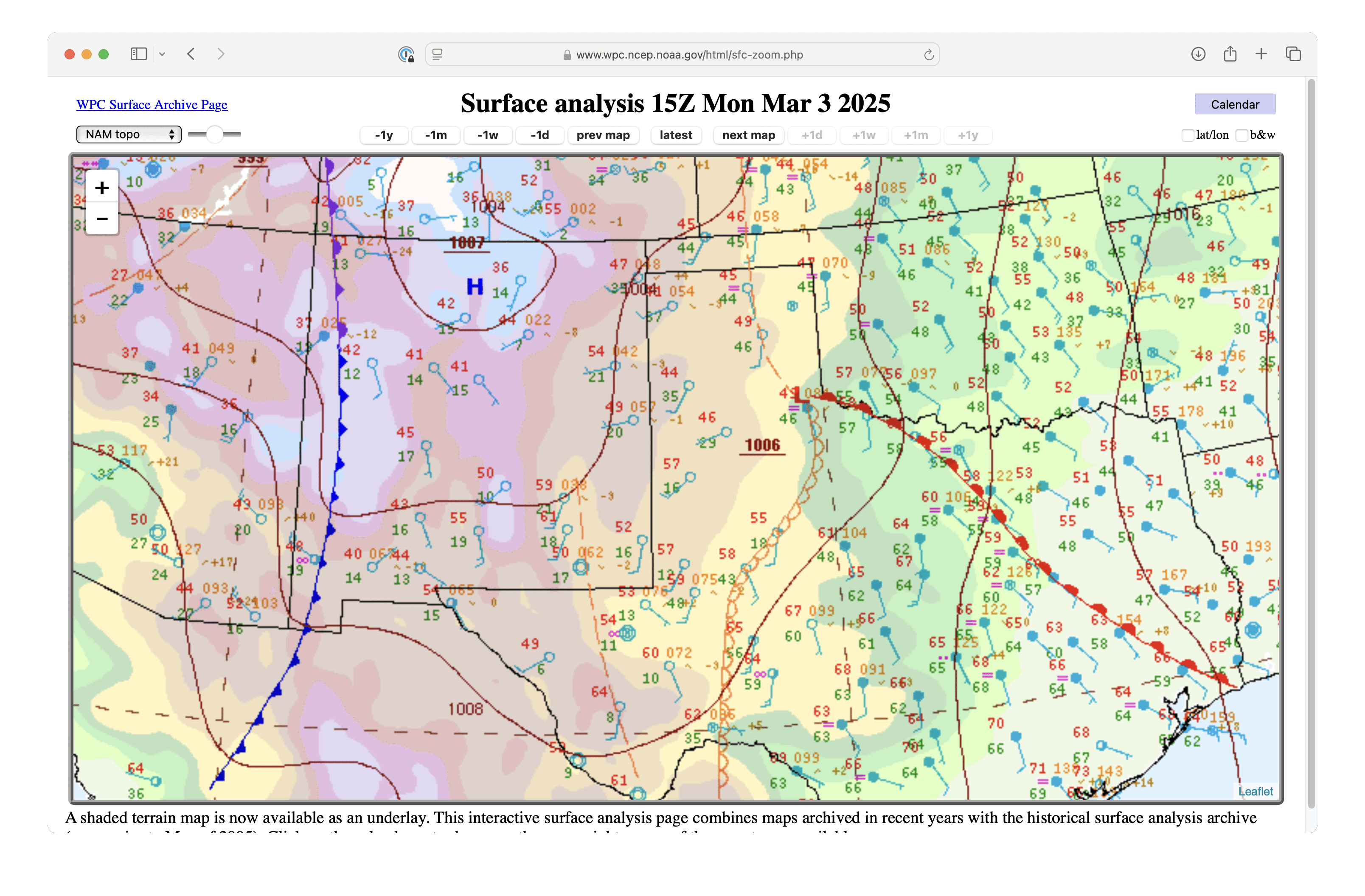
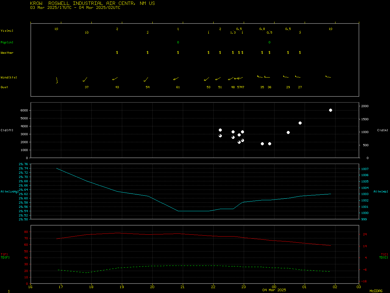
Blowing dust across eastern New Mexico and western Texas
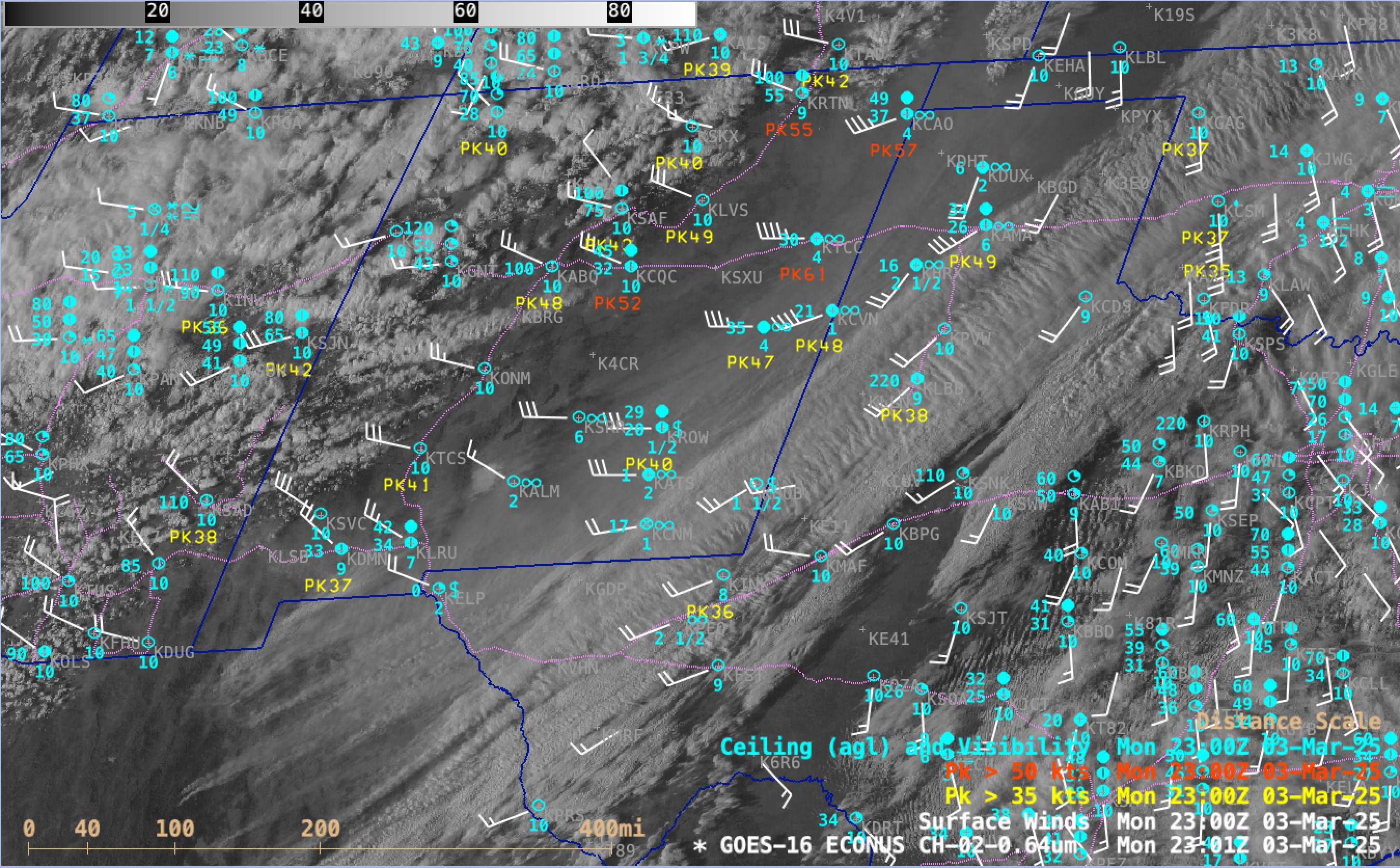
GOES-16 Red Visible (0.64 µm) images with plots of Surface Wind barbs (white), Peak Wind gusts (yellow/red) and Ceiling/Visibility/Weather (cyan) from 1516-2341 UTC on 03 March; Interstate highways are plotted in violet [click to play MP4 animation]
GOES-16 True Color RGB images from the CSPP GeoSphere site (below) provided a more distinct view of the dense blowing dust, which eventually stretched from northern Mexico to far southeast Colorado and far southwest Kansas. Note the plume of blowing sand whose source region was White Sands National Park in southern New Mexico.

GOES-16 True Color RGB images, from 1611 UTC on 03 March to 0001 UTC on 04 March [click to play MP4 animation]
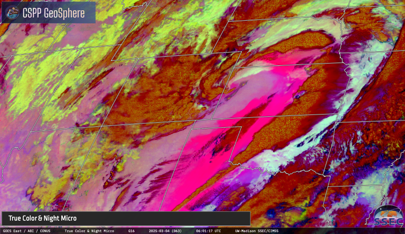
GOES-16 daytime True Color RGB and Nighttime Microphysics RGB images, from 2331 UTC on 03 March to 1201 UTC on 04 March [click to play MP4 animation]