The 4th EF-3 tornado on record in Montana (and the deadliest since 1923)
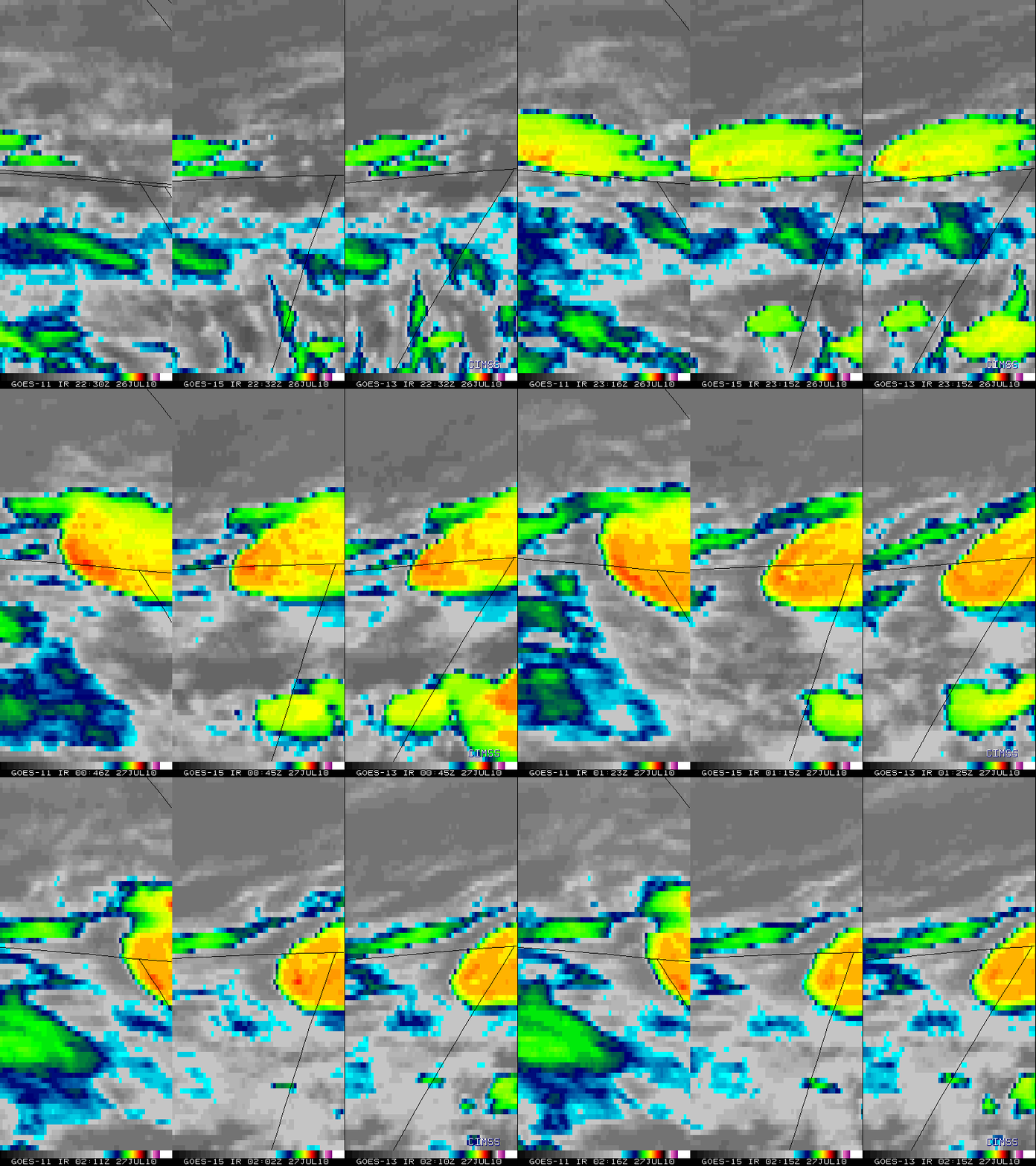
Severe thunderstorms propagated southeastward across far northeastern Montana late in the day on 26 July 2010. McIDAS images of GOES-11 (GOES-West), GOES-15, and GOES-13 (GOES-East) 10.7 µm IR data (above; each image set is displayed in the naive projection of the respective satellite) showed that a subtle “enhanced-v” storm top signature first began to appear on GOES-13 imagery around 23:25 UTC, with this signature becoming more apparent by 23:45 UTC on all 3 satellite IR images. In addition, a well-defined cold/warm thermal couplet (with an IR brightness temperature difference of 11-14º C) was displayed on all three satellite IR images around 01:00 UTC. Note that more frequent images were available from GOES-11 and GOES-13, since both of those operational satellites had been placed into Rapid Scan Operations (RSO) mode. GOES-15 is providing images as part of its Post Launch Testing.
According to the SPC Storm Reports, these storms produced hail as large as 4.0 inches in diameter, and produced a tornado that was responsible for EF-3 damage and 2 fatalities. This was only the 4th EF3 damage producing tornado on record in Montana, and the deadliest tornado in that state since 1923.
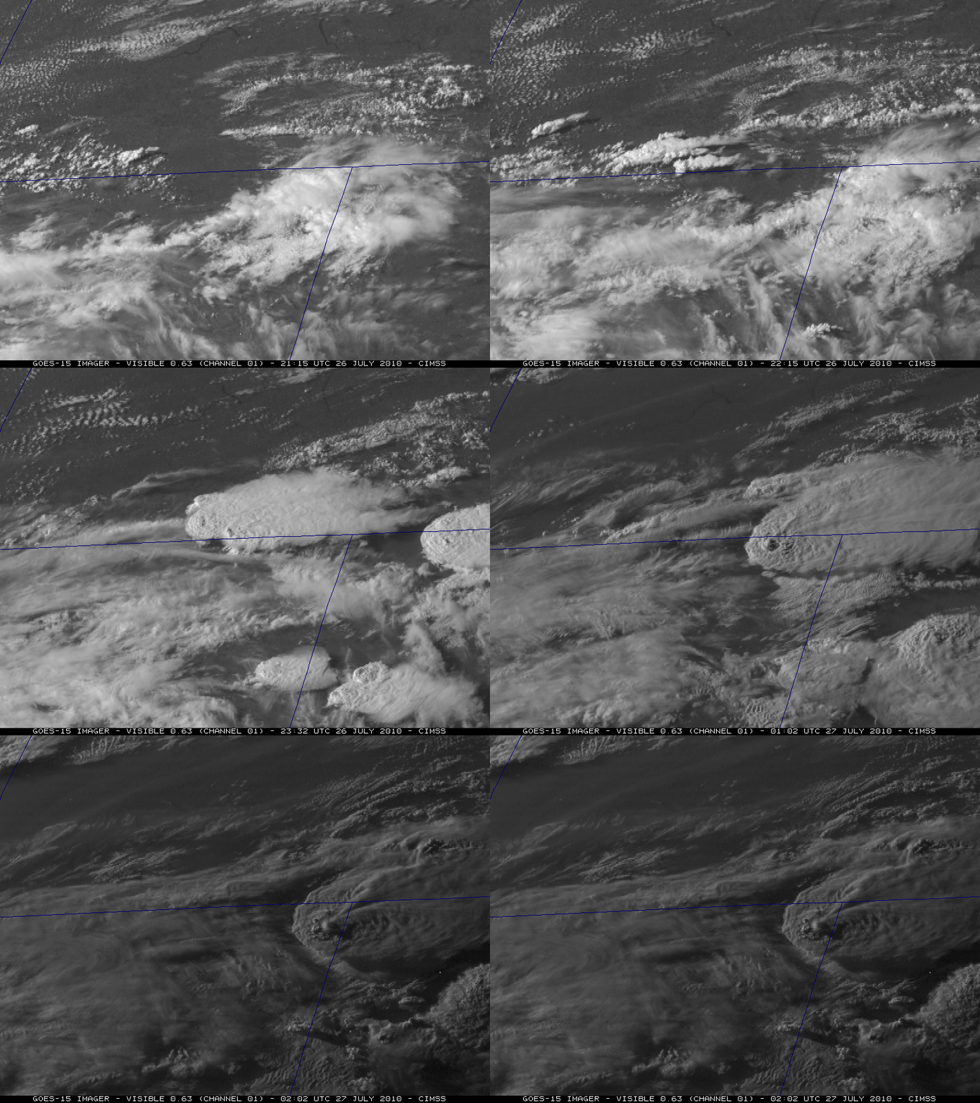
The GOES-15 satellite (positioned at 89.5º West longitude) had the most direct view of the storm — and an animation of 0.63 µm visible channel images (below) showing some interesting cloud top structure, including several overshooting tops as well as a well-defined anvil plume later in the animation sequence.
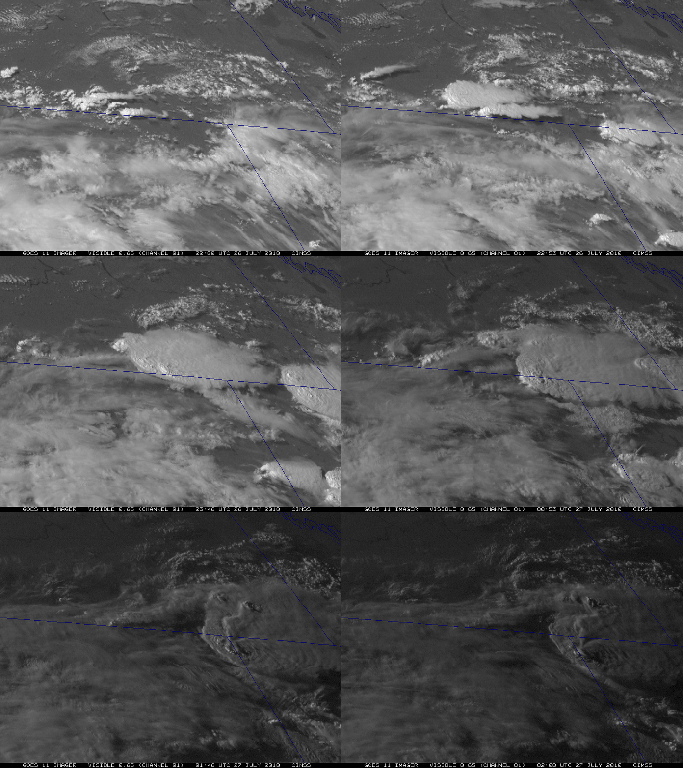
The GOES-11 (GOES-West) satellite (positioned at 135º West longitude) offered a more oblique view of the severe thunderstorms (below). Viewing the storms from such a high western angle, one can see the appearance of low-level inflow feeder band clouds as the thunderstorms were intensifying. In addition, since GOES-11 was in Rapid Scan Operations (RSO) mode, more images were available compared to the normal 15-minute scan interval used with GOES-15 above.


