Blowing snow across parts of eastern North Dakota and western Minnesota
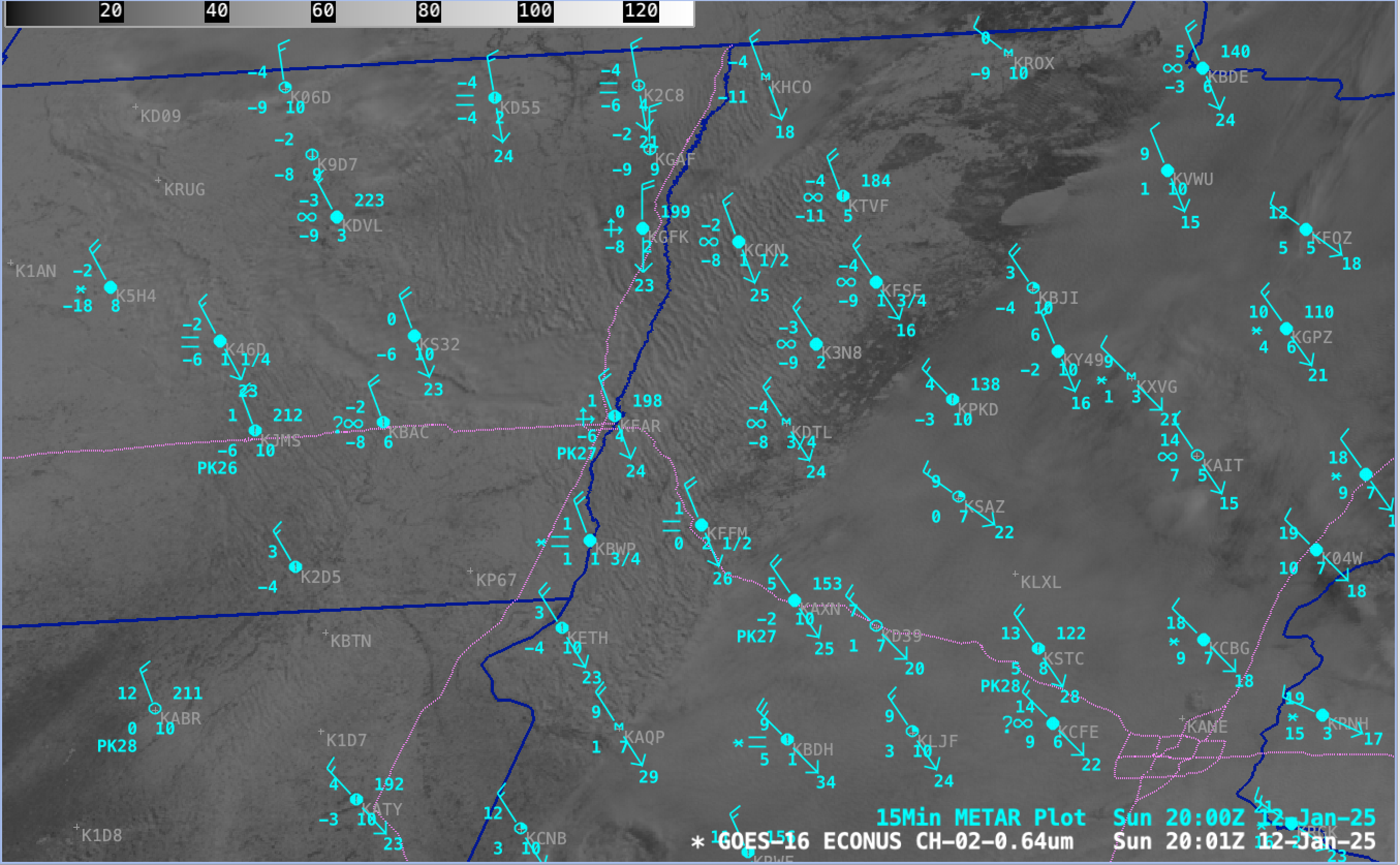
GOES-16 Red Visible (0.64 µm) images from 1501-2201 UTC on 12th December, with plots of 15-minute METAR surface reports (cyan). Interstate Highways are plotted in dotted violet. [click to play MP4 animation]
Blowing Snow RGB images from GOES-19 (Preliminary/Non-operational) — created using Geo2Grid — provided a more detailed view of the widespread HCR clouds (below). Existing snow cover appeared as darker shades of red in the RGB imagery, while bare ground appeared as brighter shades of green; supercooled water droplet clouds appeared as brighter shades of white.

GOES-19 (Preliminary/Non-operational) Blowing Snow RGB images, from 1501-2201 UTC on 12th December [click to play animated GIF]
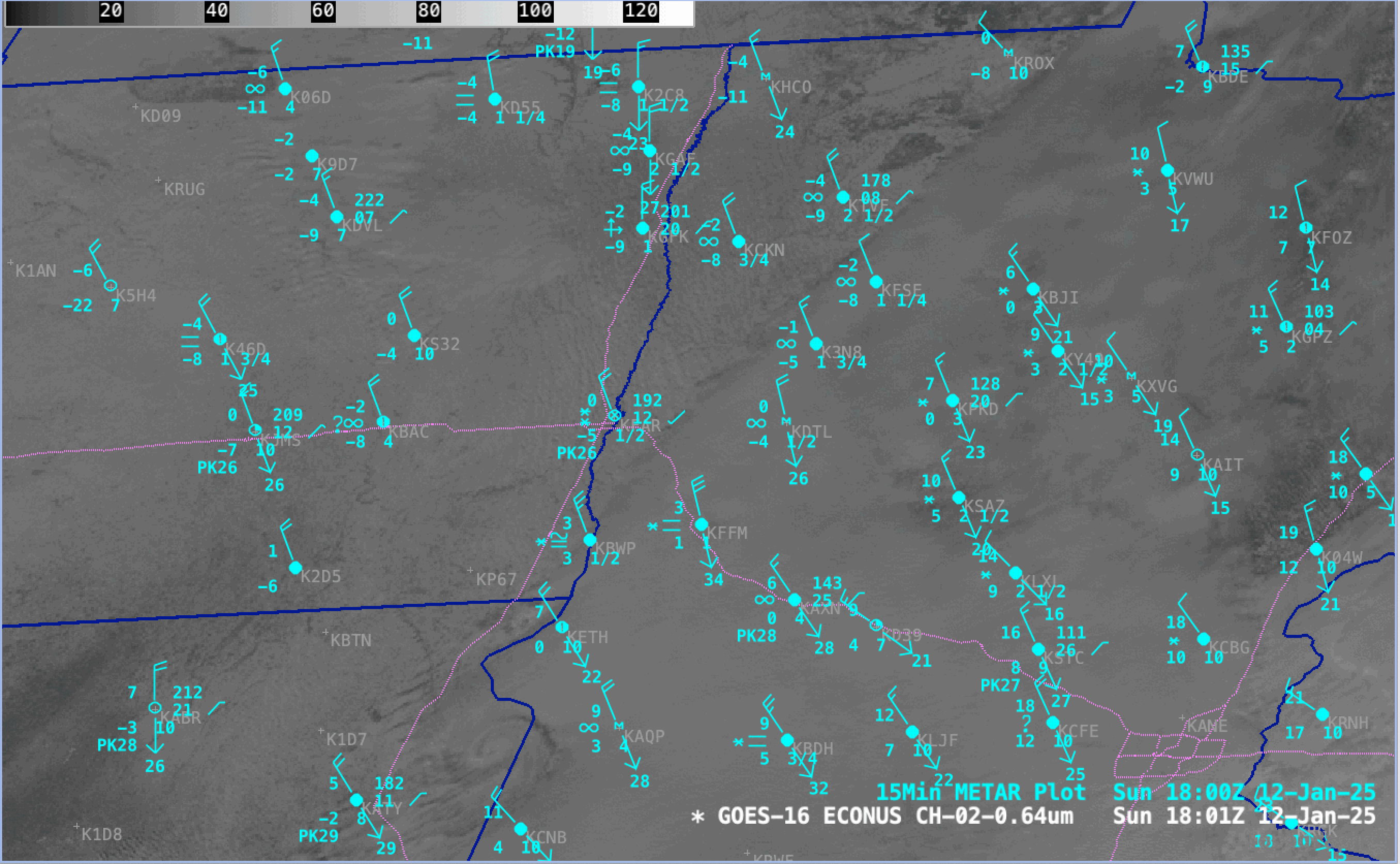
GOES-16 Red Visible (0.64 µm) image at 1801 UTC on 12th December and Topography [click to enlarge]