Power plant plumes in North Dakota
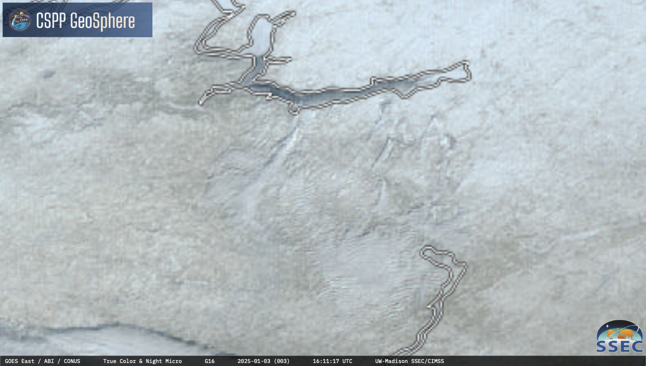
GOES-16 Nighttime Microphysics RGB + daytime True Color RGB images, from 1151-2201 UTC on 3rd January [click to play MP4 animation]
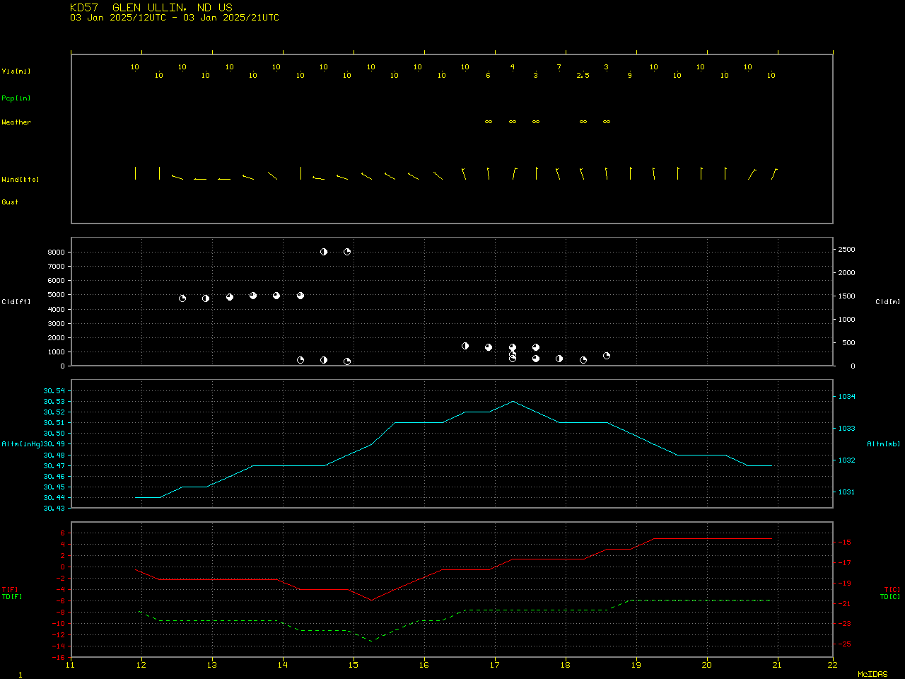
GOES-16 Near-Infrared Snow/Ice (1.61 µm) and Day Fog (3.9-10.3 µm) brightness temperature difference images (below) suggested that particulate matter within these power plant plumes (originating from plants in Mercer, Oliver and McLean counties) may have acted to seed a patch of supercooled water droplet clouds, causing them to glaciate and produce a brief period of light snow at Mandan (KY19) — and perhaps create enough ice crystals in the air to reduce visibility at Glen Ullin (KD57).
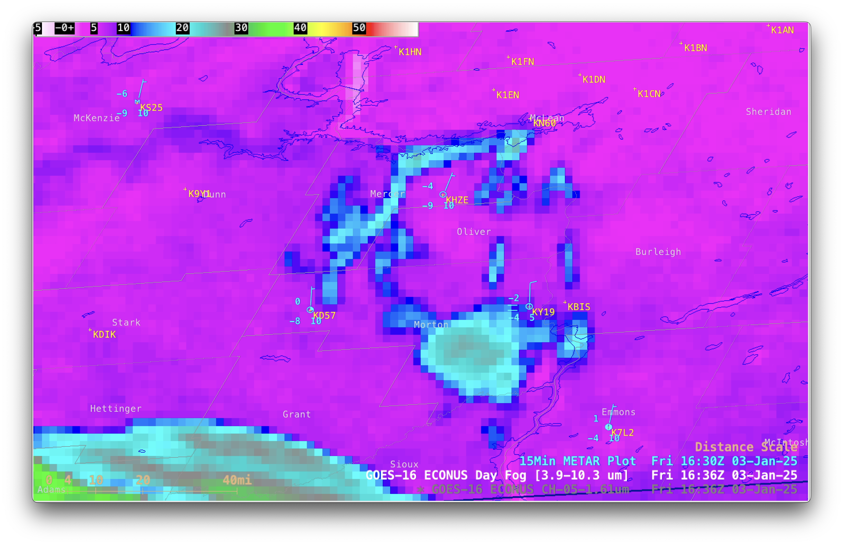
GOES-16 Near-Infrared Snow/Ice (1.61 µm) and Day Fog (3.9-10.3 µm) images with 15-minute METAR surface reports plotted in cyan, from 1501-1901 UTC on 3rd January [click to play MP4 animation]

GOES-19 (Preliminary/Non-operational) True Color RGB images (left) and Blowing Snow RGB images (right), from 1501-2201 UTC on 3rd January [click to play animated GIF | MP4]