Radiation fog over Lake Mendota in southern Wisconsin

GOES-19 True Color RGB (left) and Blowing Snow RGB (right), from 1431-1801 UTC on 25th December [click to play animated GIF | MP4]
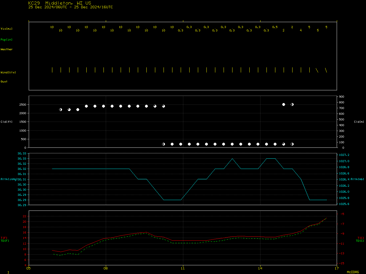
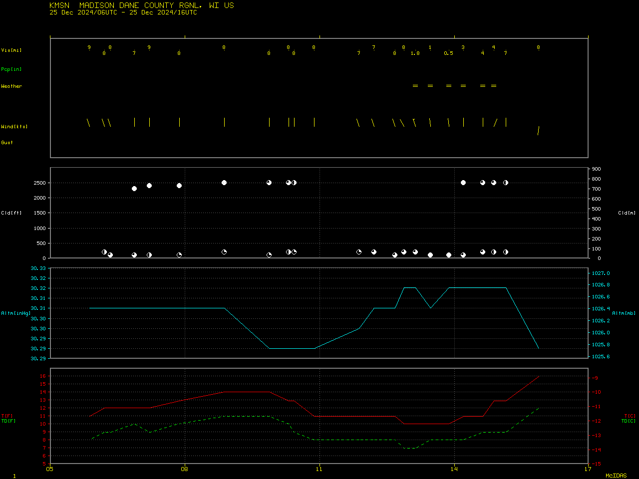
5-minute CONUS Sector GOES-19 (Preliminary/Non-operational) True Color RGB and Blowing Snow RGB images created using Geo2Grid (above) displayed a small patch of radiation fog over Lake Mendota that slowly dissipated during the morning hours on 25th December 2024 (the Blowing Snow RGB is a modified version of the Day Snow-Fog RGB, which uses higher spatial resolution Band 2 imagery in place of Band 3 as the Red component). Much of Lake Mendota was still ice-free (although some ice growth had occurred along parts of the shoreline) — but nocturnal radiational cooling allowed the surface air temperature at nearby airports to reach minimum values of 9ºF at Middleton (KC29) and 10ºF at Madison (KMSN). The Lake Mendota fog did briefly move inland across the southern and western edges of the lake.
5-minute GOES-16 (GOES-East) Visible images (below) showed the fog dissipating over the western half of Lake Mendota as surface air temperatures began to warm after sunrise.
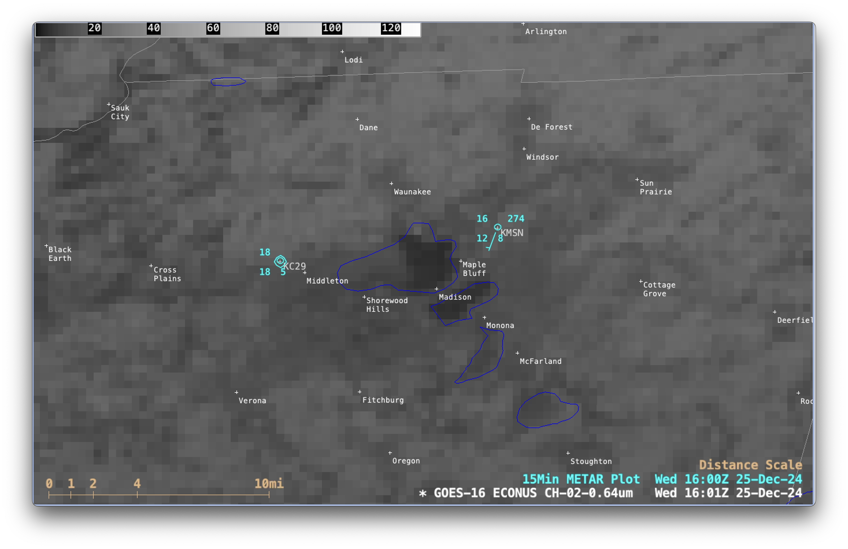
GOES-16 Red Visible (0.64 µm) images with surface reports with 15-minute METAR surface reports plotted in cyan, from 1431-1801 UTC on 25th December [click to play MP4 animation]
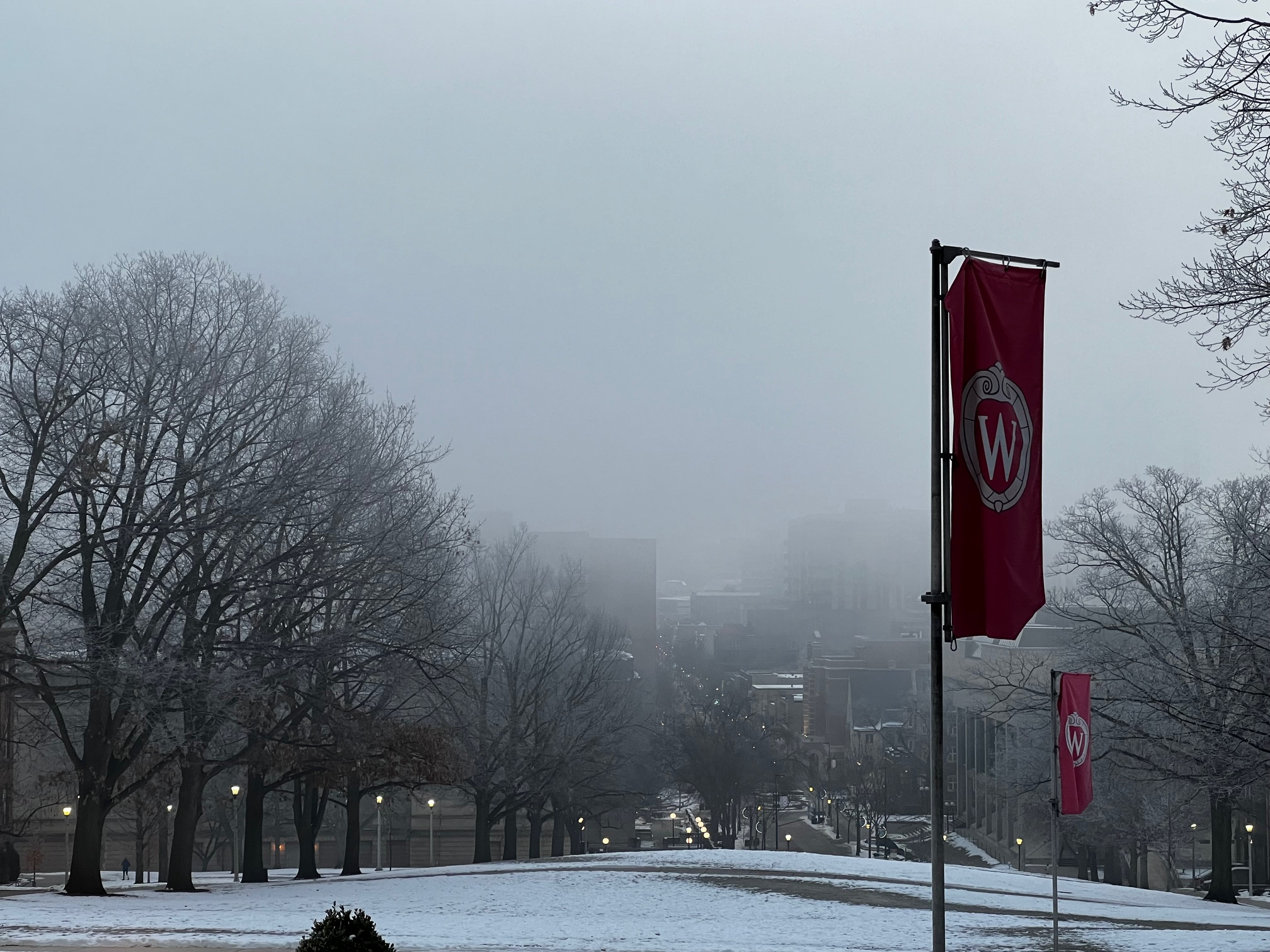
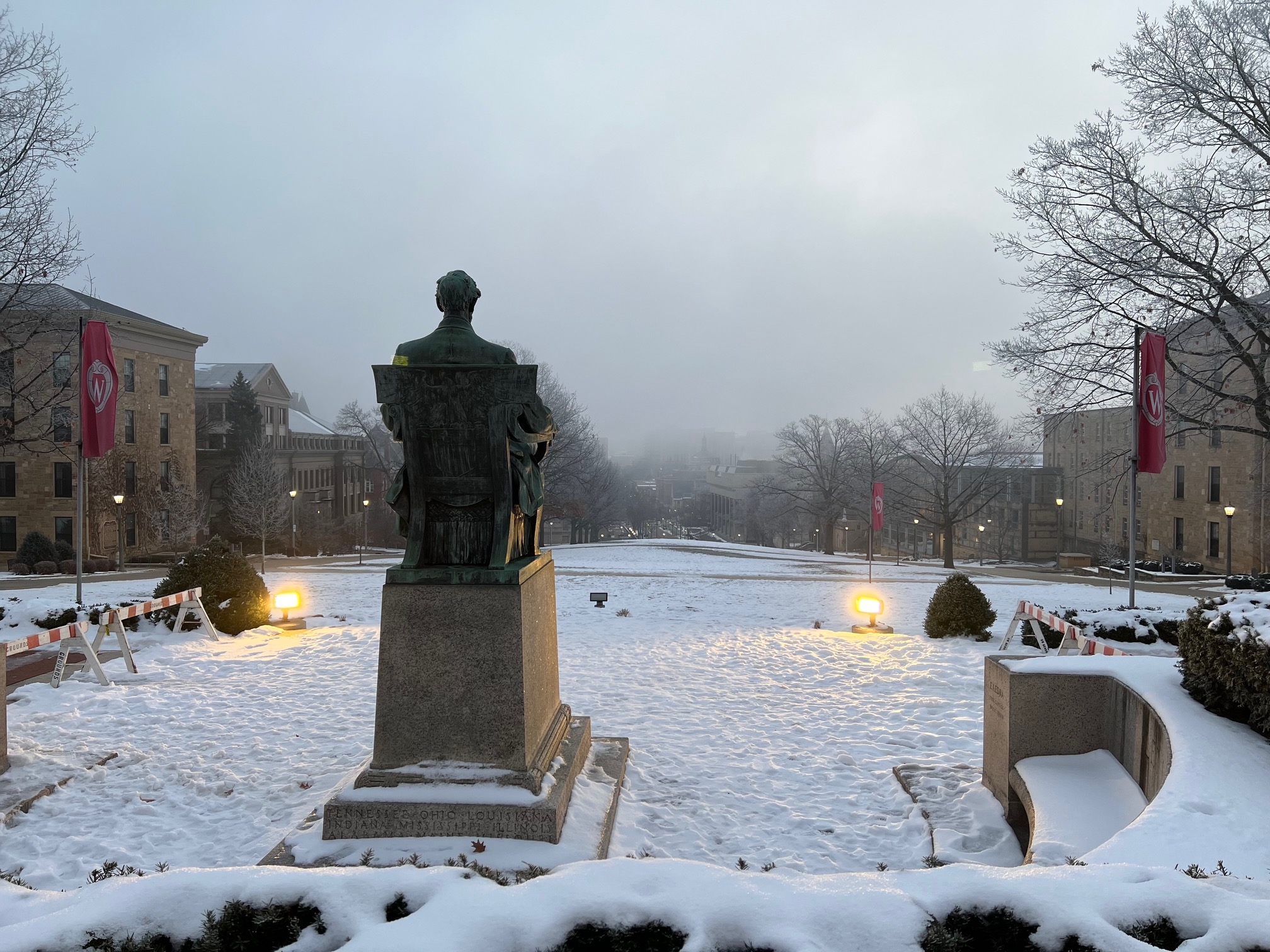
UW-SSEC/AOS north-facing rooftop camera images (below) revealed multiple incursions of the Lake Mendota fog into the University of Wisconsin – Madison campus, located just south of the lake (both before and after sunrise).
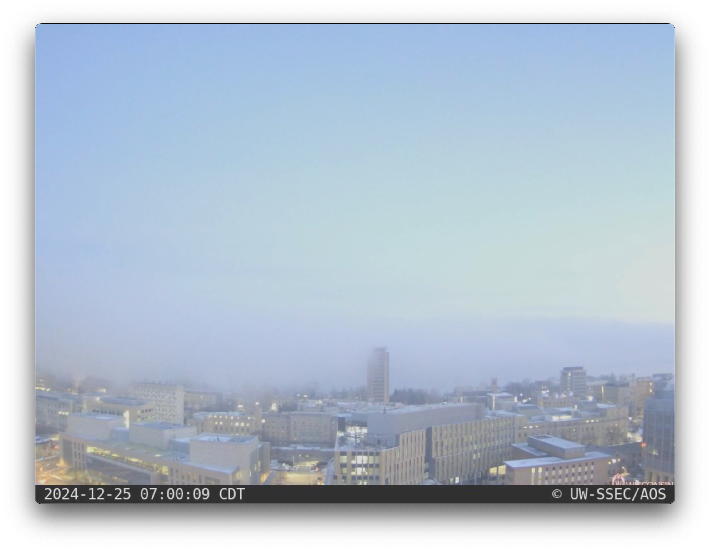
UW-SSEC/AOS north-facing rooftop camera images [click to play MP4 animation]
Thanks to Tim Schmit (NOAA/NESDIS/STAR) for bringing this interesting case to our attention (and also taking ground truth photo1 and photo2 of the fog on campus).