Largest US hailstone on record in central South Dakota
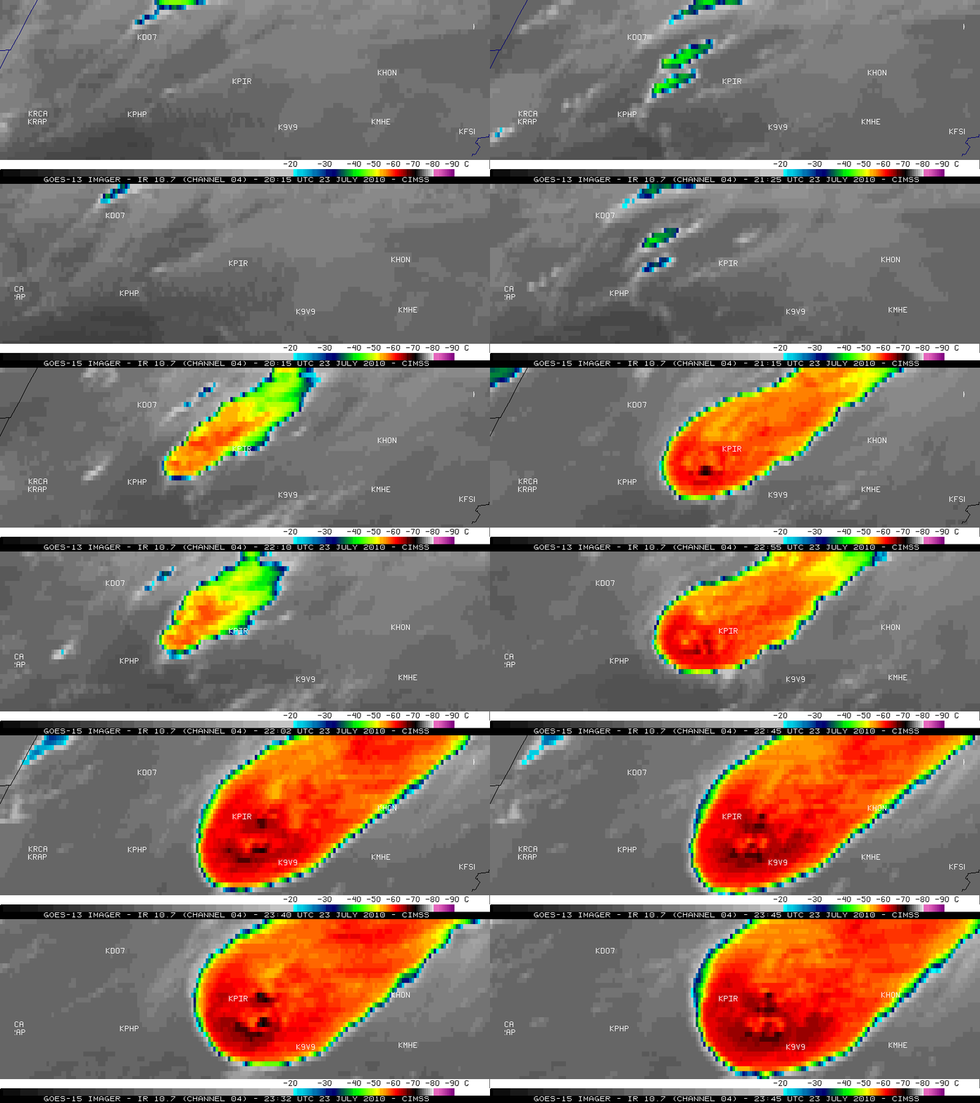
McIDAS images of GOES-13 and GOES-15 10.7 µm IR images (above) showed the development of severe thunderstorms that produced very large hail, tornadoes, and damaging surface winds (SPC storm reports) in central South Dakota on 23 July 2010. This storm produced the largest US hailstone on record: 8 inch diameter, 18.6 inch circumference, 1.9375 pound weight — photos of the record-setting largest hailstone were taken by staff from the Aberdeen, South Dakota NWS forecast office. The coldest cloud top IR brightness temperatures were -71º C (darker black color enhancement) at 23:25 and 23:32 UTC. Since the GOES-13 satellite had been placed into Rapid Scan Operations (RSO), images were available as often as every 5-10 minutes (as opposed to every 15 minutes via the routine image scan schedule on GOES-15).
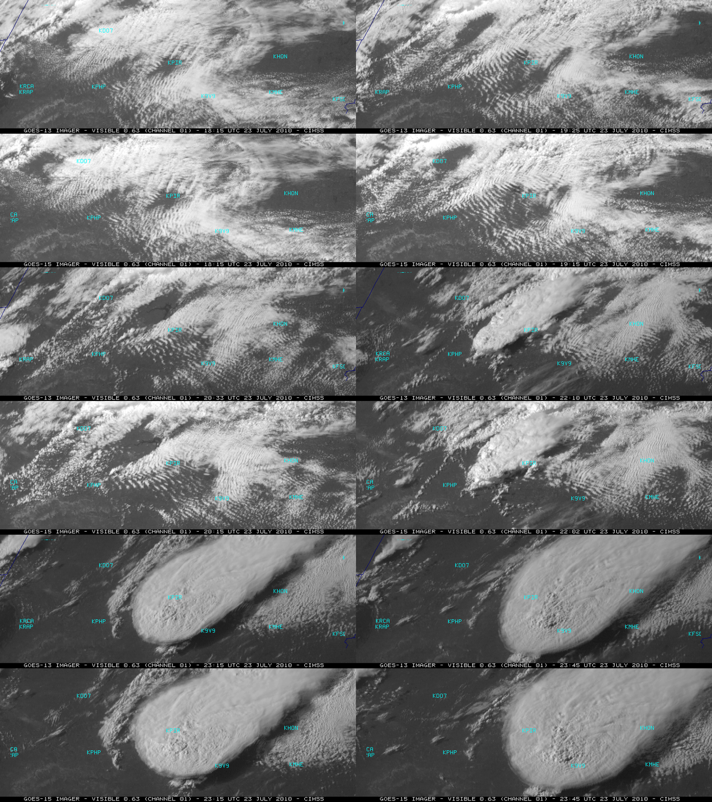
The corresponding GOES-13 and GOES-15 0.63 µm visible channel images (below) displayed a well-defined storm top anvil with distinct overshooting tops (GOES-13 visible images only: Animated GIF). Prior to convective development, the appearance of the quasi-stationary low-level parallel cloud bands suggests that there was strong warm air advection into the region from the southwest (HPC surface forecast).
=================================================
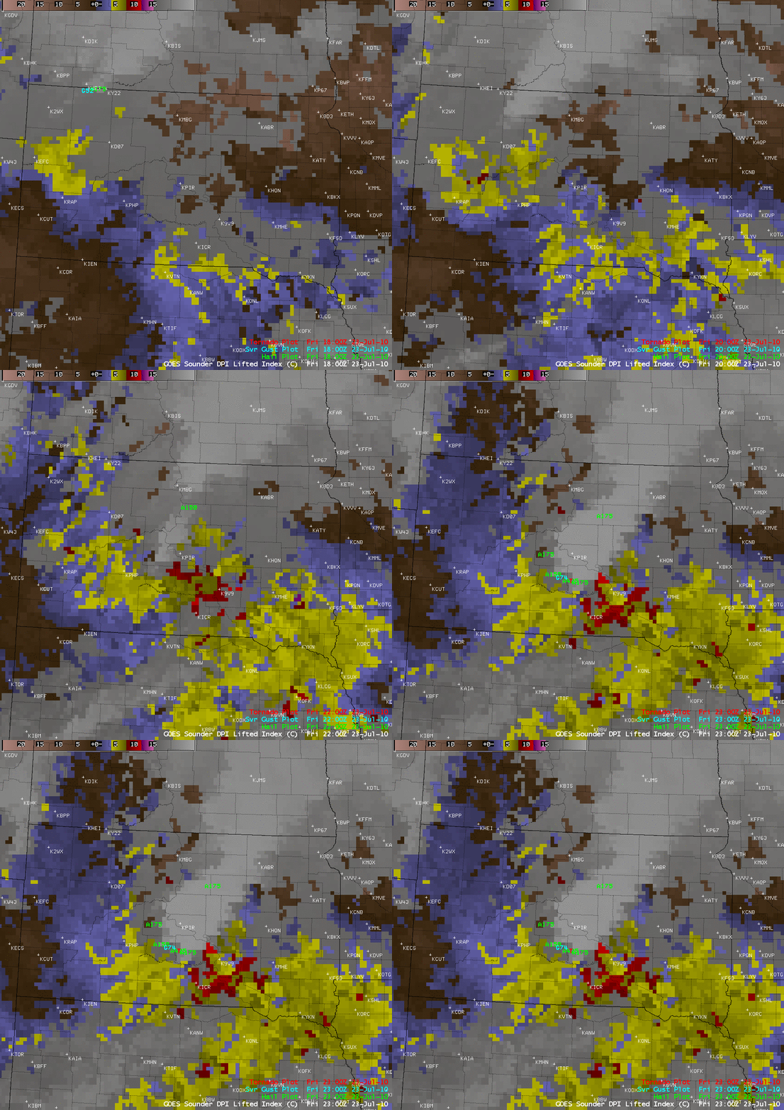
AWIPS images of the GOES-13 Sounder Total Precipitable Water (above) and Lifted Index (below) depicted a broad axis of moisture and instability that extended northwestward into central South Dakota on that day.
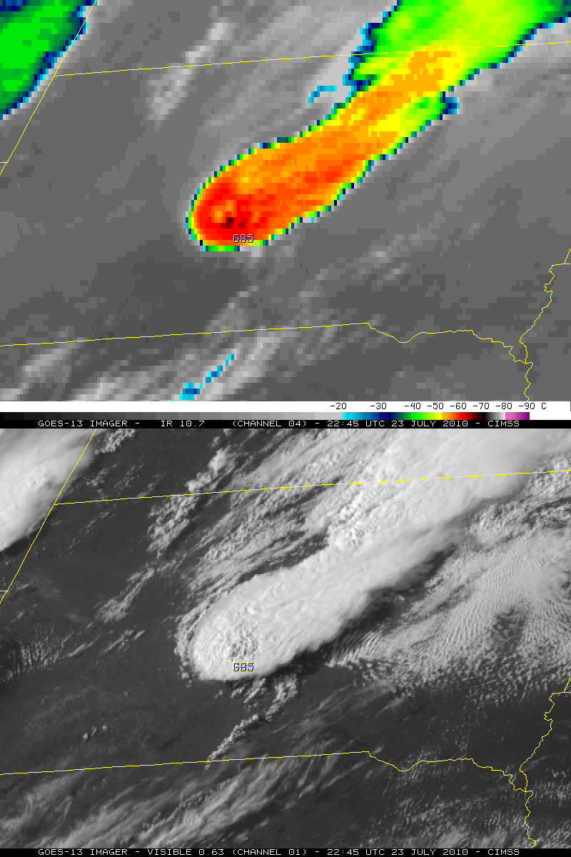
A comparison of the 1-km resolution GOES-13 0.63 µm visible image and the 4-km resolution GOES-13 10.7 µm IR image at 22:45 UTC (around the time of a report of 85 mph surface winds) is seen below. The apparent offset between the location of the overshooting top and the location of the surface wind gust is due in part to parallax error (a result of the large viewing angle from the GOES-13 satellite, which is positioned over the Equator at 75º West longitude).
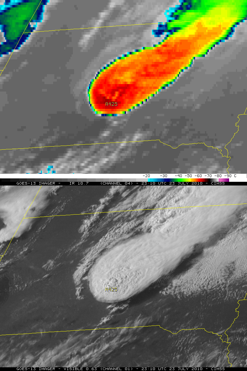
A comparison of the 1-km resolution 0.63 µm GOES-13 visible image and the 4-km resolution 10.7 µm IR image at 23:10 UTC (around the time of a report of “softball size” 4.25 inch diameter hail) is shown below.
As noted above, the coldest cloud top IR brightness temperatures observed for this storm were -71º C — according to the rawinsonde profile data from Rapid City, South Dakota (below) this temperature corresponded to an altitude of around 55,000 feet or 16,800 meters.


