Lightning activity within a lake effect snow band moving inland from Lake Erie
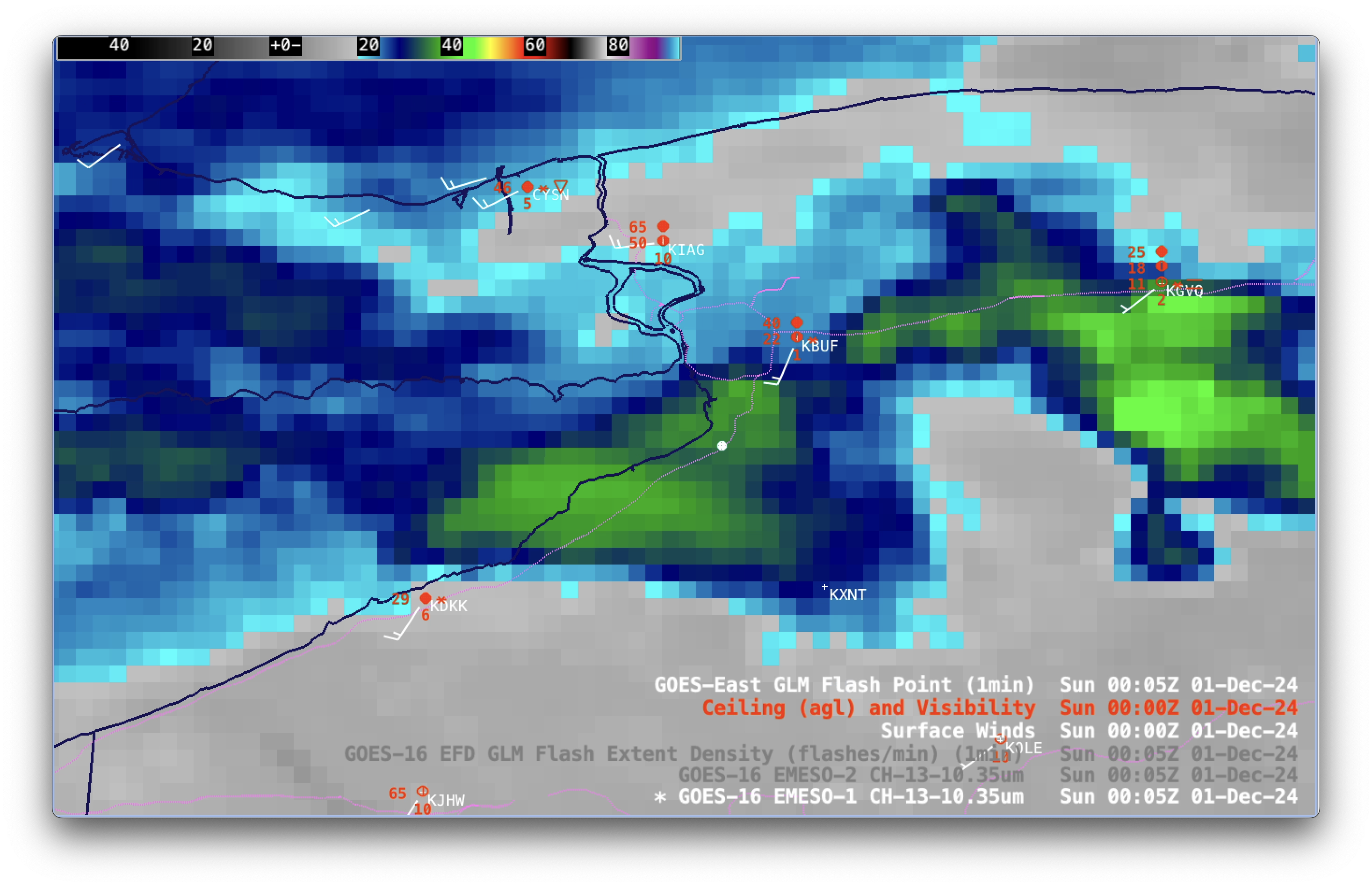
1-minute GOES-16 Clean Infrared Window (10.3 µm) images, with plots of Ceiling and Visibility (red), wind barbs (white) and GLM Flash Points (white dots), from 2300 UTC on 30th November to 0400 UTC on 1st December; Interstate Highways are plotted in magenta [click to play MP4 animation]
1-minute Mesoscale Domain Sector GOES-16 (GOES-East) Clean Infrared Window (10.3 µm) images (above) showed a lake effect snow (LES) band that intensified over far eastern Lake Erie, shortly before moving inland across western New York after sunset on 30th November 2024. Intermittent lightning activity was seen immediately inland as the LES band moved across Interstate 90 between Buffalo (KBUF) and Dunkirk (KDKK), with several GLM Flash Points appearing.
A similar animation of GOES-16 Infrared images included overlays of both GLM Flash Extent Density and Flash Points (below). Note the slight northward displacement of the Flash Extent Density pixels compared to the Flash Points — this is because commonly-used Gridded GLM products (such as Flash Extent Density, Minimum Flash Area and Total Optical Energy) are not corrected for parallax, as the GLM Flash Points are.
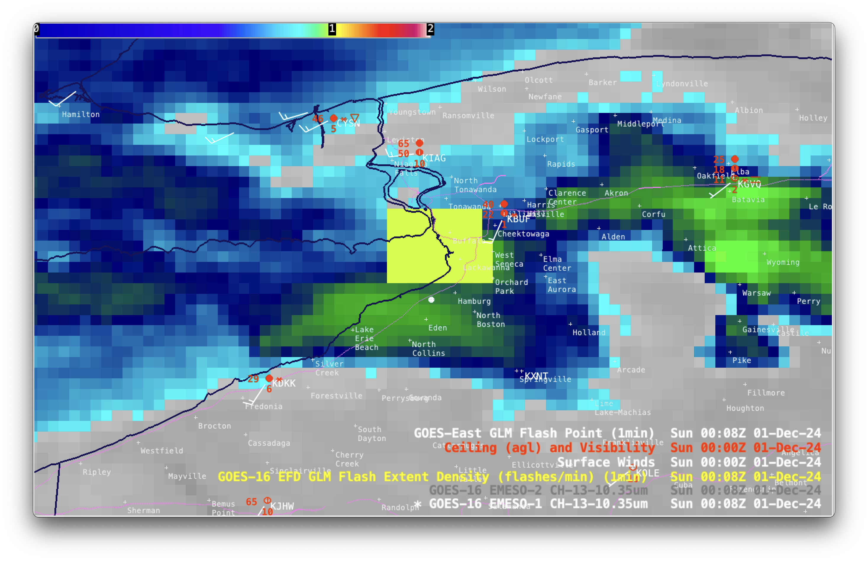
1-minute GOES-16 Clean Infrared Window (10.3 µm) images, with plots of Ceiling and Visibility (red), wind barbs (white), GLM Flash Extent Density (large yellow to white pixels) and GLM Flash Points (white dots), from 2300 UTC on 30th November to 0400 UTC on 1st December; Interstate Highways are plotted in magenta [click to play MP4 animation]
A stepped sequence of 6 times with GLM observations (2329 UTC/2339 UTC/2345 UTC/0005 UTC/0008 UTC/0051 UTC) is shown below, to provide an easier examination of the displacement between GLM Flash Extent Density and GLM Flash Points. Much of this satellite-detected lightning activity was occurring near Lackawanna (south of Buffalo), where thundersnow was observed.
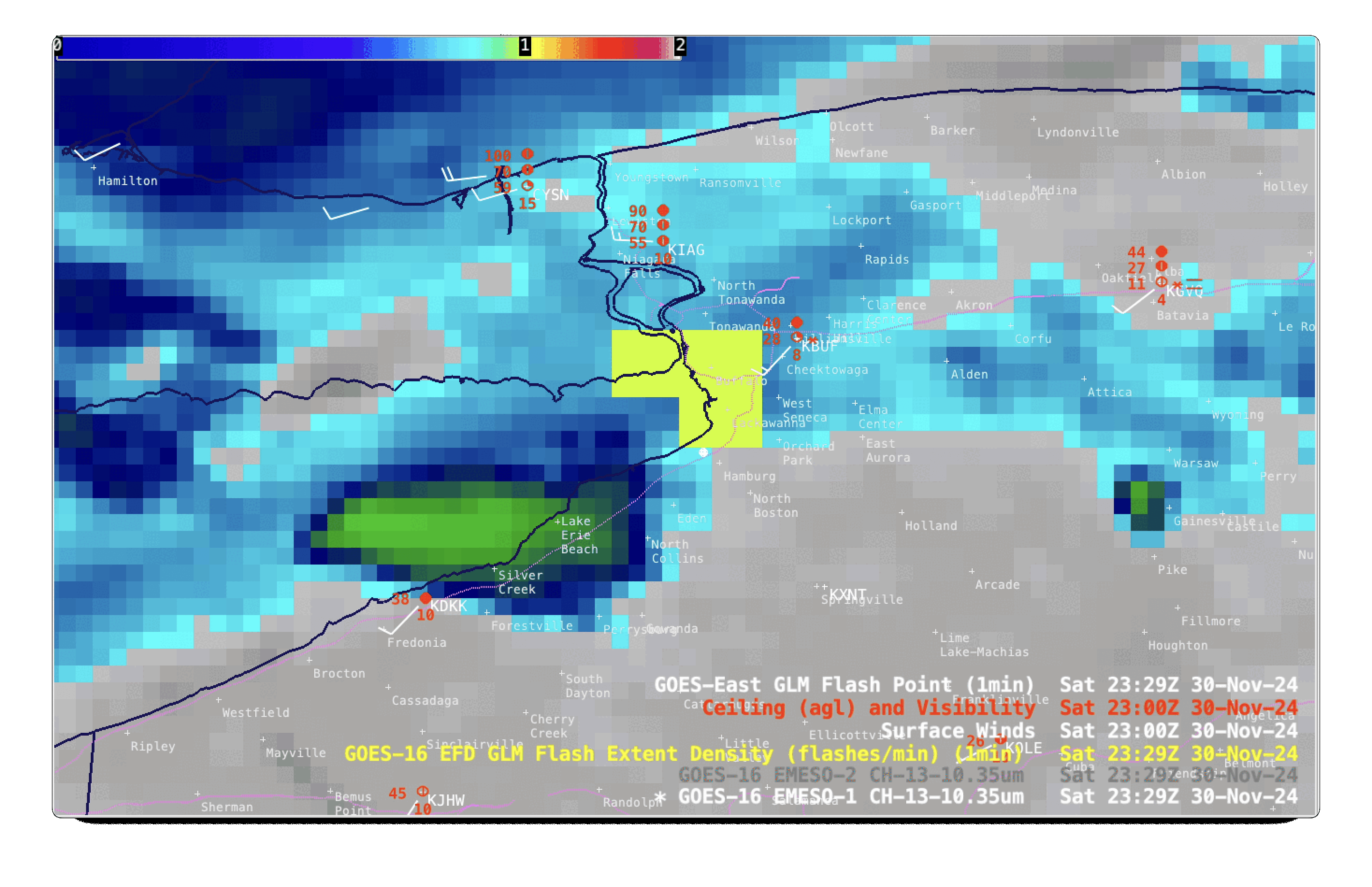
GOES-16 Clean Infrared Window (10.3 µm) images, with plots of Ceiling and Visibility (red), wind barbs (white), GLM Flash Extent Density (large yellow to white pixels) and GLM Flash Points (white dots); Interstate Highways are plotted in magenta [click to enlarge]