Severe thunderstorms in central Oklahoma
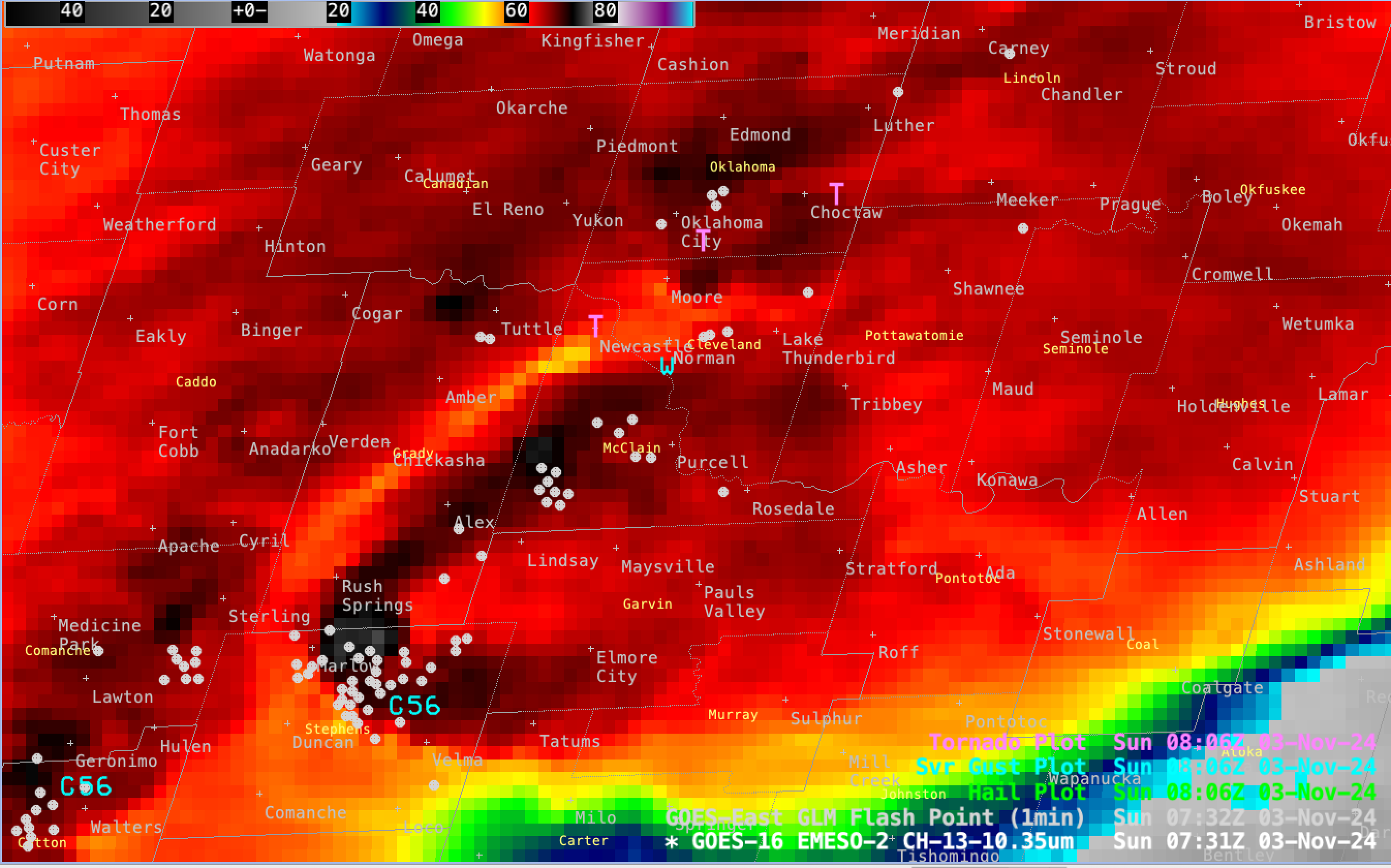
1-minute Mesoscale Domain Sector GOES-16 (GOES-East) “Clean” Infrared Window (10.3 µm) images (above) showed thunderstorms that produced several tornadoes and damaging wind gusts (SPC Storm Reports) across parts of central Oklahoma on 03 November 2024. Pulses of thunderstorm overshooting tops exhibited 10.3 µm brightness temperatures as cold as -78.6ºC (brighter white pixels embedded within dark black regions) — and Enhanced-V cloud-top signatures were evident with some of the storms; the interior warm portion of the Enhanced-V signature (shades of red, in this particular color enhancement) often highlights where an Above-Anvil Cirrus Plume might be present.1-minute GOES-16 GLM Flash Points depicted abundant lightning activity associated with these thunderstorms.