Using MODIS imagery to detect thin stratus/fog over snow cover
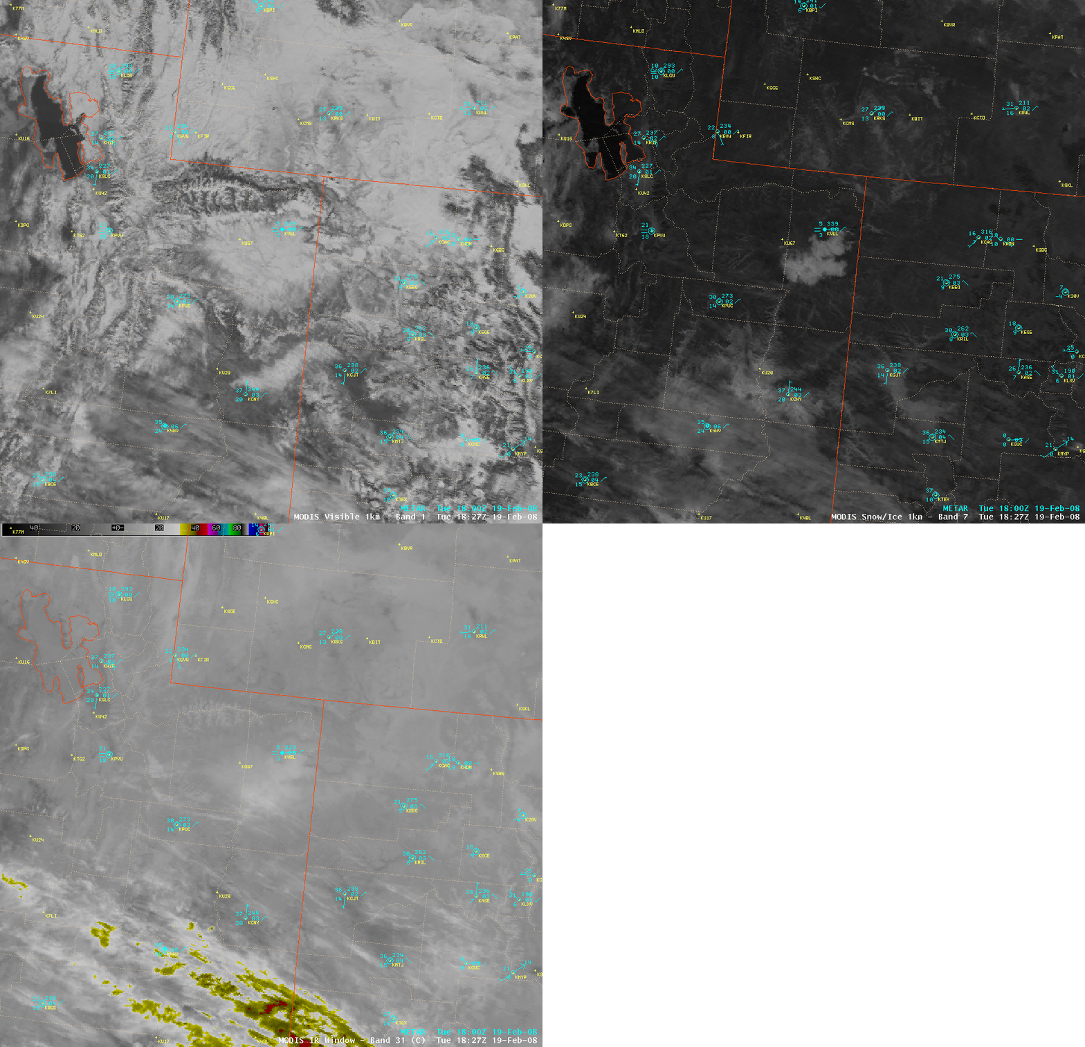
AWIPS images of the MODIS visible channel, the 1.6µm near-IR “snow/ice channel”, and the 11.0µm “IR window” channel (above) revealed a large patch of supercooled water droplet stratus cloud (and/or fog) over northeastern Utah on 19 February 2008. This stratus/fog cloud feature was confined to the lower elevations (AWIPS topography image | Johns Hopkins topography image) where several river valleys converge just south of Vernal, Utah (station identifier KVEL); at the time of the images, the surface visibility at Vernal was restricted to 1 mile with fog. The areal extent of this cloud feature was difficult to judge using either the 1-km resolution MODIS visible image (due to the bright white appearance of both the stratus/fog and the surrounding non-cloudy snow cover) or the 1-km resolution MODIS IR window image (due to the light gray enhancement of both the cloud feature and the cold air that had collected within the remainder of the lower elevations) — but on the snow/ice image, the contrast of the brighter gray-to-white enhancement of the supercooled water droplet stratus/fog feature really stood out against the dark appearance of the surrounding snow-covered terrain.
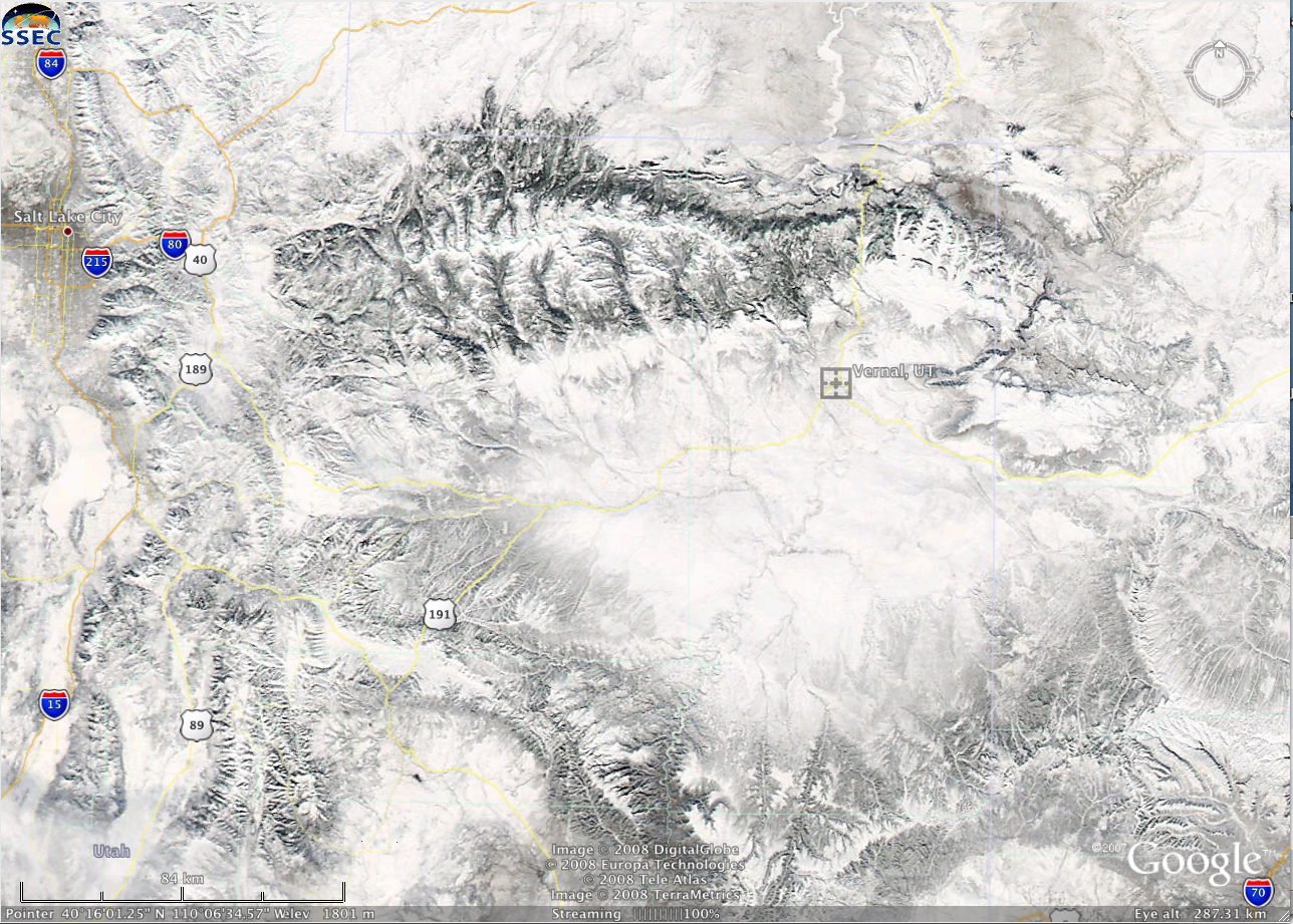
The corresponding 250-meter resolution MODIS true color image from the SSEC MODIS Today site (below, viewed using Google Earth) showed the “translucent” nature of the patch of stratus/fog — note that you can actually see the outlines of some of the converging rivers (the Green River, White River, and Duchesne River) through the optically-thin cloud feature.


