Record Heat in the Pacific Northwest

Oregon has seen triple-digit (o Fahrenheit) heat in early July 2024. (Here are records for 9 July) The animation below shows GOES-18 Land Surface Temperatures on 9 July. This hourly level-2 product is created in clear skies. It shows warmest values between 2100 and 2200 UTC on 9 July 2024. Land Surface Temperature imagery is available online at this NOAA website.
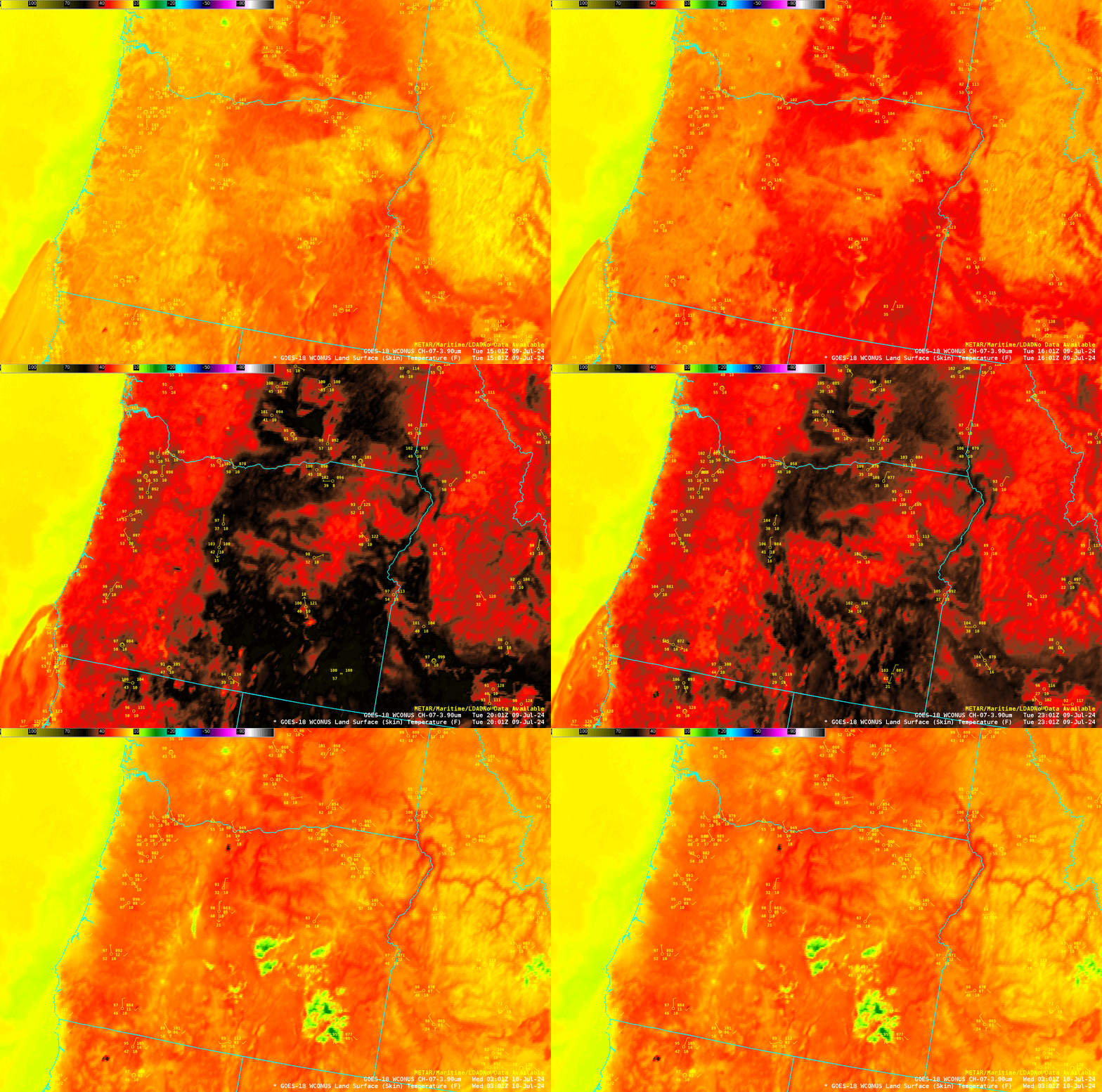
GOES-18 Band 7 imagery, below, also presented hourly instead of at its normal 5-minute cadence for the GOES-18 PACUS domain, shows a similar evolution of temperatures. The surface temperatures become just as warm as two fires, one in northern California (the Shelley Fire) and one east of Medford (the Salt Creek Fire).

Relief from the heat over western Oregon is shown in the gridded NUCAPS 850-mb temperature field shown below. In contrast to the values around 20oC (in yellow) over eastern Oregon at 0530 UTC on 10 July, values closer to 10oC (in cyan) are over the Pacific Ocean. That cooler airmass will help to temper the heat over western Oregon, but heat on will continue in eastern Oregon.

The National Weather Service Offices in Portland, Medford and Pendleton have more information on this event.

