Swath of snow cover in the Deep South
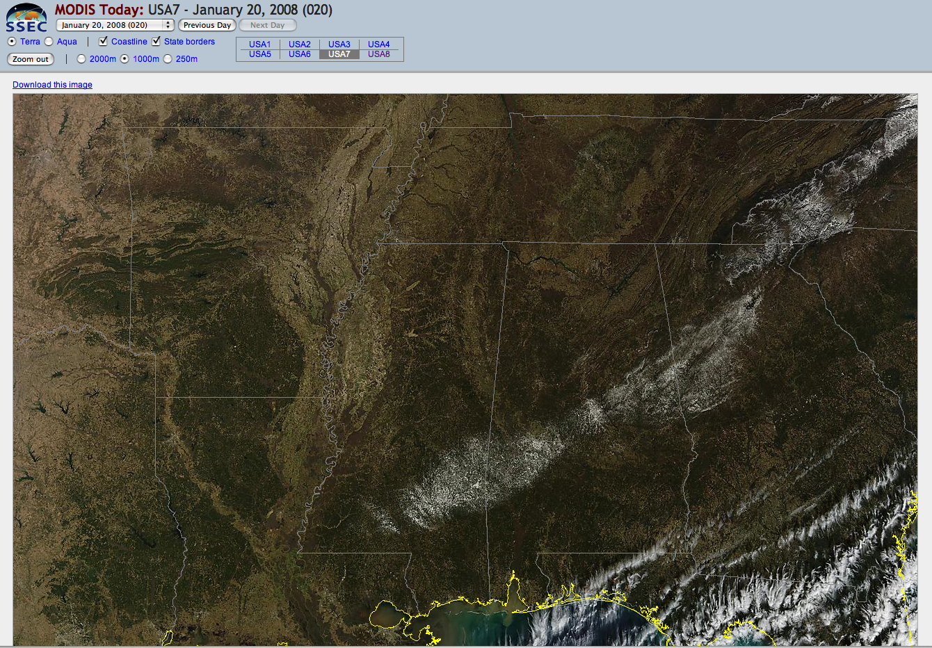
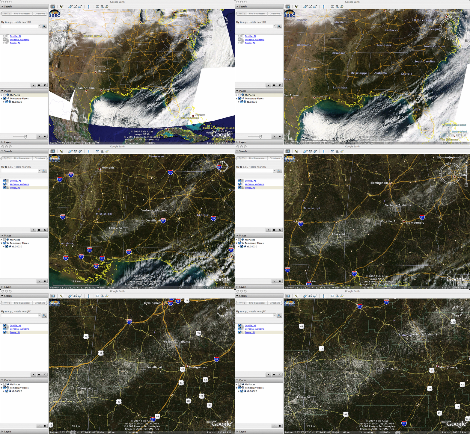
A Terra MODIS true color image from the SSEC MODIS Today site (above) revealed a swath of fresh snow cover across parts of Mississippi, Alabama, and Georgia on 20 January 2008. Snowfall amounts in the state of Alabama (which fell on the previous day) were as high as 5.8 inches near Verbena, 5.0 inches at Orrville, and 4.0 inches at Toxley (located on the MODIS imagery using Google Earth, below); snowfall up to 3.0 inches was reported in Mississippi, with 1.5 inches falling in Georgia.
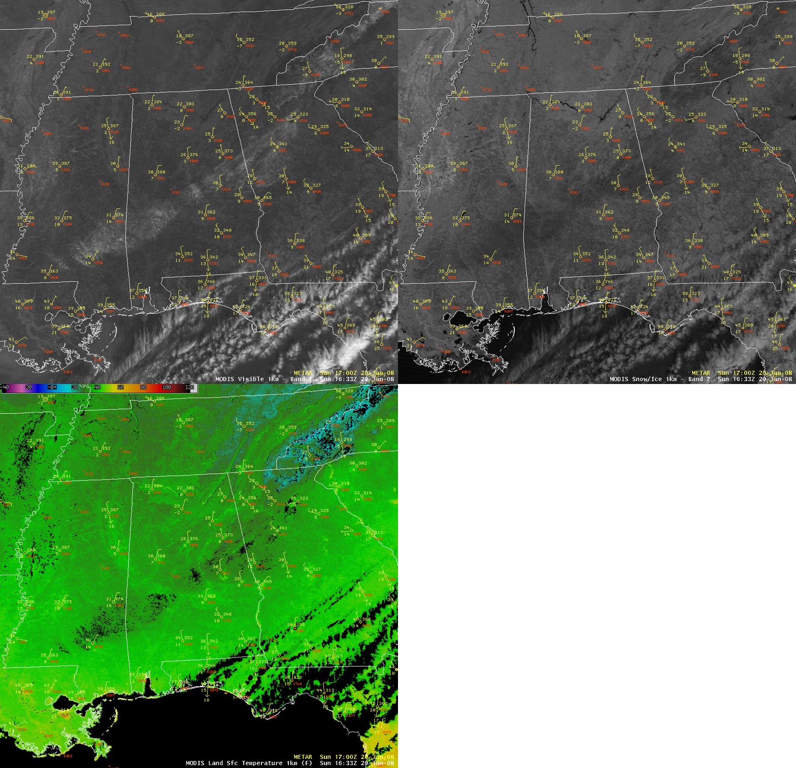
AWIPS images of the MODIS visible channel, the 1.6µm “snow/ice channel”, and the Land Surface Temperature product (below) confirmed that this feature was indeed snow cover (snow is a strong absorber at the 1.6µm wavelength, and appears darker on the “snow/ice channel” image); in addition, the land surface temperatures within the area of snow cover were generally several degrees F colder (upper 20s to low 30s F, darker green enhancement) compared to the surrounding areas with bare ground (where land surface temperatures were generally in the mid 30s to around 40 F).


