Long-lived MCV Over Texas
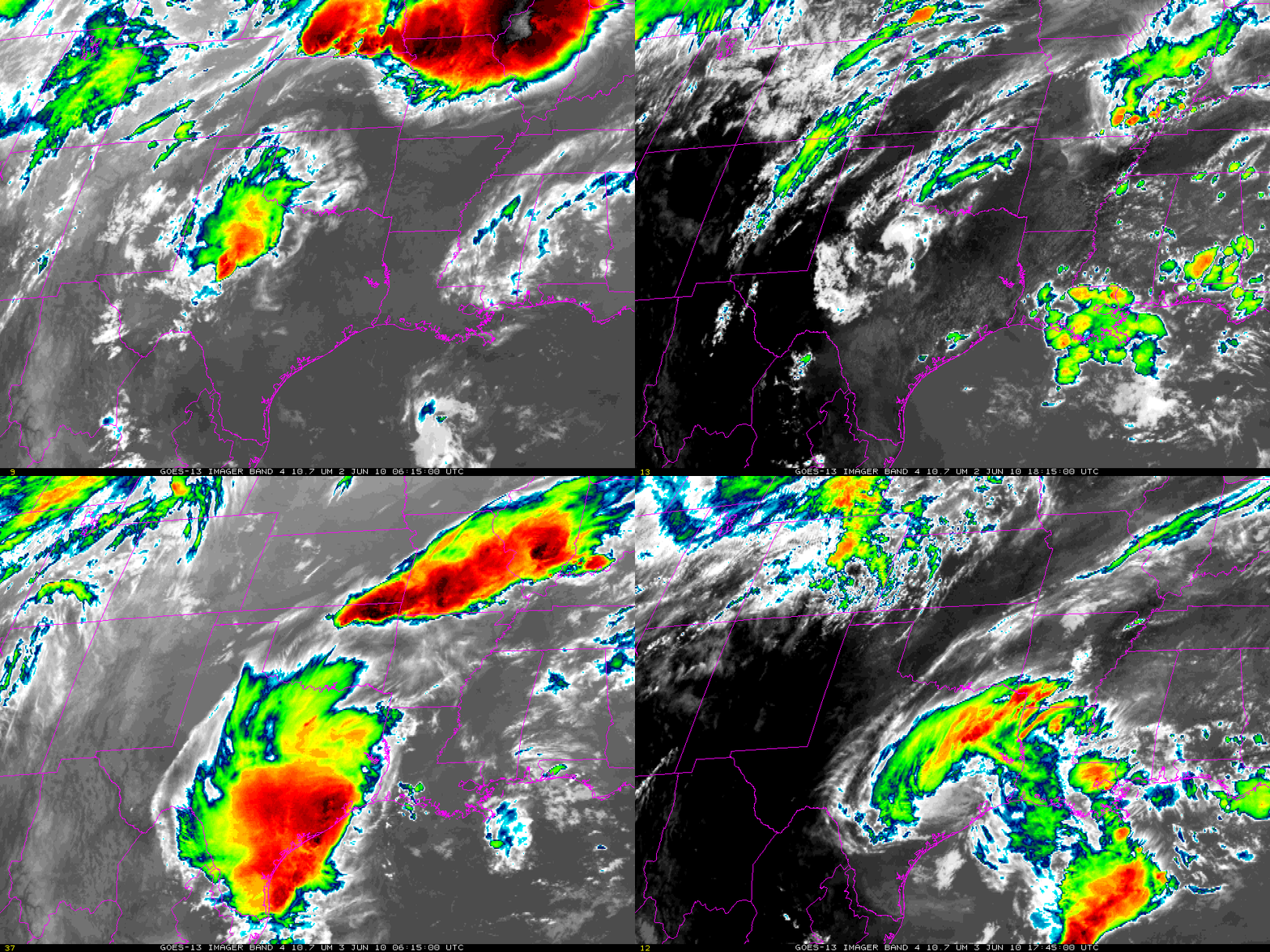
A convective system over Texas spawned a Mesoscale Convective Vortex (MCV) during the day on 2 June, as shown in the 1.5-day loop above (color-enhanced GOES-13 11-micron imagery shown every 12 hours). The convection along the dryline at 0615 UTC on 2 June evolved into the MCV shown at 1815 UTC as a swirl of mid-level cloudiness over central Texas. That swirl supported the development of convection that subsequently evolved into a larger MCV on 3 June.
Atmospheric conditions that support MCVs are fairly well-understood. Wind shear acts to disrupt the warm core circulation of the MCV, thus small values of wind shear are commonly found near MCVs. In addition, MCVs are maintained by latent heat release in convection, suggesting the presence of abundant moisture. Low values of wind shear are noted on 3 June over eastern Texas: Model shear from the RUC (shown here overlain on the 11-micron imagery in a screengrab from AWIPS) has a wide region of weak shear over east Texas. The radiosonde from Fort Worth from 1200 UTC on 3 June also shows low values of shear. Abundant moisture is available to the system. Blended Total Precipitable Water (TPW) imagery (data from GPS over land and AMSU over water — click here and here for more information) from AWIPS shows values nearing two inches over east Texas. A loop of MIMIC TPW suggests moisture is being drawn into east Texas from the adjacent Gulf of Mexico.
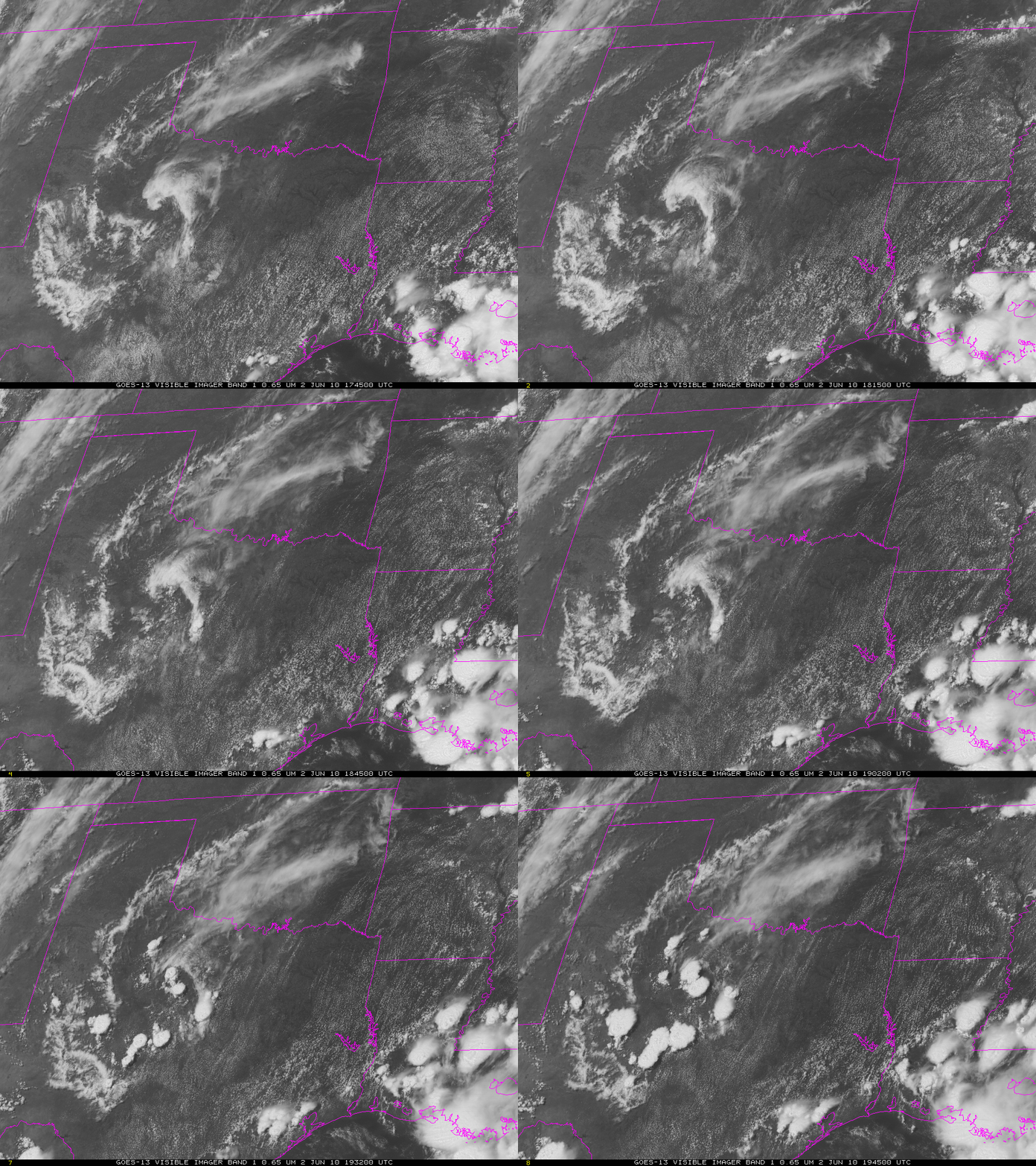
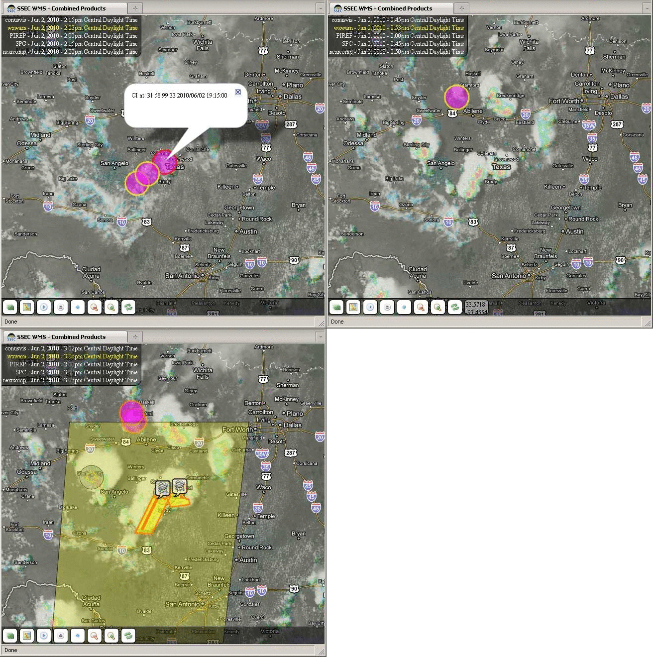
Visible imagery from GOES-13 (above) shows convection developing rapidly over central Texas yesterday in the vicinity of the MCV. How well do CIMSS convective products do in predicting that development? Careful inspection of the loop above shows towering Cumulus at 1845 UTC and glaciating towers only 45 minutes later at 1932 UTC. (Click for imagery at 1902 and 1915 UTC). Screengrabs from a webmap server run at SSEC show UW Convective Initiation indicated as ongoing at 1915 UTC for a developing system that is warned as severe 45 minutes later. See the loop of screengrabs below.
Multi-day MCVs are infrequent: usually, an MCV will not persist for more than 12 hours, although famous multi-day examples exist (such as the MCV that spawned the July 1977 Johnstown, PA flood. That MCV could be traced to convective development over the Dakotas three days earlier). Note how the MCV over Texas grows in horizontal size from 2 June to 3 June. At 1200 UTC on 2 June the convective system was confined to a small region of north-central Texas. By 1200 UTC on 3 June, the region of influence has grown greatly, and the convective system covers all of eastern Texas and extends into the Gulf of Mexico. In addition, the strength of the accompanying 500-mb height field perturbation has increased. This upscale development — from smaller scale to larger scale — is one more interesting aspect of this system.
Added: Click here for a 2.5-day animated gif loop of 13-micron imagery data from GOES-13 (48 megabytes of data) produced using McIDAS-V.
This weather event is also discussed at the Hazardous Weather Testbed blog. Link.


