Thundersnow in southern Wisconsin
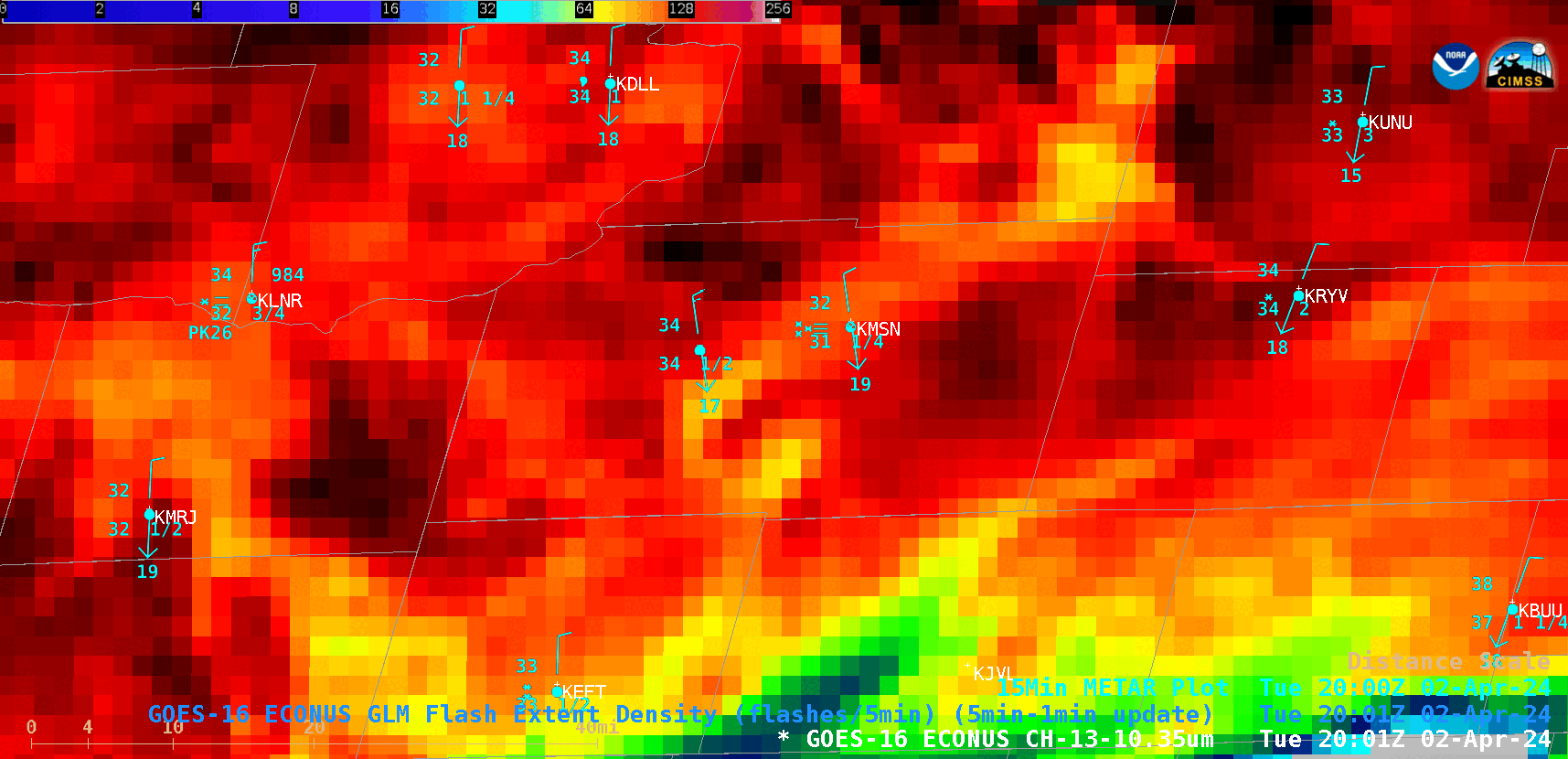
GOES-16 “Clean” Infrared Window (10.3 µm) images with an overlay of GLM Flash Extent Density and plots of surface reports, from 2001-2106 UTC on 02 April [click to play animated GIF | MP4]
A cursor sample of the GOES-16 cloud-top infrared (10.3 µm) brightness temperature along with the associated Cloud Top Height and Cloud Top Phase derived products at 2041 UTC (below) showed that the Height was 27884.88 ft and the Phase was Ice (as would be expected with a 10.3 µm infrared brightness temperature of -41.57ºC).
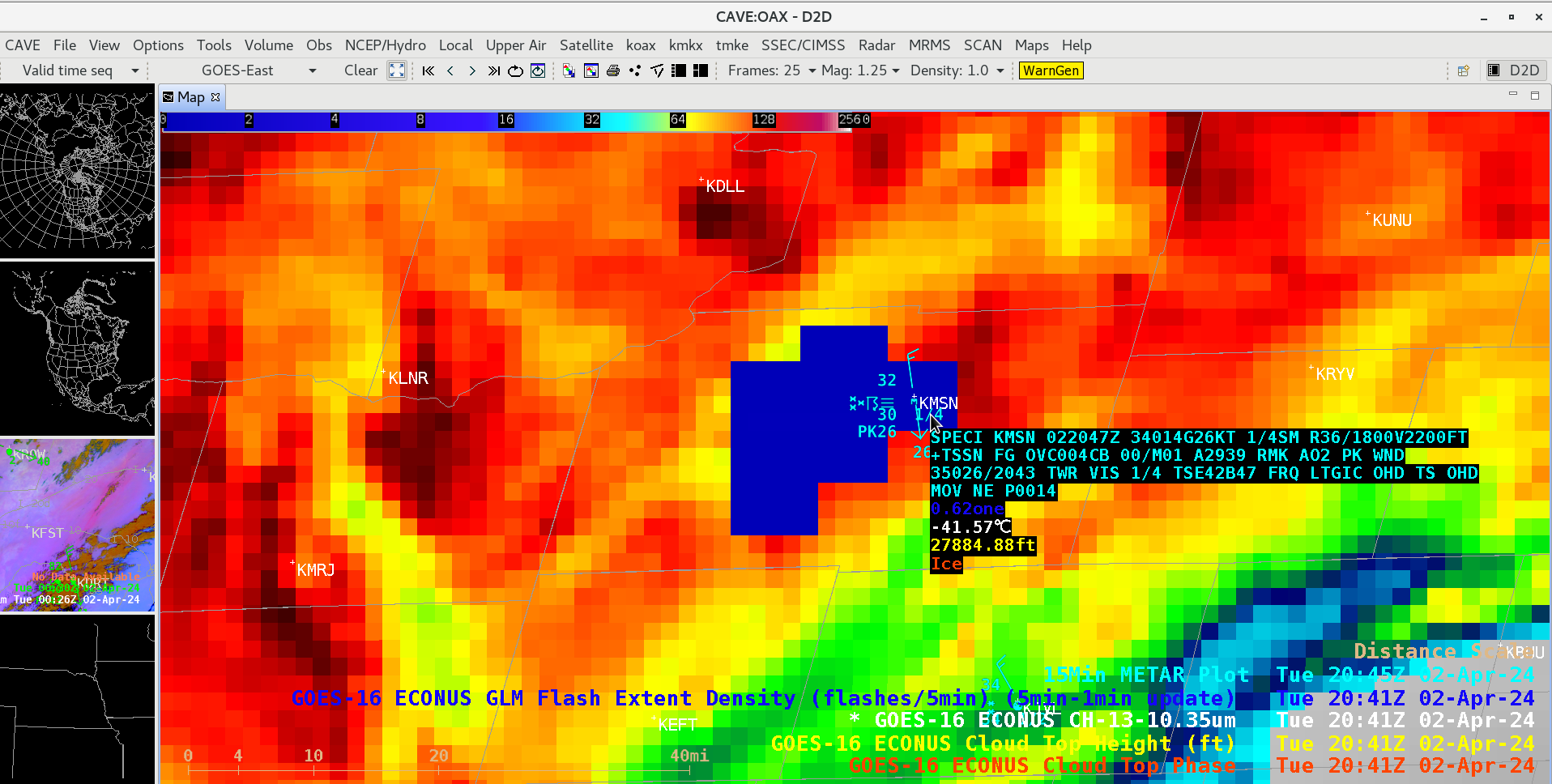
Cursor sample of the GOES-16 “Clean” Infrared Window (10.3 µm) cloud-top brightness temperature along with the Cloud Top Height and Cloud Top Phase derived products at 2041 UTC on 02 April [click to enlarge]
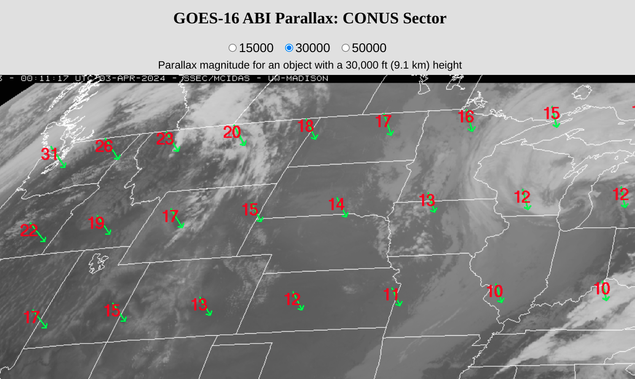
GOES-16 parallax correction direction (green) and magnitude (km, red) for a cloud top of 30000 ft or 9.1 km [click to enlarge]