Swaths of snow cover across Iowa, northern Illinois and southern Wisconsin
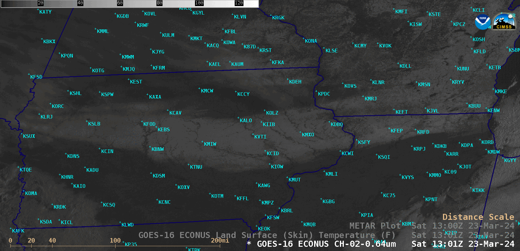
GOES-16 “Red” Visible (0.64 µm) images, with/without hourly plots of surface observations, from 1301-2001 UTC on 23 March [click to play animated GIF | MP4]
As daytime air temperatures warmed as a result of abundant incoming solar radiation, the zone of lesser snow depth (along the Wisconsin/Illinois border) between the 2 primary swaths of deeper snow cover revealed their northern and southern boundaries. The sharp southern boundary of the Illinois snow cover was particularly notable.
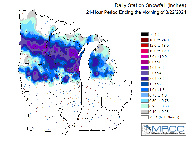
Maps of 24-hour snowfall ending at 1200 UTC on 22 March and 23 March (source)

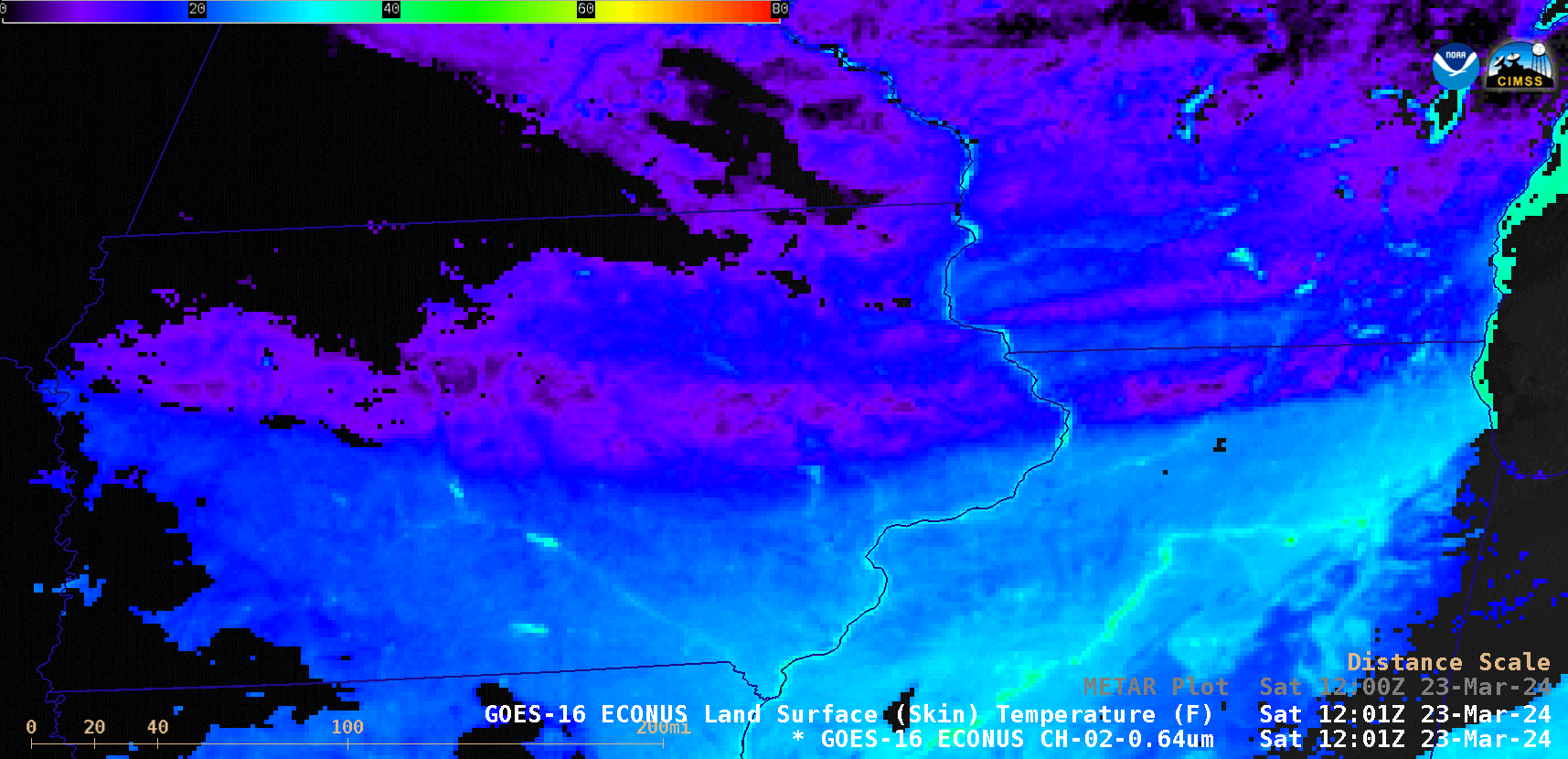
GOES-16 Land Surface Temperature derived product at 1201 UTC, with/without plots of METAR sites [click to enlarge]
A toggle between the GOES-16 Land Surface Temperature derived product at 1201 UTC and a Visible image at 1331 UTC (below) demonstrated how the LST product could be useful for identifying areas where snow depth was likely the greatest (especially in areas having sparse observations) — with deeper snow cover exhibiting a colder LST value.
GOES-16 Land Surface Temperature derived product at 1201 UTC and “Red” Visible image at 1331 UTC [click to enlarge]
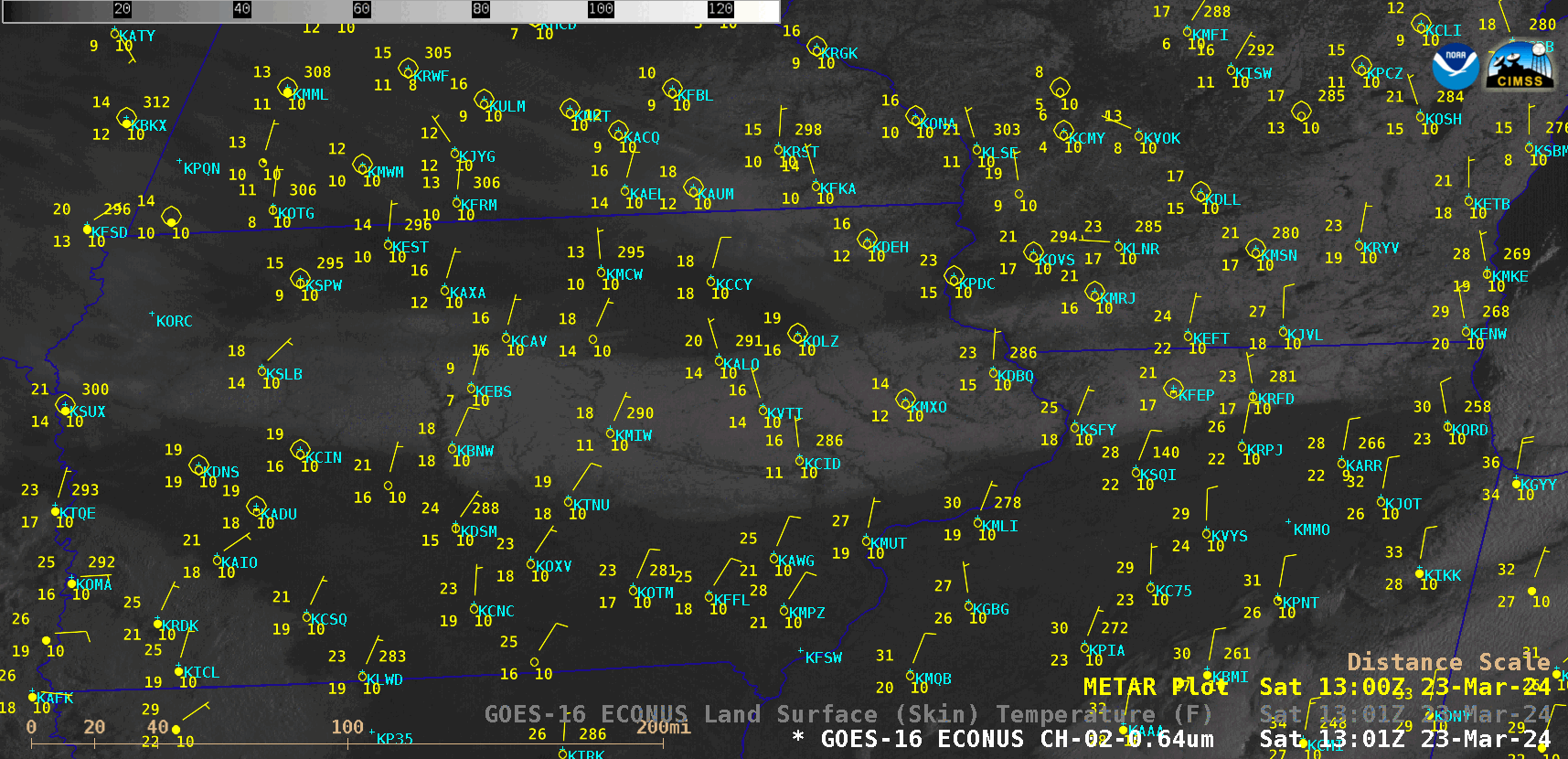
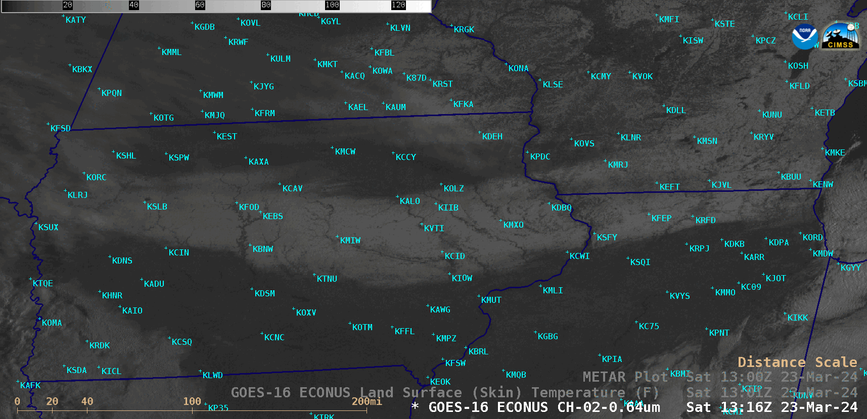
GOES-16 Visible image and Land Surface Temperature derived product at 1301 UTC [click to enlarge]
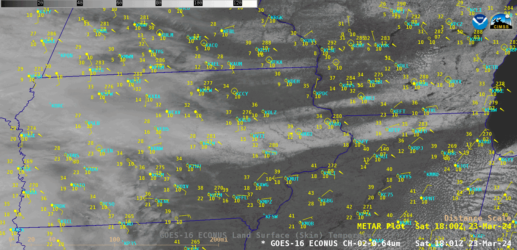
GOES-16 Visible image and Land Surface Temperature derived product at 1801 UTC [click to enlarge]
_______________________________________
It bears mentioning that some lightning activity was seen during the 22 March snowfall event, with two sites — Cedar Rapids, Iowa (KCID) and Savanna, Illinois (KSFY) — briefly reporting thundersnow. Toggles between GOES-16 Water Vapor (6.9 µm) images + GLM Flash Extent Density on 22 March and Visible images on 23 March (below) indicated that the lightning occurred near the southern edge of the resulting swath of heavy snow across Iowa and Illinois.
GOES-16 Mid-level Water Vapor (6.9 µm) image with an overlay of GLM Flash Extent Density at 1151 UTC on 22 March, along with a “Red” Visible (0.64 µm) image at 1316 UTC on 23 March [click to enlarge]

GOES-16 Mid-level Water Vapor (6.9 µm) image with an overlay of GLM Flash Extent Density at 1316 UTC on 22 March, along with a “Red” Visible (0.64 µm) image at 1316 UTC on 23 March [click to enlarge]