Wind-driven grass fires in Nebraska
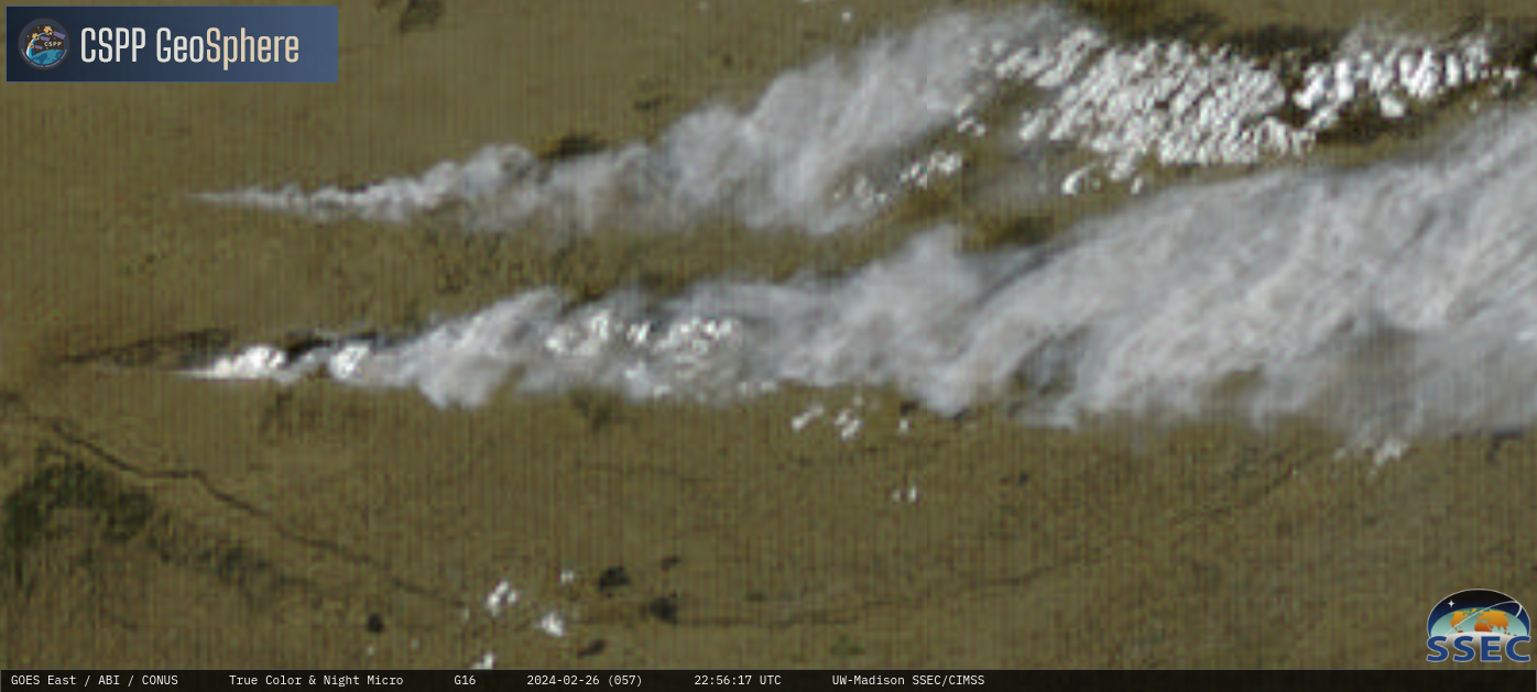
GOES-16 True Color RGB images + Nighttime Microphysics RGB images, from 1601 on 26 February to 0016 UTC on 27 February [click to play MP4 animation]
5-minute CONUS Sector GOES-16 (GOES-East) True Color RGB images + Nighttime Microphysics RGB images from the CSPP GeoSphere site (above) showed large smoke plumes produced by 2 wind-driven grass fires in central Nebraska (just north of North Platte) on 26 February 2024. The burn scar associated with the larger (southernmost) fire was very apparent, as a west-to-east oriented swath of darker brown shades. After sunset, the hot fire signatures showed up as clusters of darker purple pixels in Nighttime Microphysics RGB imagery.
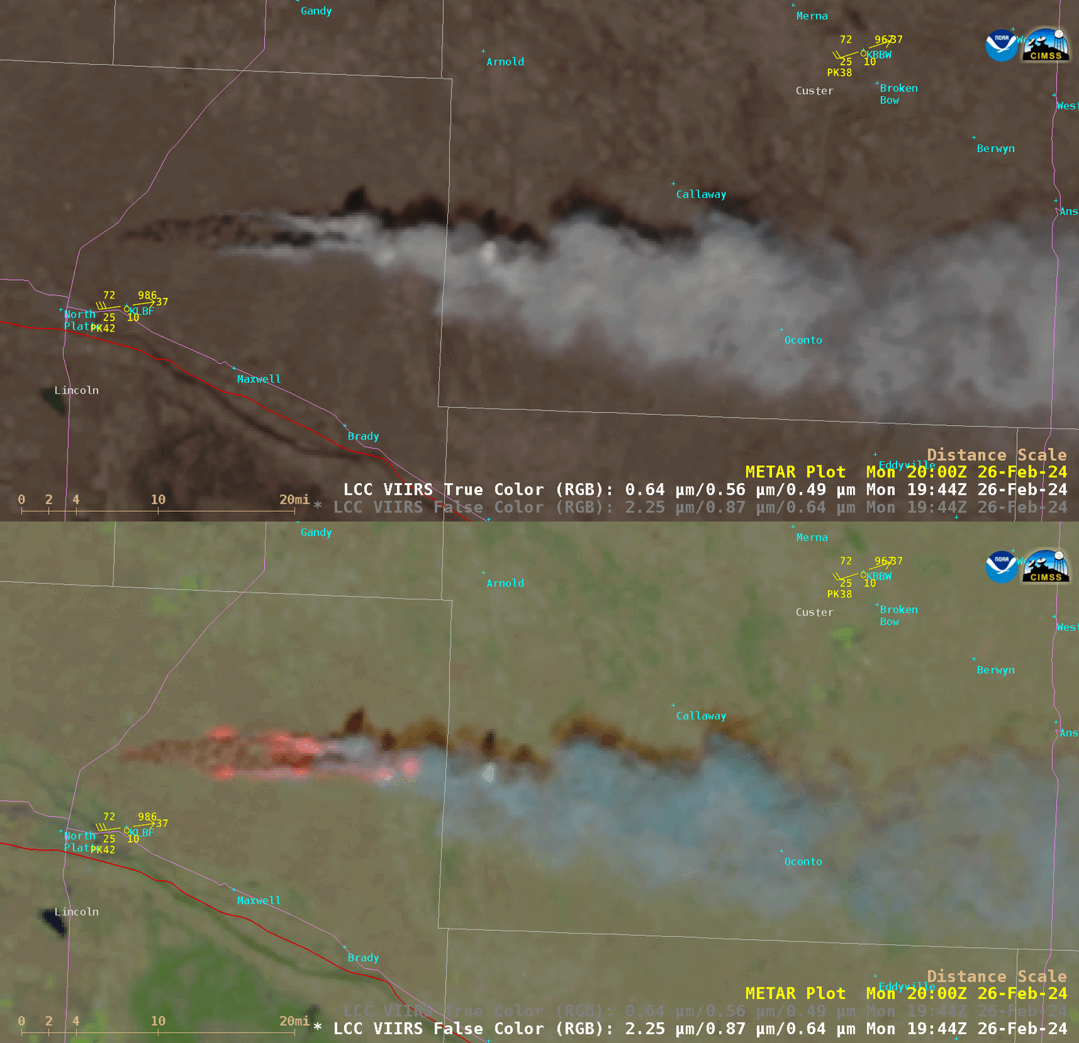
Suomi-NPP VIIRS True Color RGB and False Color RGB images valid at 1950 UTC; Interstates are plotted in red, with State Highways plotted in violet [click to enlarge]
In a toggle between Suomi-NPP VIIRS True Color RGB and False Color RGB images valid at 1950 UTC (above), a more detailed view of the burn scar was seen in the True Color RGB image — with the hot thermal signatures of active fires exhibiting brighter shades of pink to red. The head of the fire was close to the Lincoln County / Custer County line at that time. A sequence of 3 VIIRS Shortwave Infrared (3.74 µm) images from NOAA-20 and Suomi-NPP (below) provided a high-resolution view of how quickly the fire’s leading edge moved eastward in a time span of about 1 hour and 40 minutes. The VIIRS data used to create these images were received and processed using the CIMSS/SSEC Direct Broadcast ground station.
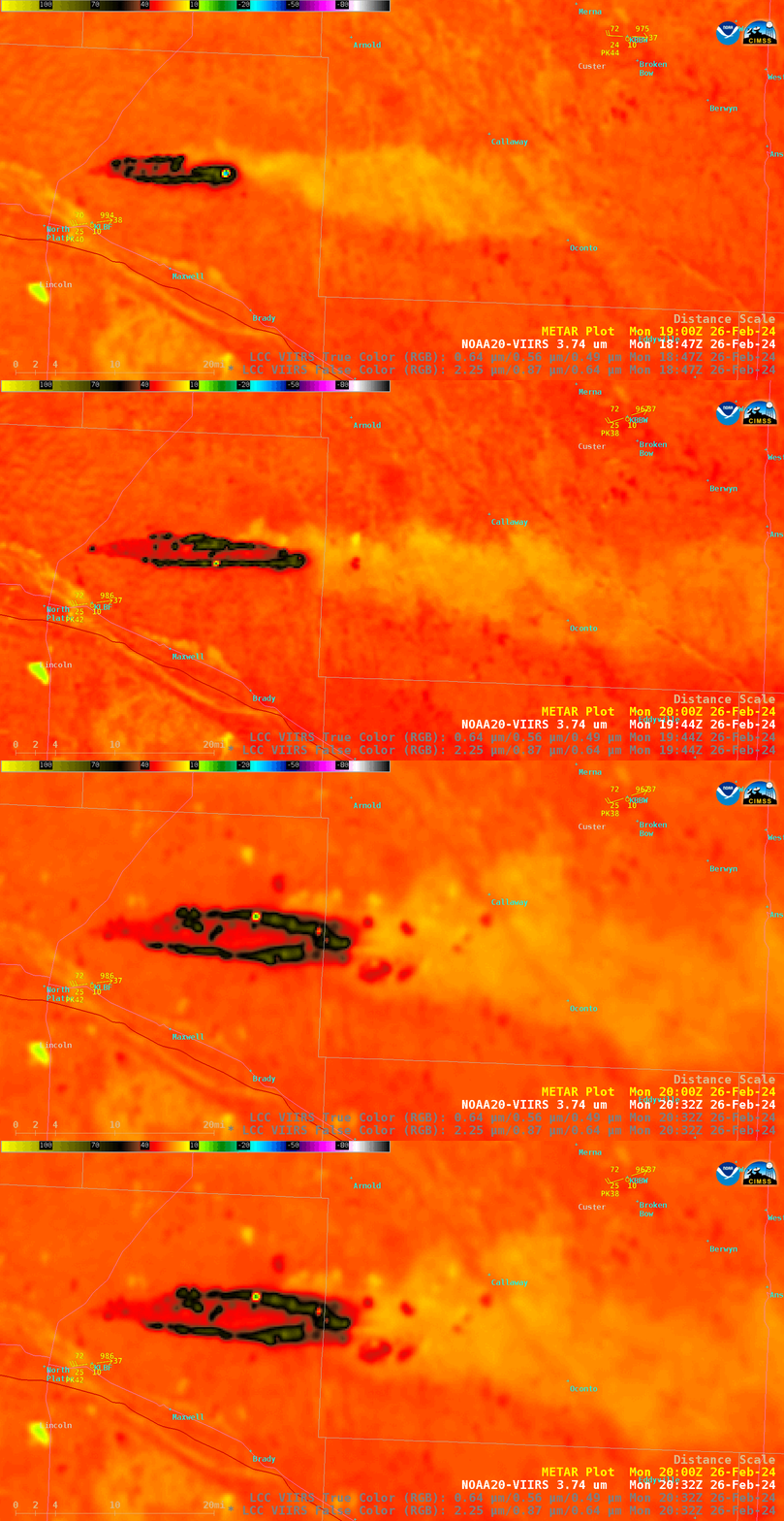
VIIRS Shortwave Infrared (3.74 µm) images from NOAA-20 and Suomi-NPP on 26 February [click to enlarge]
1-minute Mesoscale Domain Sector GOES-16 Fire Temperature RGB images along with the Fire Power, Fire Mask and Fire Temperature derived products (below) provided a closer view of the southern grass fire thermal signature and its rapid eastward run toward (and eventually across) the Lincoln County / Custer County line (the Fire Power, Fire Mask and Fire Temperature derived products are components of the GOES Fire Detection and Characterization Algorithm FDCA). Distinct thermal signatures of the fire were evident beginning at 1644 UTC — which advanced quickly eastward due to winds gusting as high as 42 knots (49 mph) at North Platte (KLBF).
GOES-16 Fire Temperature RGB (top left), Fire Power (top right), Fire Mask (bottom left) and Fire Temperature (bottom right) derived products, from 1600 UTC on 26 February to 0000 UTC on 27 February; Interstates and State Highways are plotted in violet [click to play animated GIF | MP4]
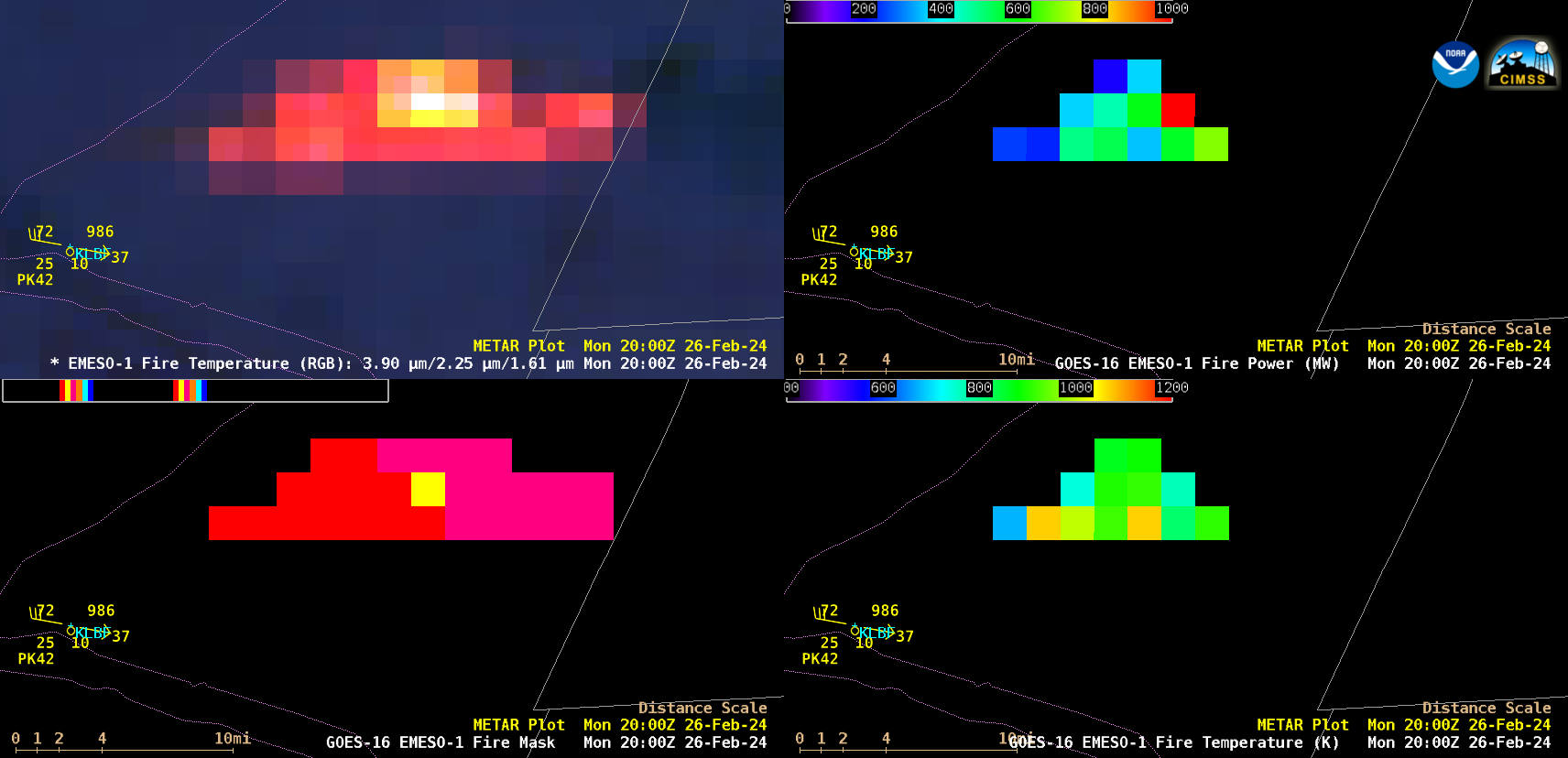
Parts of this fast-moving grass fire burned very hot at times — in fact, a cursor sample of GOES-16 Fire Temperature RGB and Fire Mask at 2000 UTC (below) showed that the fire exhibited a maximum 3.9 µm infrared brightness temperature of 138.71ºC (which is the saturation temperature of the GOES-16 ABI Band 7 detectors). The Fire Mask product helps to quickly identify such “Saturated Fire” pixels by highlighting them as bright yellow. In addition, maximum Fire Power values exceeded 2500 MW.
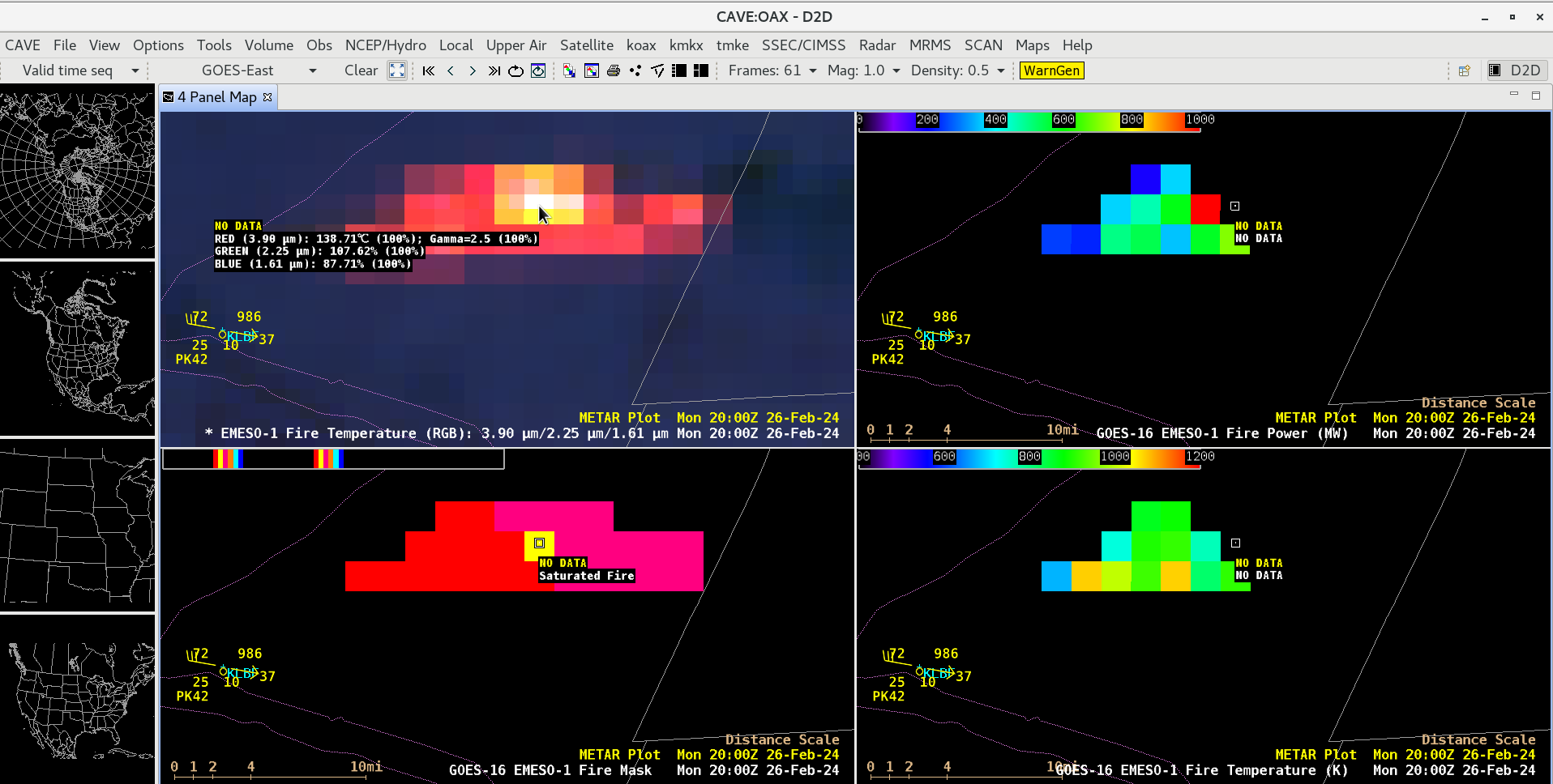
Cursor sample of GOES-16 Fire Temperature RGB (top left) and Fire Mask (bottom left) at 2000 UTC on 26 February [click to enlarge]
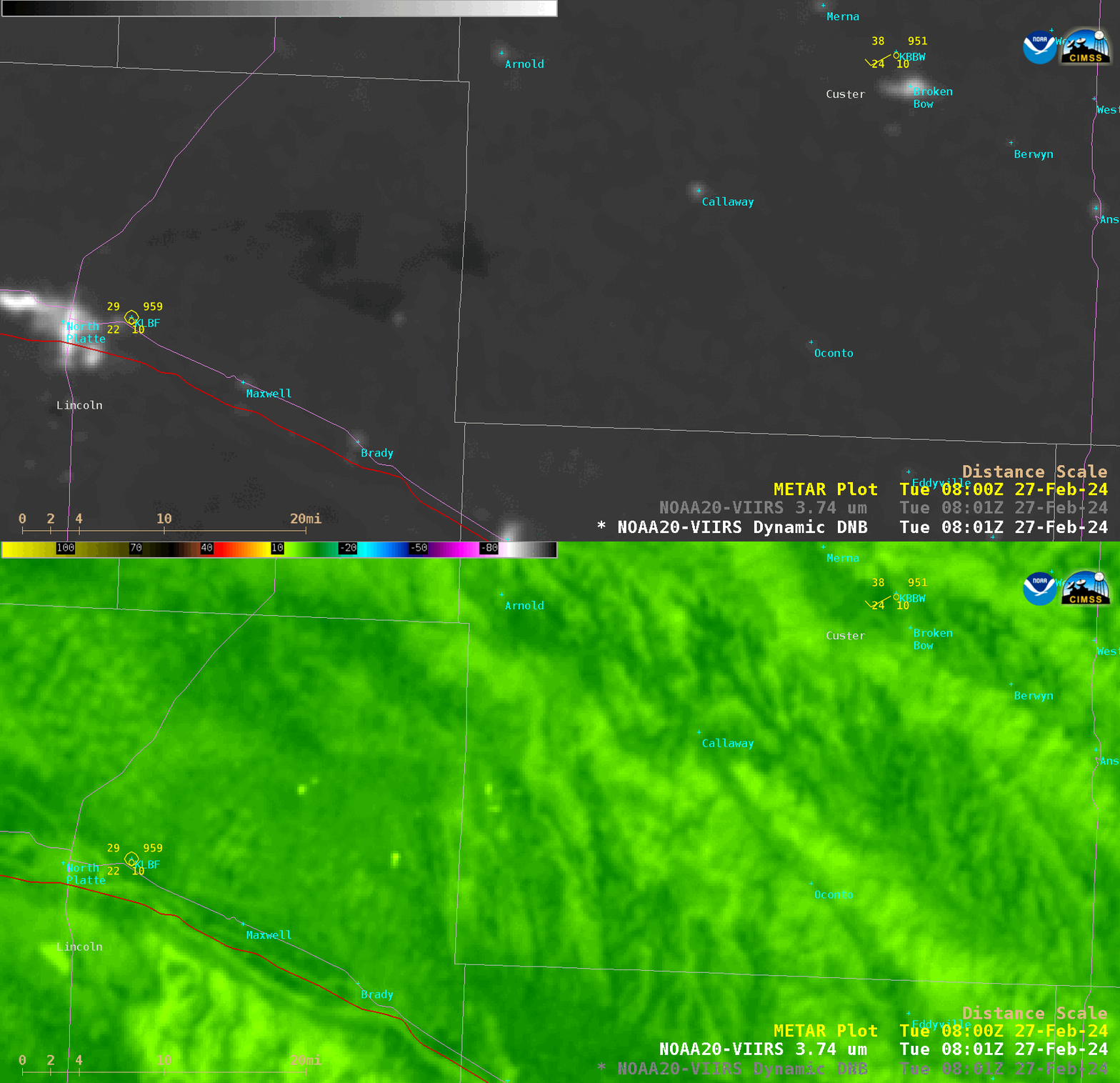
Suomi-NPP (mislabeled as NOAA-20) VIIRS Day/Night Band (0.7 µm) and Shortwave Infrared (3.74 µm) images, valid at 0808 UTC on 27 February [click to enlarge]
During the following nighttime hours, a toggle between Suomi-NPP (mislabeled as NOAA-20) VIIRS Day/Night Band (0.7 µm) and Shortwave Infrared (3.74 µm) images (above) showed the area of the grass fire at 0808 UTC (2:08 AM CST) on 27 February. Due to ample illumination from the Moon — which was in the Waning Gibbous phase, at 92% of Full — darker areas of burned grassland could be seen, extending just across the Lincoln County / Custer County border. Although most of the fire had ended (since wind speeds decreased dramatically after sunset), a few clusters of warmer pixels remained along the perimeter of the burn scar.

