Atmospheric Rivers Drench California
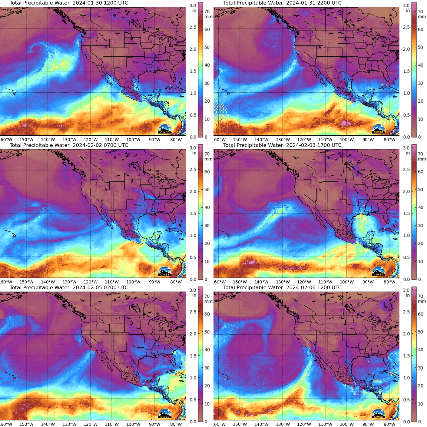
2024 has seen several strong storms hit the U.S. West Coast delivering repeated rounds of widespread rains and mountain snow, with Southern California experiencing the heaviest rainfall totals. Total Precipitable Water imagery (MIMIC TPW) conveying data acquired by microwave sensors on polar-orbiting satellites is a key tool for meteorologists tracking atmospheric rivers associated with these storm systems, as seen in this loop from 30 January to 6 February.

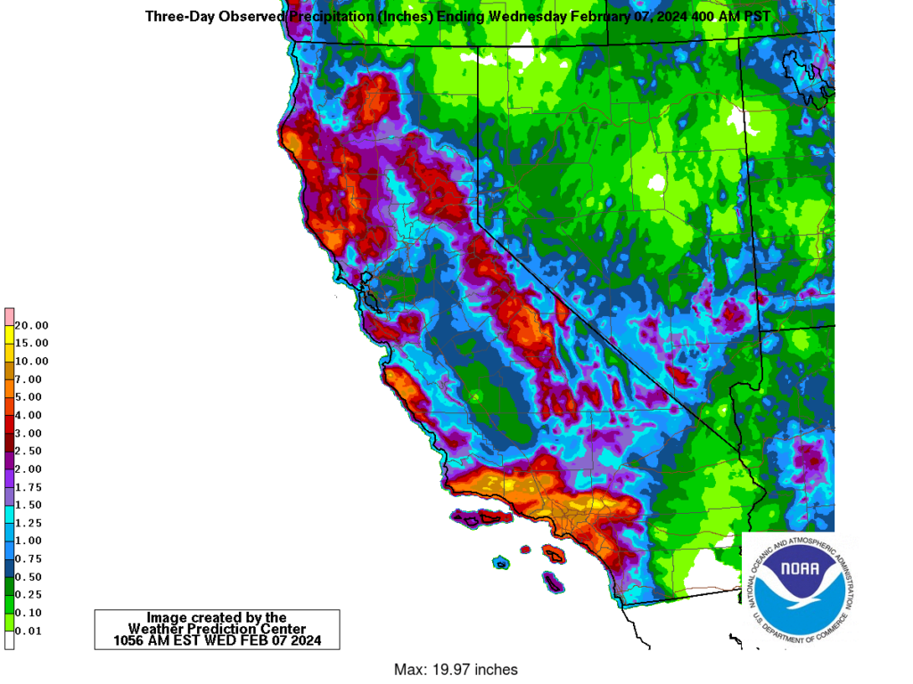
Numerous daily rainfall records have been set so far this year. Below are 3-day observed precipitation totals across the state of California ending at 4am PST on February 7th, with an impressive maximum of 19.97 inches from southwest California.
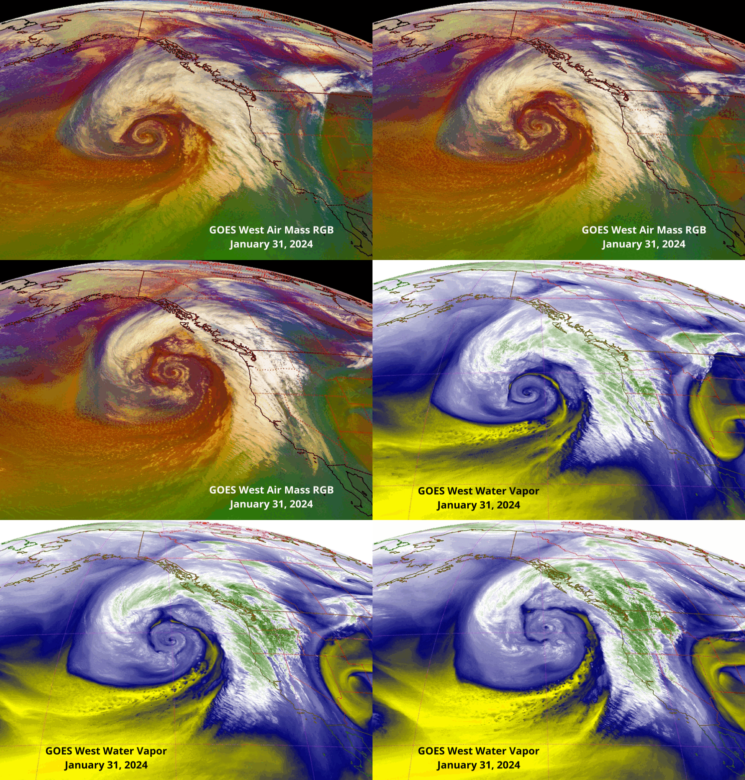
GOES-18 (GOES West) monitors all storms over the Pacific Ocean and U.S. West Coast. The following animation toggles between Mid-level Water Vapor (ABI band 9) and Air Mass RGB imagery on January 31st.

A second storm directed a significant Atmospheric River at southern California on the 3rd and 4th of February as seen in the following loop of GOES West Water Vapor imagery.
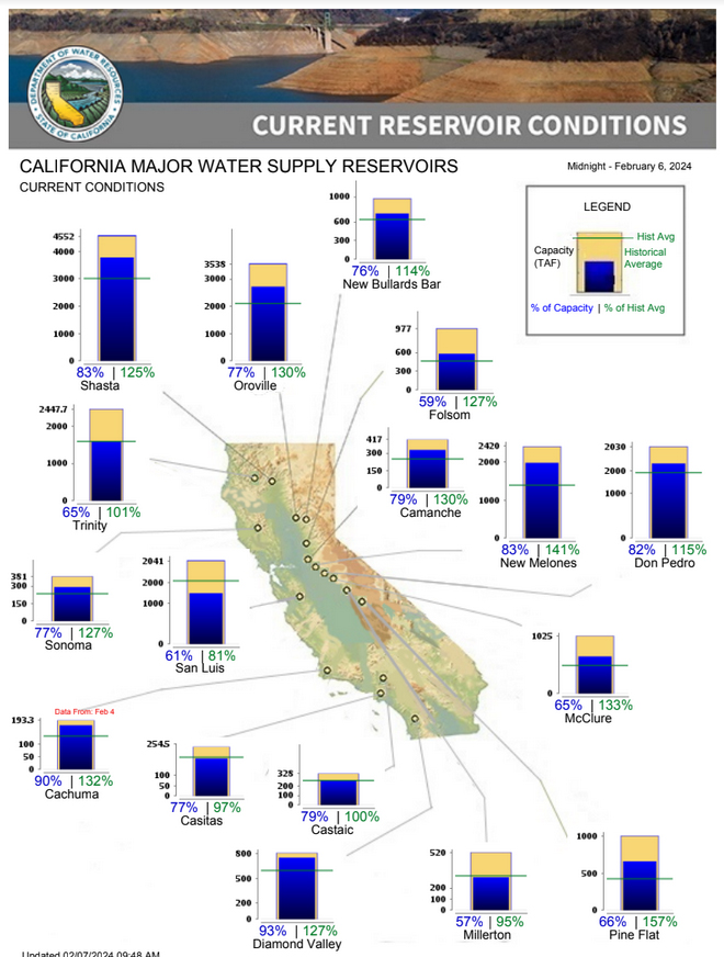
As seen in the accompanying graphic, a majority of the major water supply reservoirs in California are at or above historical averages, an astonishing rebound from the dire drought conditions at the end of 2022. This turn-around commenced last winter when an historic run of nine atmospheric rivers inundated California between December 2022 and January 2023.
Now the concern has shifted to damaging floods, falling trees, mudslides and debris flows.


