Standing waves downwind of the Hawai’ian Islands

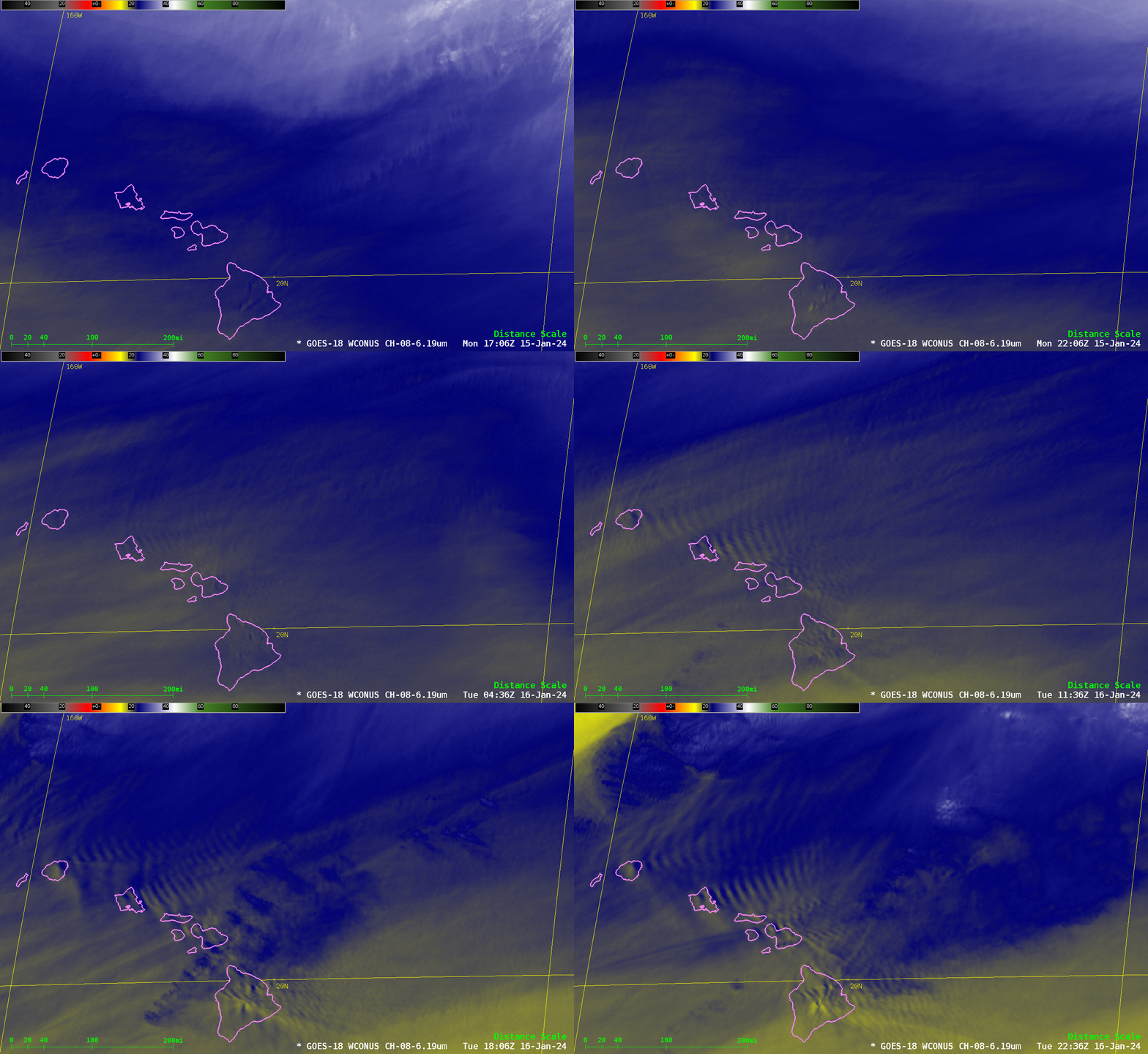
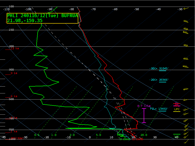
Upper-level water vapor imagery, above, shows the development of standing waves in the lee of the Hawai’ian islands. (The waves were also apparent in mid-level and low-level water vapor imagery). Wave development as shown above requires a perturbation in the vertical — achieved by southwesterly flow in the atmosphere encountering the higher terrain of the islands — and an inversion layer along which the gravity wave will propagate. The Lihue sounding at 1200 UTC on 16 January 2024, below, shows an inversion just above 850 mb, and also one near 570 mb. The higher inversion is likely the one that is trapping the wave energy.

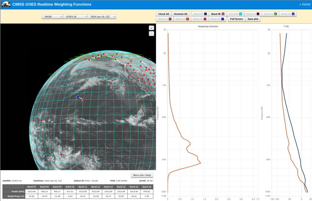
The 6.19 µm Weighting Function (viewable at this CIMSS website) for the Lihue Sounding at 1200 UTC on 16 January 2024, below, shows much of the contribution sensed by the satellite to come from the layer between 400 and 600 mb (with a peak contribution at 535 mb). The warm/cold couplet in the observed waves in the water vapor animation above is from -21 to -24oC. The Lihue sounding had temperatures in that range around 350 mb.

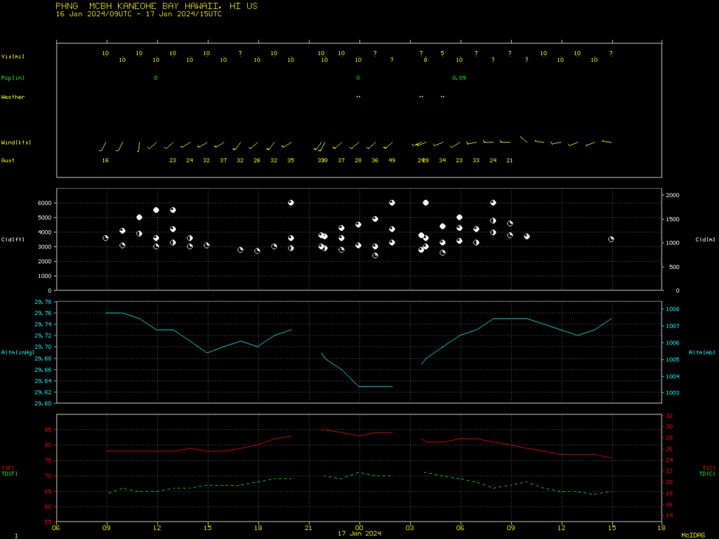
The development of the standing waves coincided with very strong winds near Kaneohe bay on the northeastern shore of Oahu. The Meteorogram below shows observations from Marion E. Carl Field (the Marine Corps Air Station PHNG). Gusts exceeded 30 knots for 9+ hours starting at 1500 UTC.


