“River effect” cloud bands and blowing snow in South Dakota
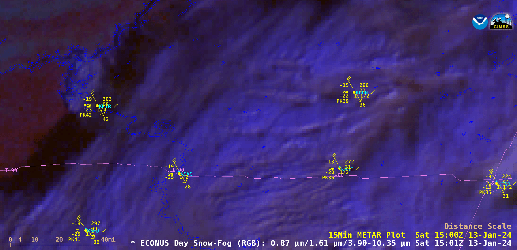
GOES-16 Day Snow-Fog RGB images, from 1501-2301 UTC on 13 January [click to play animated GIF | MP4]
A 30-meter resolution Landsat-9 “Natural Color” RGB (or Day Land Cloud RGB) image at 1730 UTC viewed using RealEarth (below) provided a more detailed look at a few of the cloud plumes developing over Lake Oahe and flowing southeastward. Open water appeared as dark shades of blue, while snow cover and ice appeared as shades of cyan.
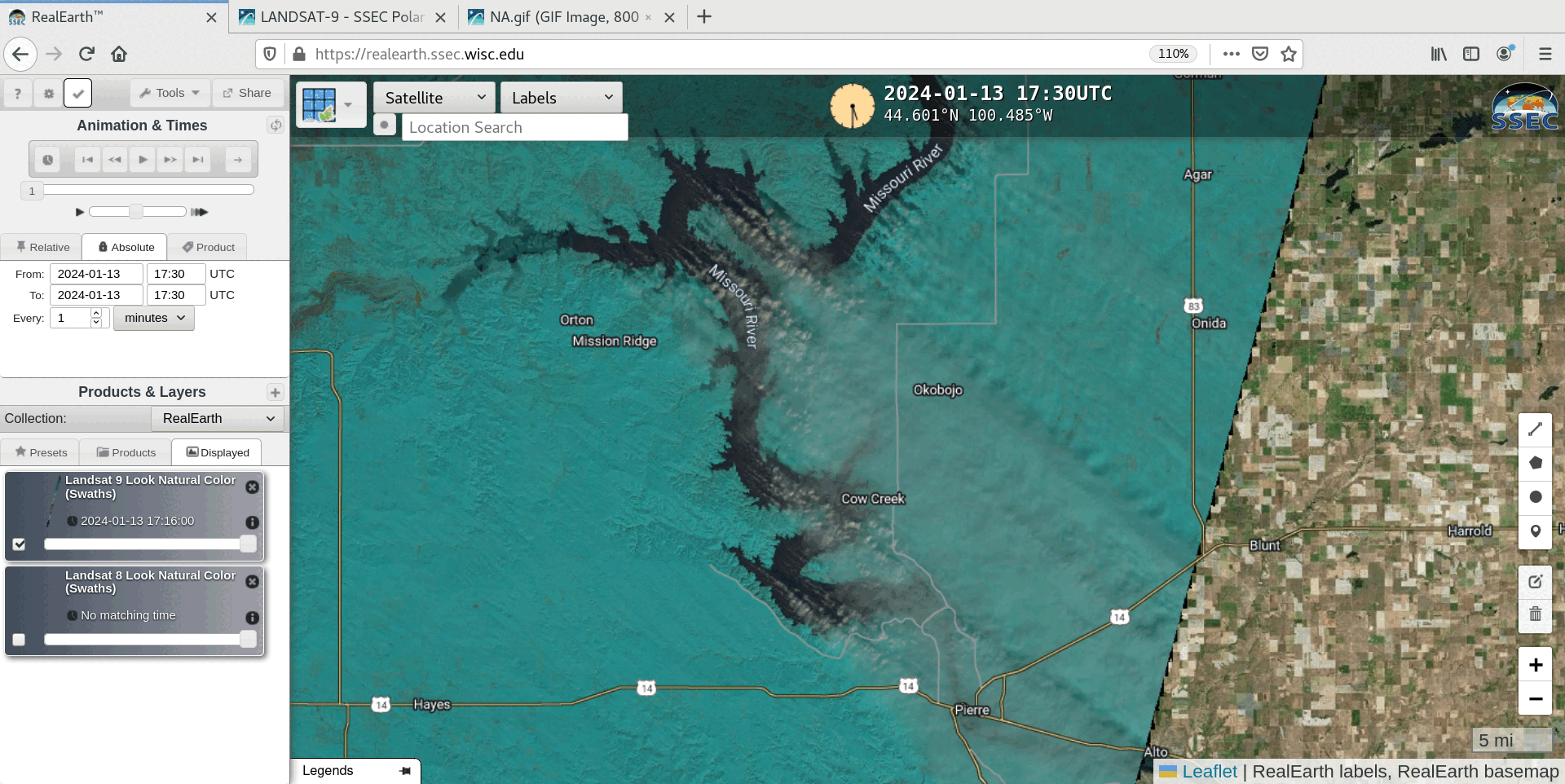
Landsat-9 “Natural Color” RGB (or Day Land Cloud RGB) image at 1730 UTC, with and without labels [click to enlarge]