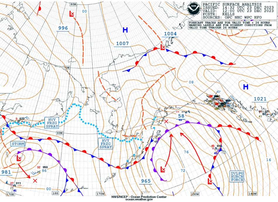
Hurricane Force Low in the Gulf of Alaska

GOES-18 Air Mass RGB images, with/without contours of AK-NAM40 model PV 1.5 Pressure, from 0000 UTC on 23 December to 0300 UTC on 24 December [click to play animated GIF | MP4]
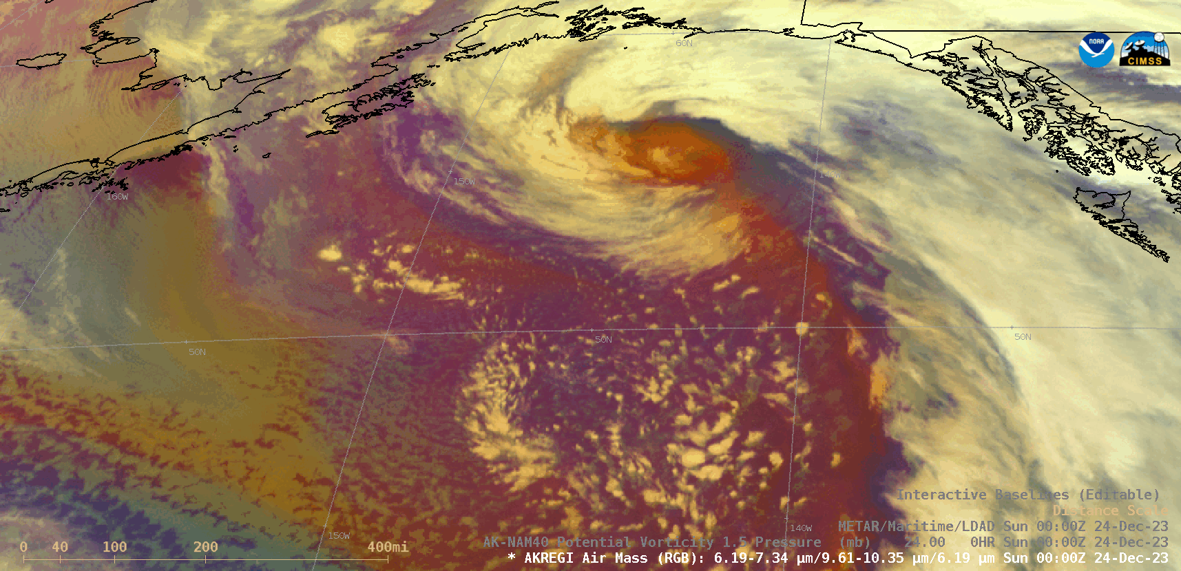
GOES-18 Air Mass RGB image at 0000 UTC on 24 December, with/without contours of AK-NAM40 model PV 1.5 Pressure [click to enlarge]
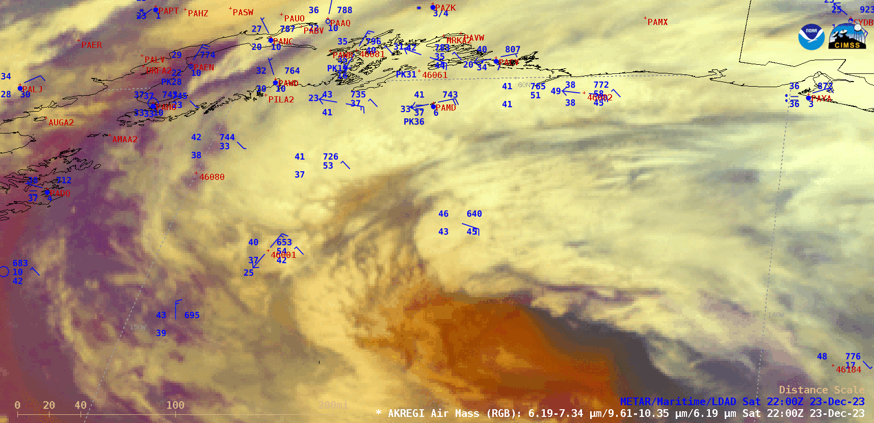
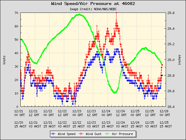
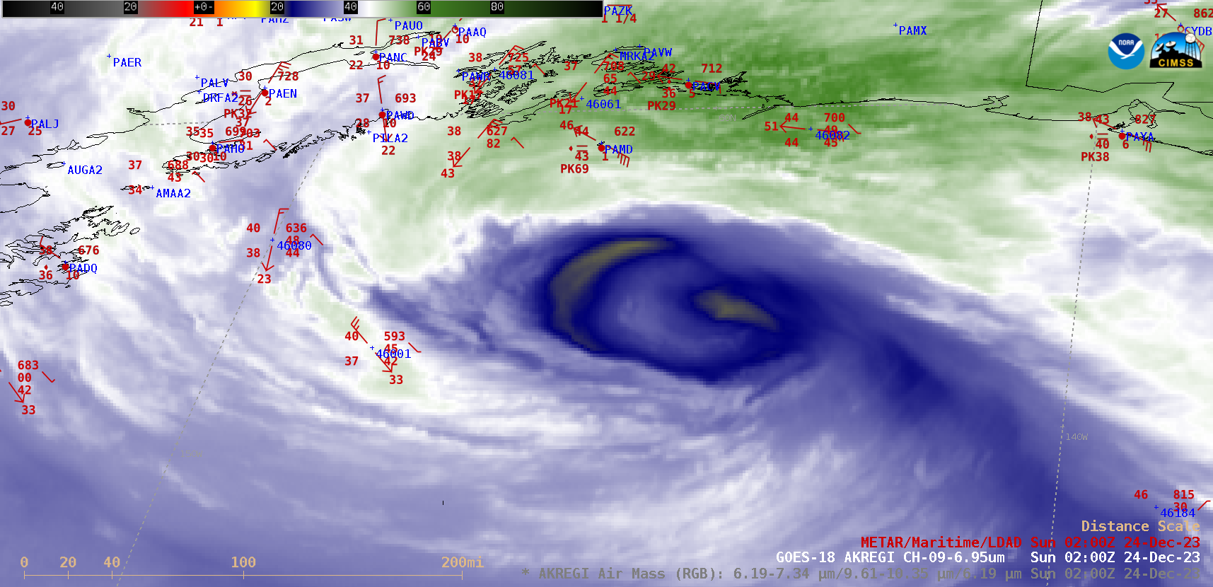
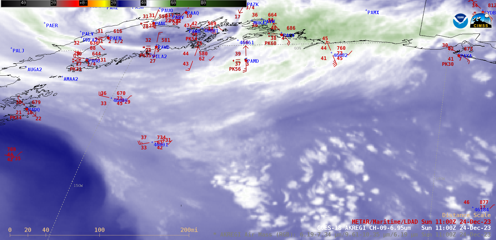
GOES-18 Air Mass RGB and Mid-level Water Vapor (6.9 µm) images, with plots of Surface/Buoy/Ship Reports, from 0000 UTC to 1200 UTC on 24 December [click to play animated GIF | MP4]
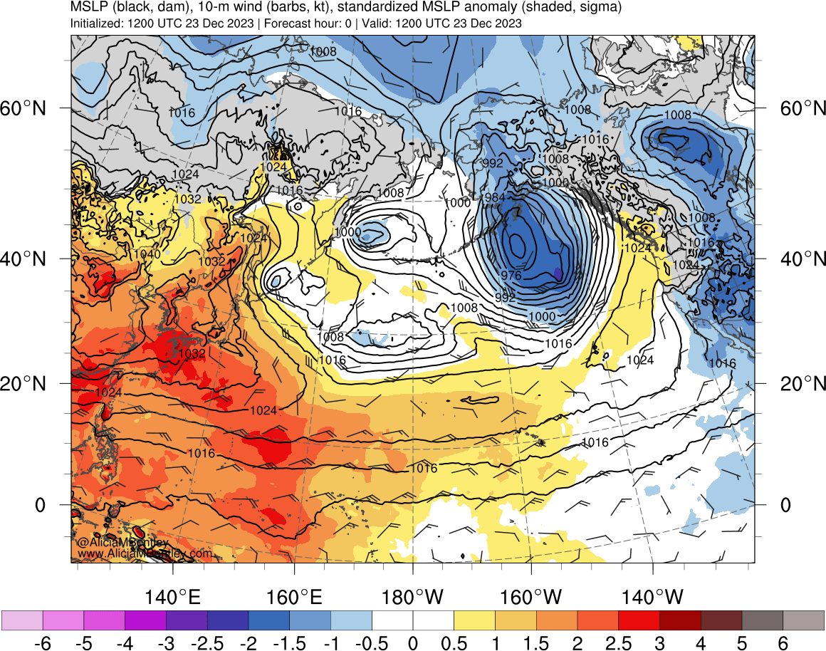
MSLP Anomaly [click to enlarge]
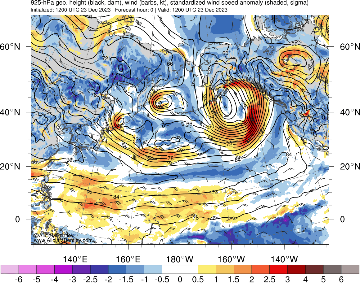
925 hPa Wind Speed anomaly [click to enlarge]