Tropical Storm Mal in the south Pacific
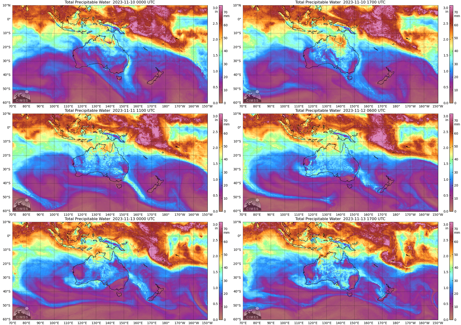
MIMIC Total Precipitable Water fields over the south Pacific near Fiji and Australia, above (source), show the development of a cyclonic circulation in between the ITCZ and SPCZ that moves southward as Cyclone Mal. Some dry air is diagnosed to impinge on the northern part of the storm at the end of the animation.
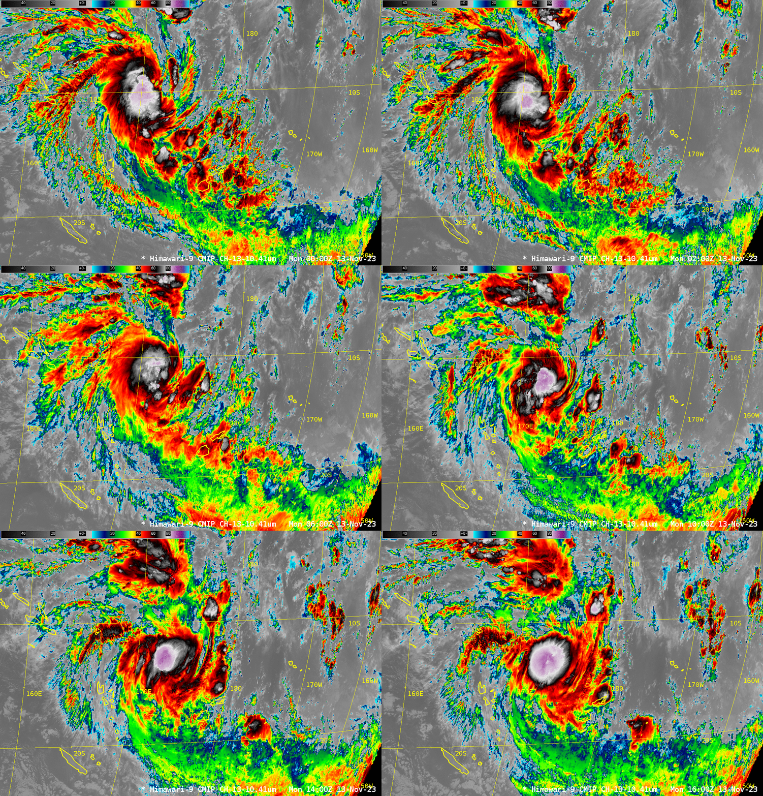
Himawari-9 Clean Window infrared (10.4) imagery, below, shows the development of a very cold Central Dense Overcast (CDO) by 1600 UTC, with brightness temperatures (violet in the enhancement used) between -85oC and -90oC.
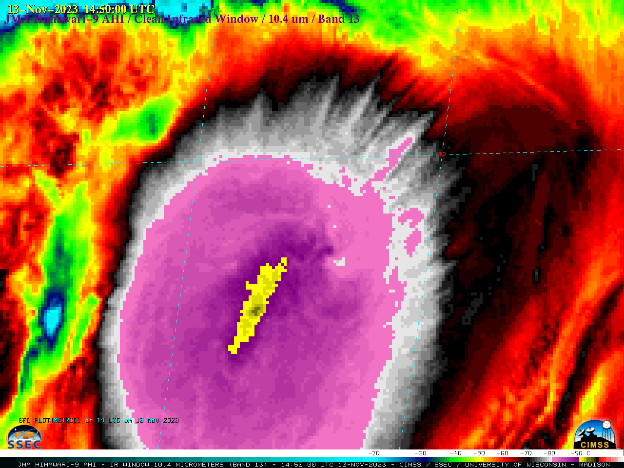
A closer look at 10-minute Himawari-9 Infrared images (below) revealed that cloud-top 10.4 µm brightness temperatures within the CDO were as cold as -96ºC (darker gray pixels embedded within the interior yellow-enhanced region) at 1450 UTC.
JMA Himawari-9 “Clean” Infrared Window (10.4 µm) images, from 1130 UTC to 1800 UTC on 13 November (courtesy Scott Bachmeier, CIMSS) [click to play animated GIF | MP4]
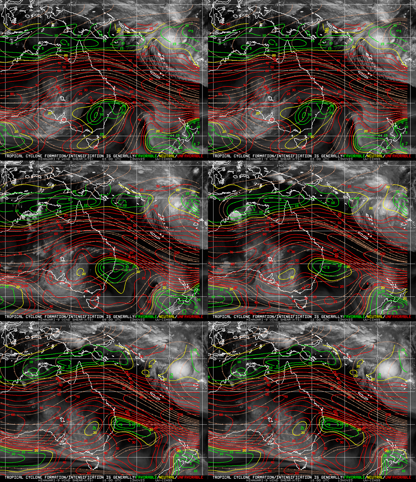
What are shear values like around Mal? The animation below, taken from the SSEC/CIMSS Tropical Weather website (direct link) shows modest amounts of shear over the storm, with significantly more shear to the south.
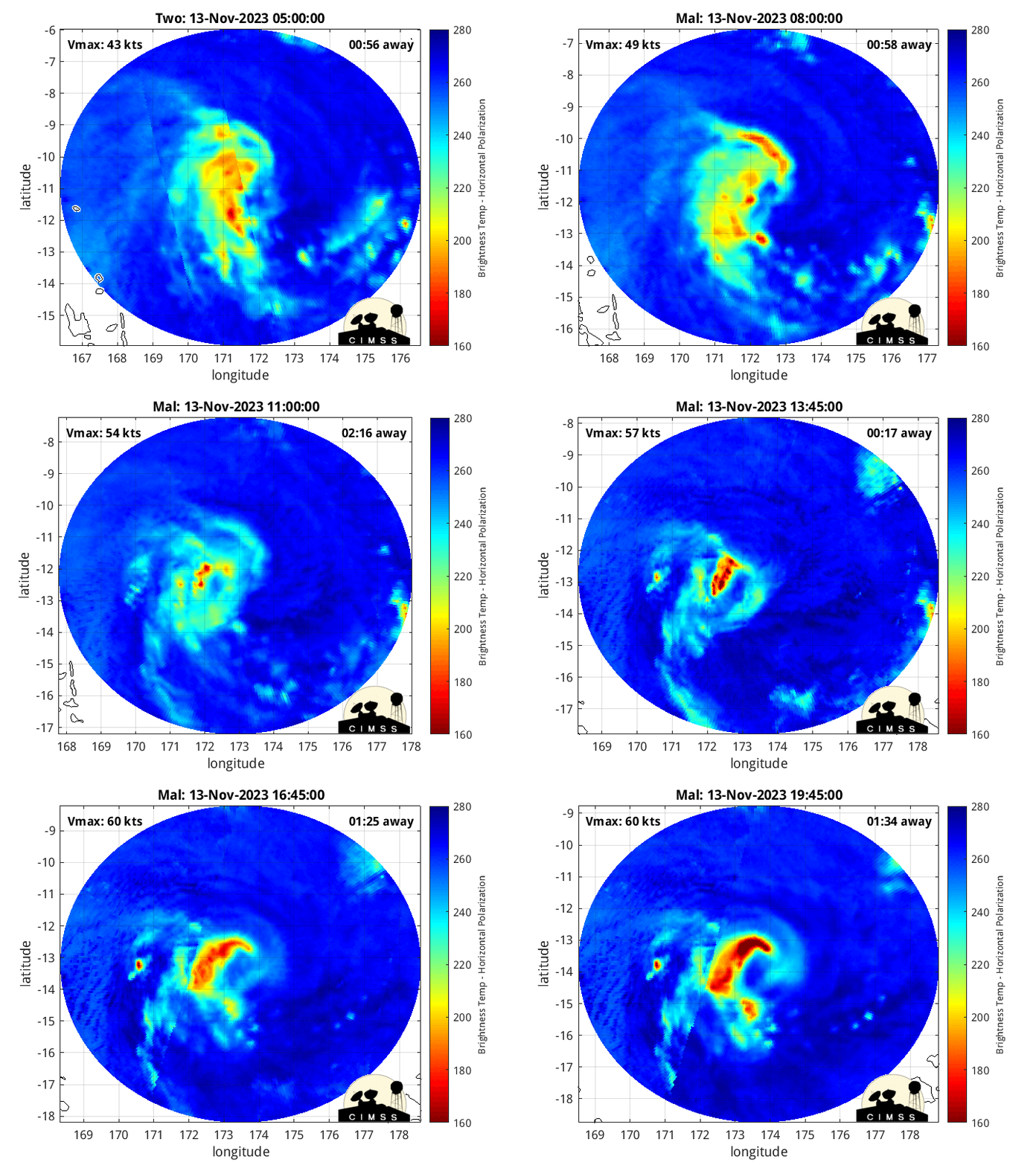
Morphed microwave imagery (source), below, shows a slow organization of the storm with vigorous convection surrounding about half the eye by 1900 UTC.
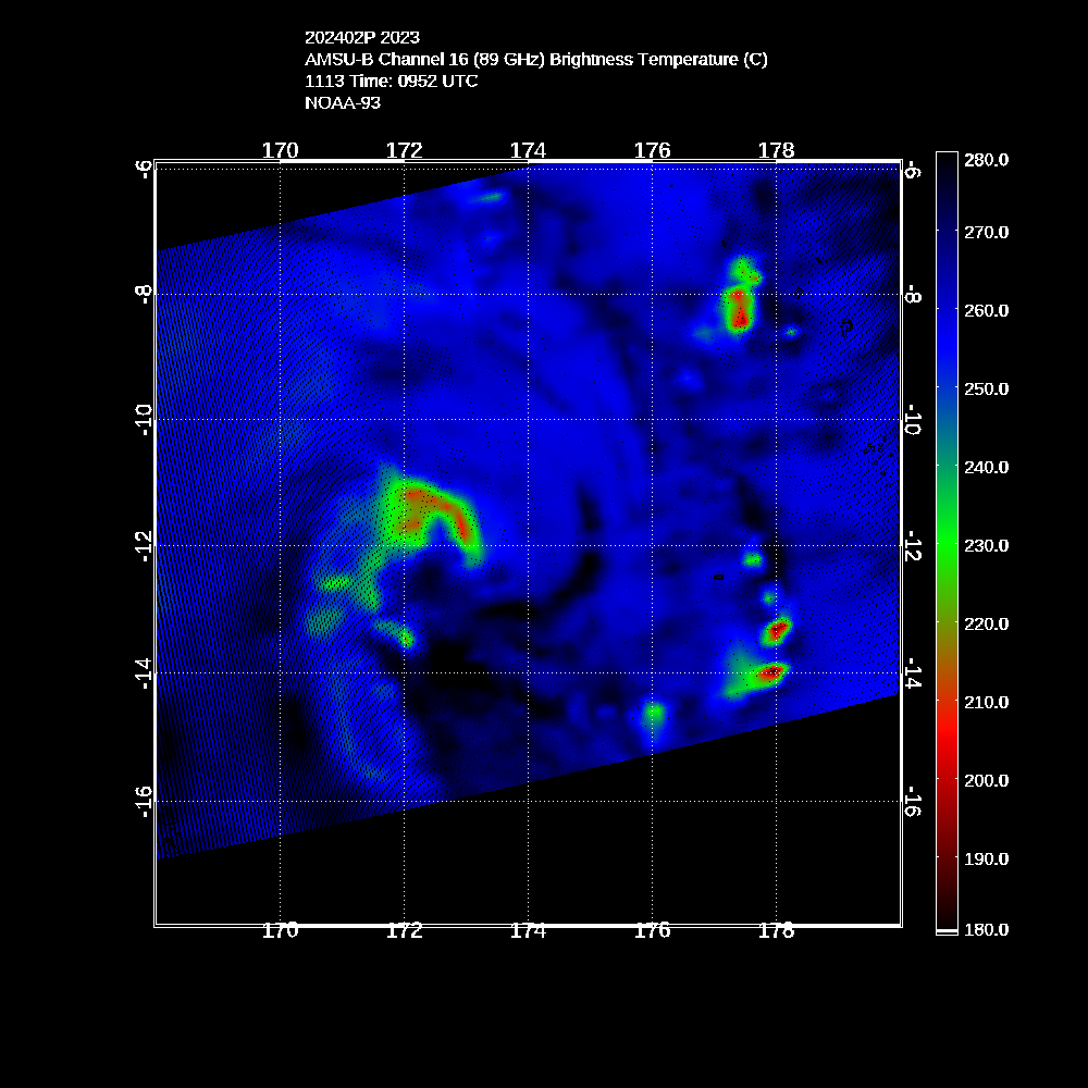
The AMSU 89-GHz field at 0952 UTC on 13 November, below (source), also shows evidence of strong convection (i.e., cold brightness temperatures caused by strong scattering of 89 GHz energy by ice) near the storm center.
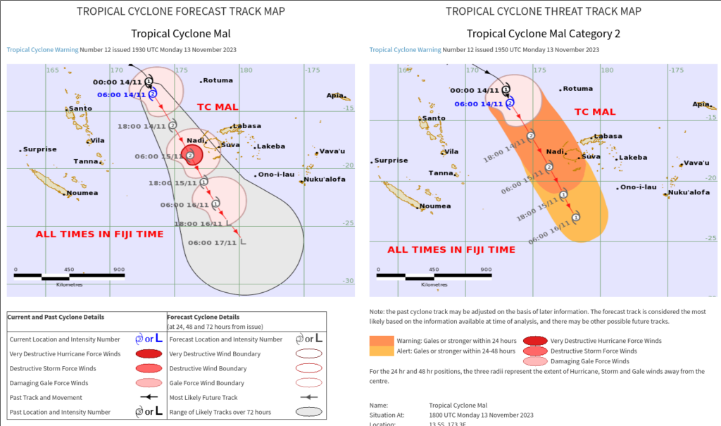
For more information on Mal, refer to the CIMSS Tropical Website for this storm (link), or to the Fiji RSMC. The forecast for the storm from JTWC (here), shows intensification through 1200 UTC 14 November, and a path that takes the storm very close to Fiji. The forecast graphic from Fiji is shown below, showing something similar to the JTWC graph. Note the times on the graphic below are Fiji Standard time, i.e., UTC + 12.
Users can view Mal using RealEarth such as in the example above, provided by Alexa Ross, SSEC/CIMSS, that shows true color imagery and Band 9 mid-level water vapor infrared (6.95 µm) imagery from Japan’s Advanced Himawari Imager (AHI).

