SAR winds over the Alenuihaha channel on 20 July 2023
Sentinel-1A overflew Hawai’i and Maui near sunrise on 20 July 2023, measuring the surface winds surrounding those islands. The mp4 animation above (click here for an animated gif) shows GOES-18 visible imagery (Band 2, 0.64 µm) from 1601 to 1801 UTC. The animation includes toggles at 1616 UTC when Sentinel 1A data resulted in wind measurements. (Sentinel-1A winds are available at this website — note that this is a new url!; this website shows global views of Normalized Radar Cross Section (NRCS) data.) The strong winds in the channel can be inferred by the swift motion of the clouds there compared to elsewhere during the animation. Note also how the high terrain of Hawai’i and Maui are effectively blocking the low-level flow around those islands.
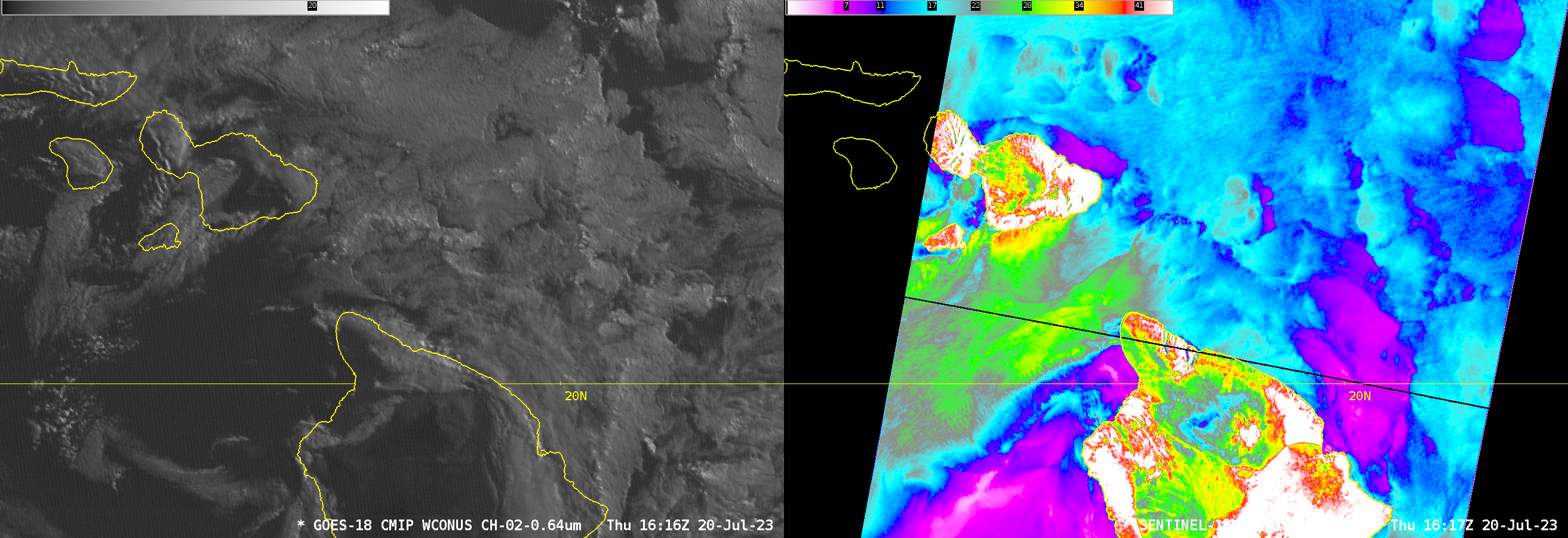
The 1616 UTC imagery are shown side by side below (the visible image grey scale upper bound is reduced in the image from the default 130 to 25). The strong winds through the Alenuihaha channel (20-30 knots, and closer to 35 knots just south of Maui) are apparent, and many wind gradients in the SAR data are associated with GOES-18 visible imagery features.

SAR Satellites operate on a 12-day repeat cycle. Sentinel-1A will take observations in this same region 12 days after 20 July, i.e., on 1 August.

