Canadian wildfire smoke across the North Central US
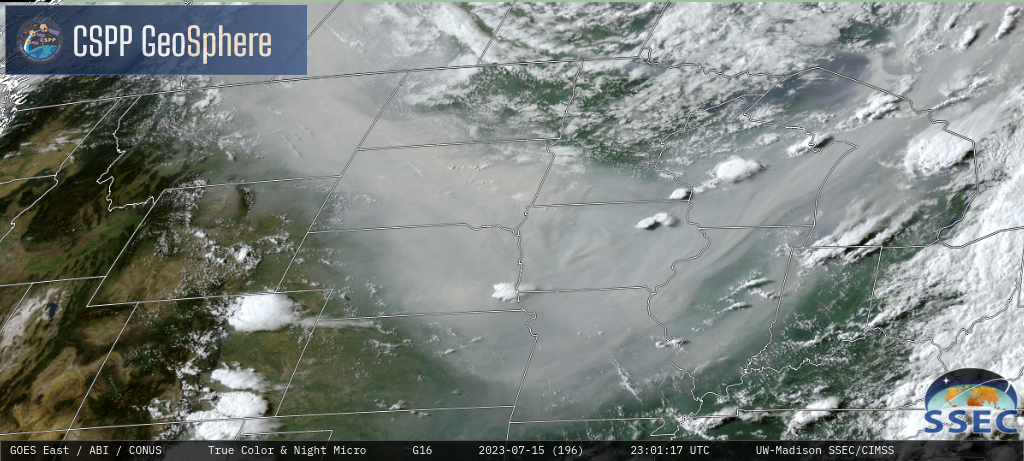
GOES-16 True Color RGB images [click to play MP4 animation]
GOES-16 Visible images with/without an overlay of the Aerosol Optical Depth (AOD) derived product is shown below — hourly Ceiling/Visibility observations indicted that the smoke reduced surface visibility to 1-3 miles at several sites. AOD values were quite high, reaching the 2.0-3.0 range in the most dense portions of the smoke pall.

GOES-16 Visible images with/without an overlay of the Aerosol Optical Depth derived product, and hourly Ceiling/Visibility observations plotted in yellow [click to play animated GIF | MP4]
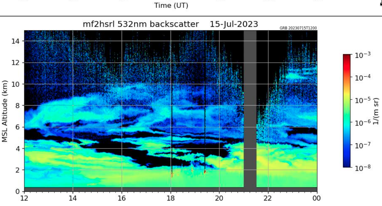
Lidar backscatter at Madison, Wisconsin from 1200 UTC on 15 July to 0000 UTC on 16 July [click to enlarge]
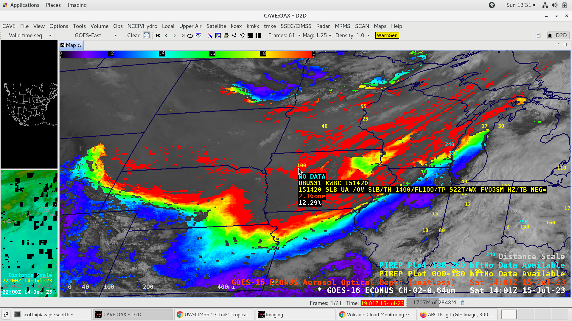
Pilot Report indicating a Flight Visibility of 3 statute miles due to haze, at an altitude of 10,000 feet over Iowa [click to enlarge]
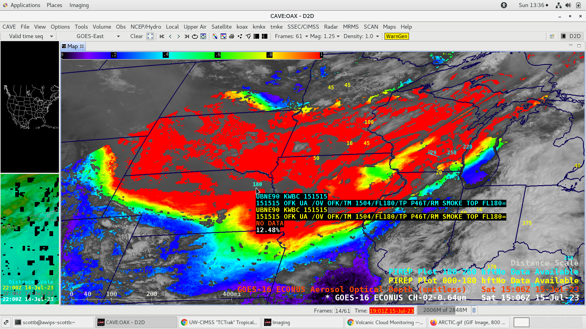
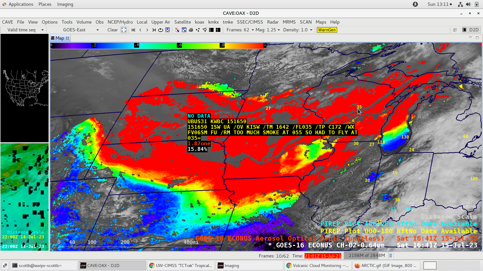
Pilot Report indicating the top of the smoke layer was at 18,000 feet over Nebraska [click to enlarge]
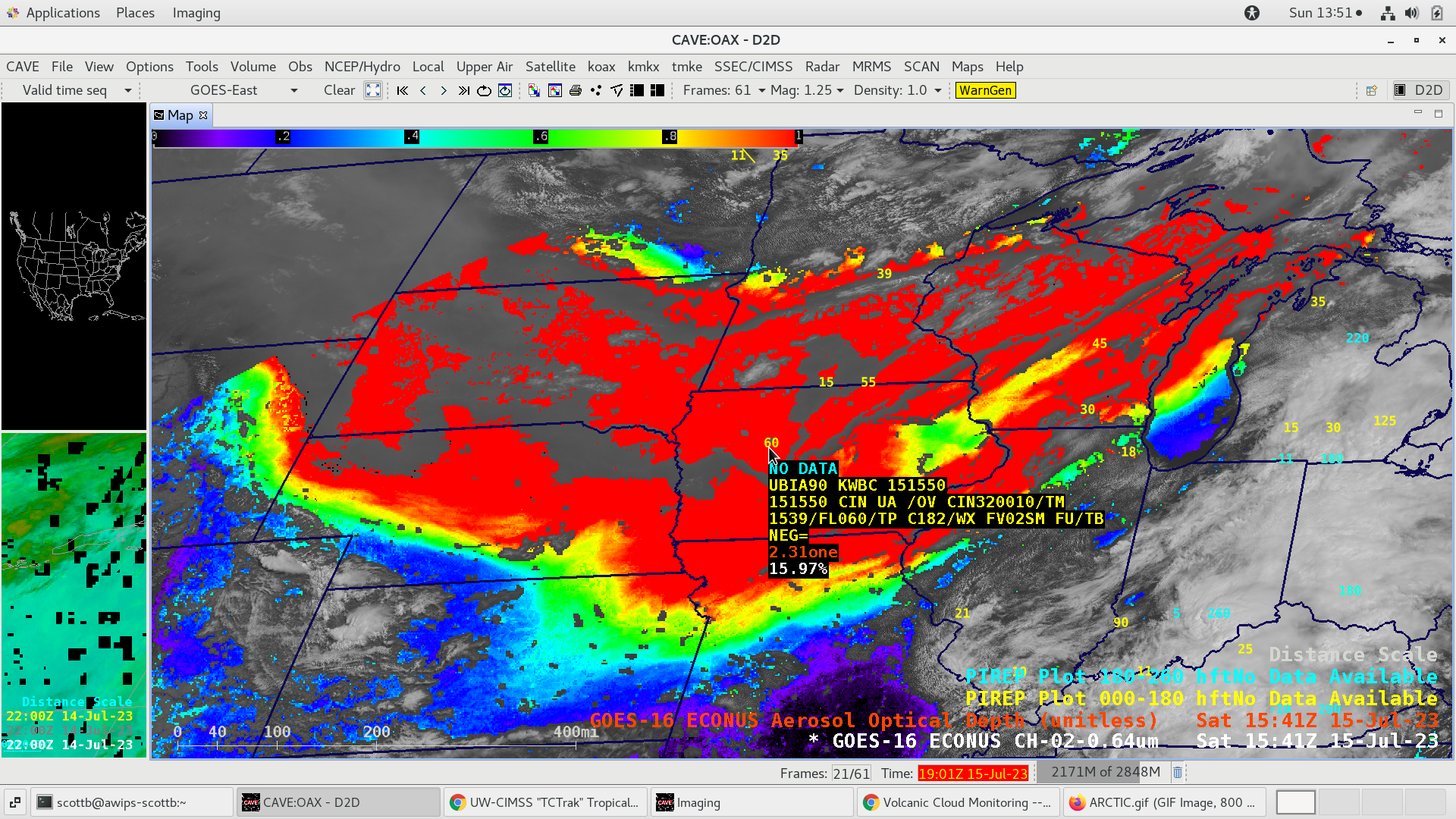
Pilot Report indicating a Flight Visibility of 2 statute miles due to smoke, at an altitude of 6,000 feet over Iowa [click to enlarge]
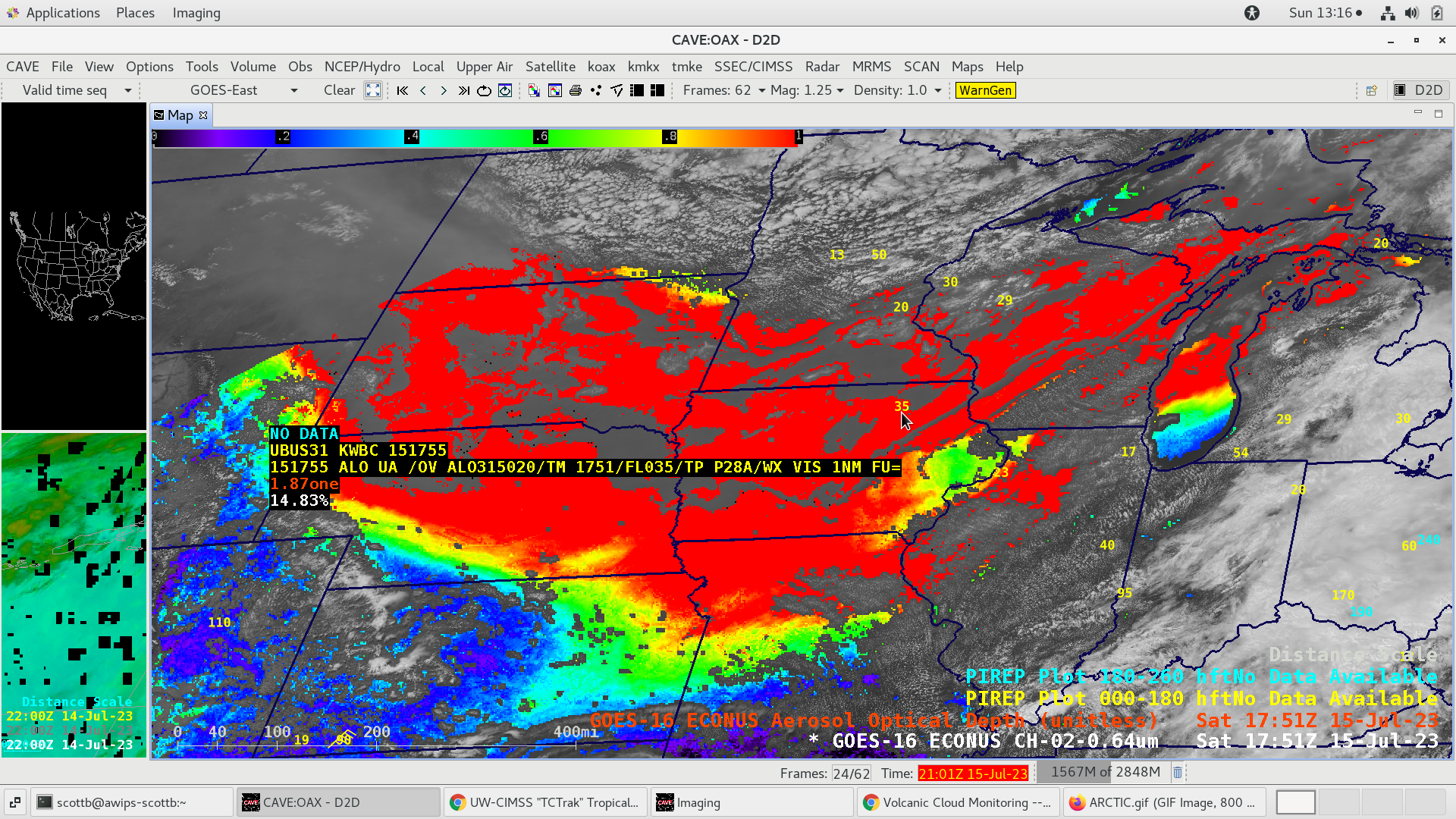
Pilot Report indicating thick smoke at an altitude of 5,500 feet over Wisconsin, requiring a change to a lower altitude of 3,500 feet [click to enlarge]
Pilot Report indicating a Flight Visibility of 1 statute mile due to smoke, at an altitude of 3,500 feet over Iowa [click to enlarge]
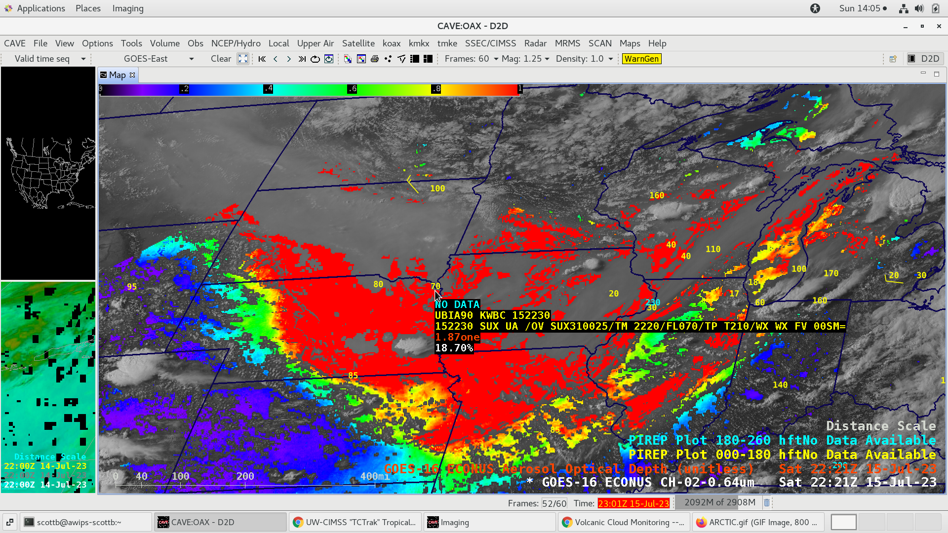
Pilot Report indicating a Flight Visibility of 0 statute miles, at an altitude of 7,000 feet over Iowa [click to enlarge]