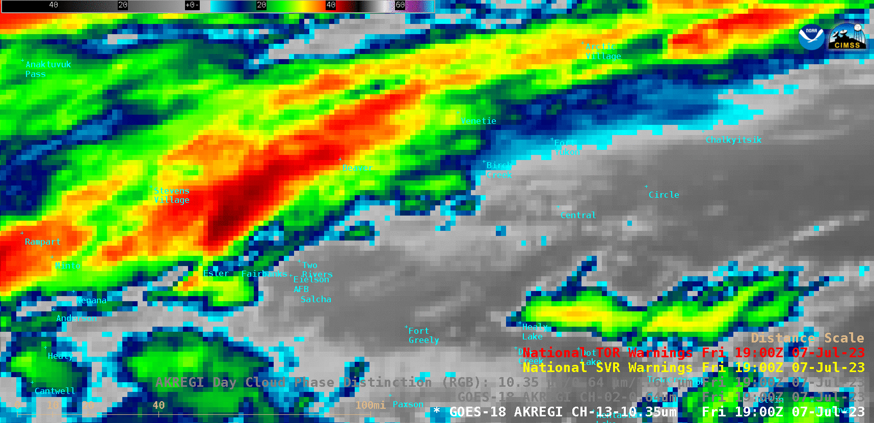
NWS Fairbanks issues a record 13 Severe Thunderstorm Warnings in a single day
GOES-18 “Clean” Infrared Window (10.3 µm) and “Red” Visible (0.64 µm) images, with Severe Thunderstorm Warning polygons plotted in yellow [click to play animated GIF | MP4]
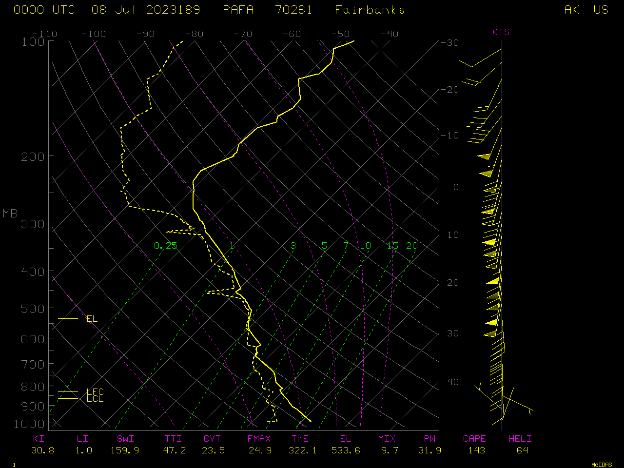
Plot of rawinsonde data from Fairbanks at 0000 UTC on 08 July [click to enlarge]
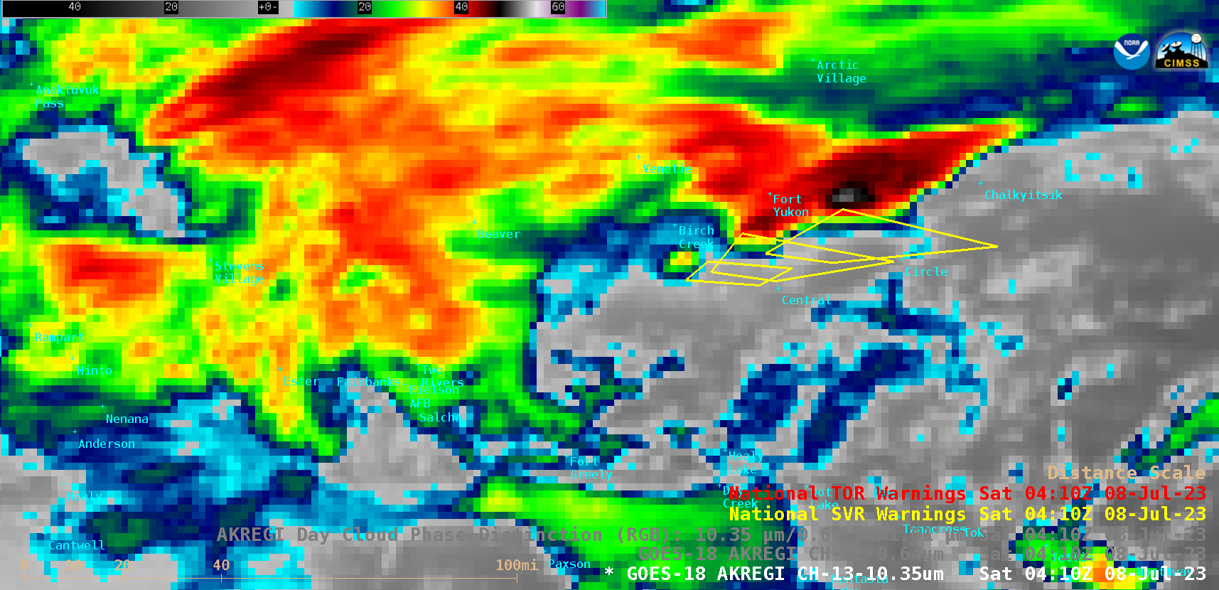
GOES-18 “Clean” Infrared Window (10.3 µm) image at 0410 UTC [click to enlarge]
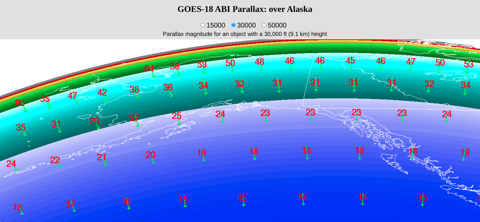
GOES-18 parallax correction vector (green) and magnitude (in km, red) for a cloud-top feature at a height of 9.1 km (30,000 feet) [click to enlarge]
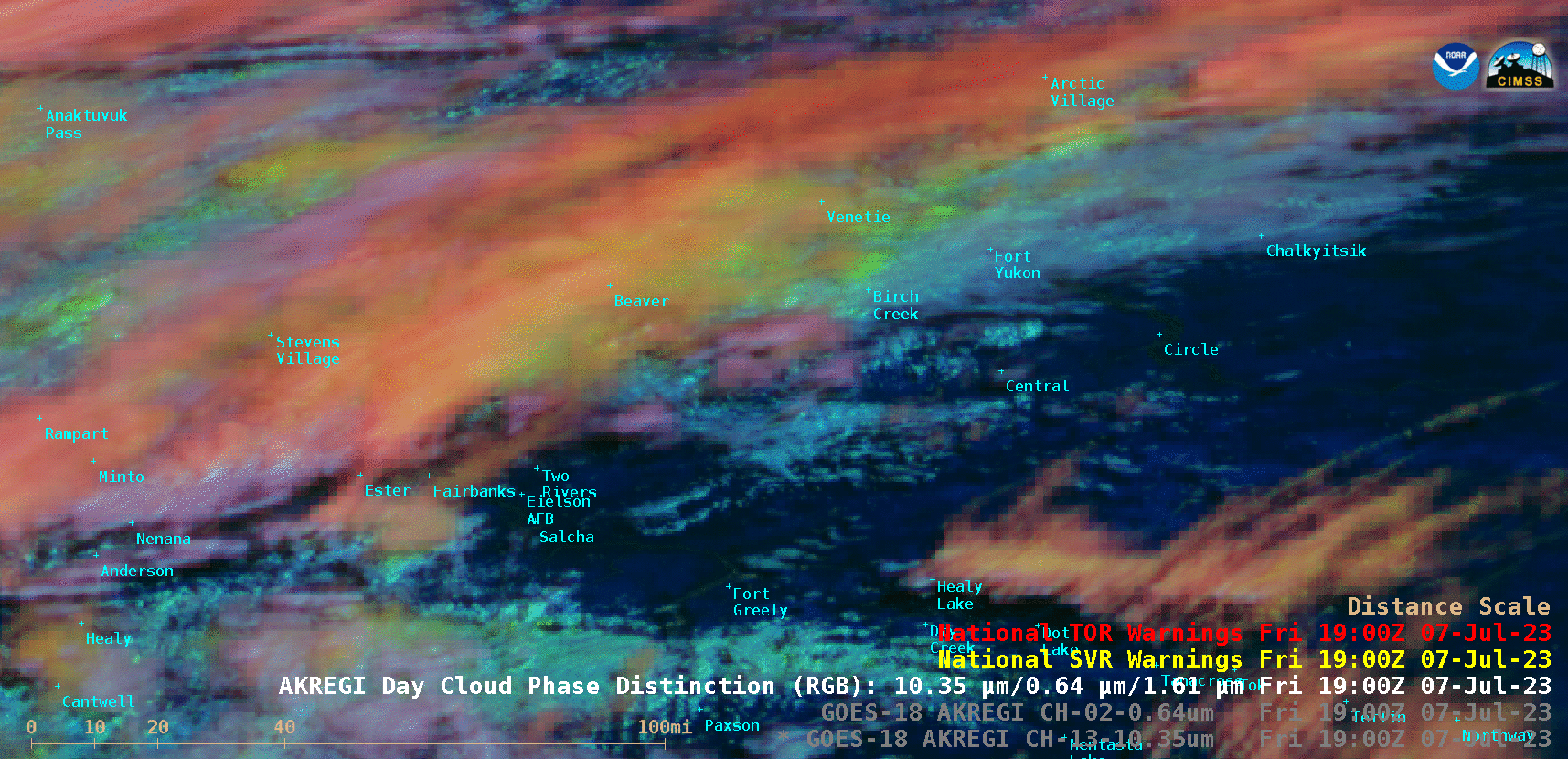
GOES-18 Day Cloud Phase Distinction RGB images, with Severe Thunderstorm Warnings plotted in yellow [click to play animated GIF | MP4]