Derecho damage swath in southern Nebraska
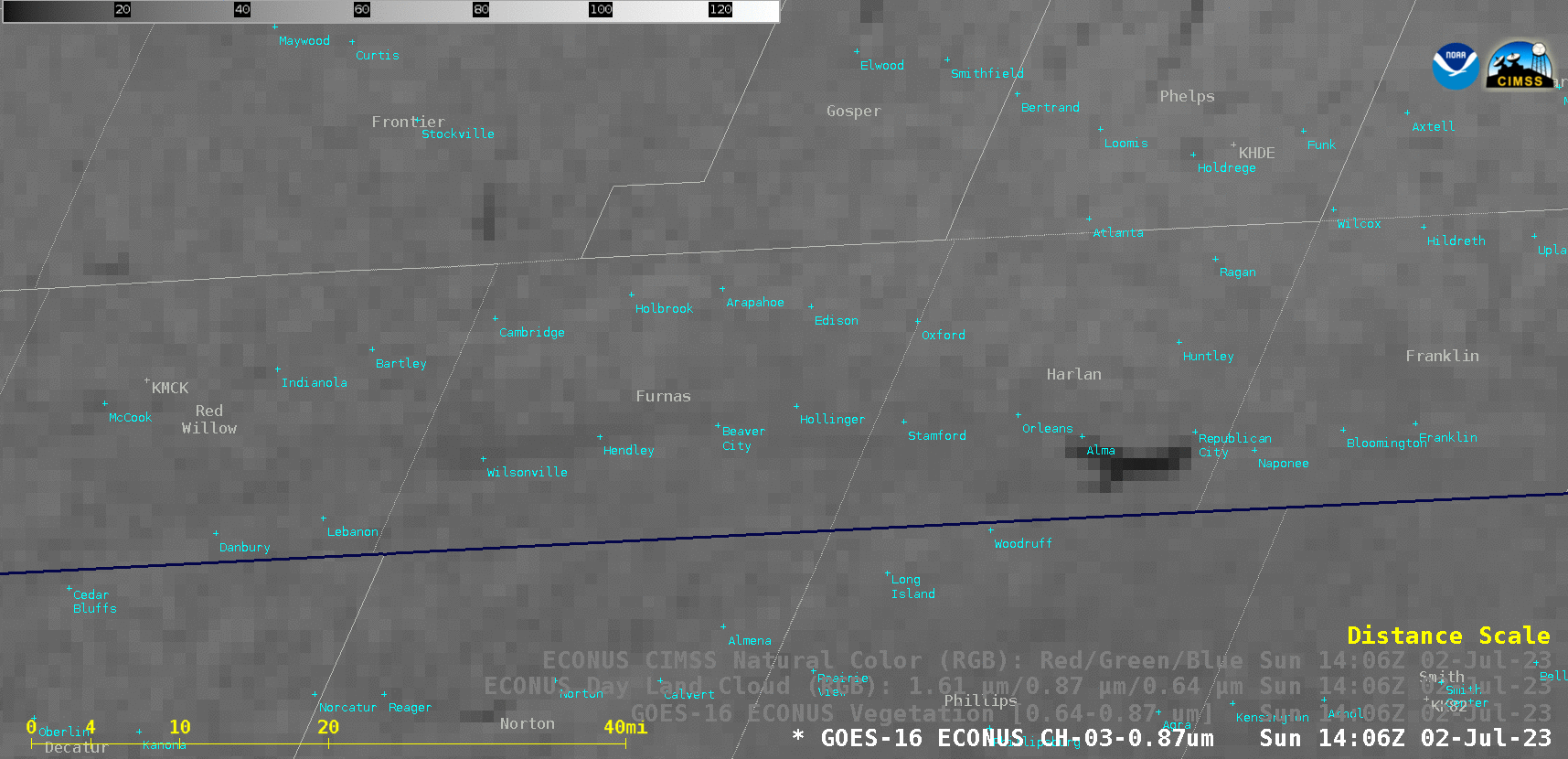
GOES-16 Near-Infrared “Vegetation” (0.86 µm), Vegetation Channel Difference (0.64 µm – 0.86 µm), Day Land Cloud RGB and CIMSS Natural Color RGB images [click to play animated GIF | MP4]
GOES-16 Rayleigh-scattering-corrected True Color RGB images from the CSPP GeoSphere site (below) provided a higher-contrast view of the damage swath, which exhibited shades of tan (in contrast to the predominantly greener appearance of adjacent healthy vegetation and fields of crops).
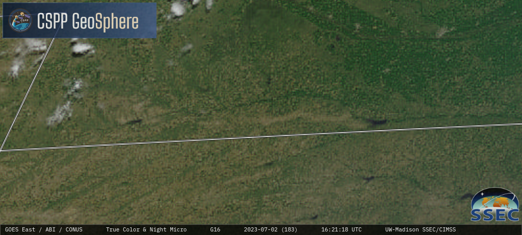
GOES-16 True Color RGB images [click to play MP4 animation]
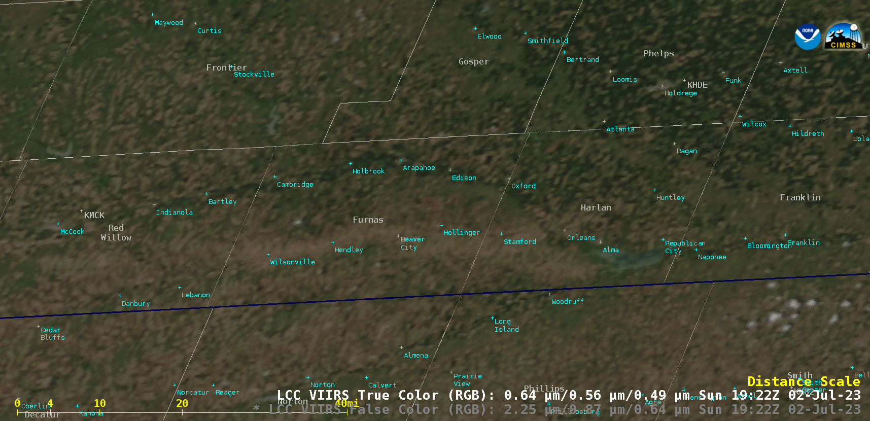
Suomi-NPP VIIRS True Color RGB and False Color RGB images valid at 1932 UTC [click to enlarge]
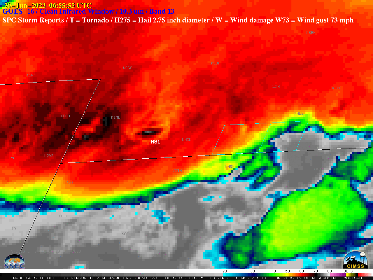
GOES-16 “Clean” Infrared Window (10.3 µm) images, with time-matched SPC Storm Reports plotted in white; Furnas and Harlan counties are outlined in cyan [click to play animated GIF | MP4]