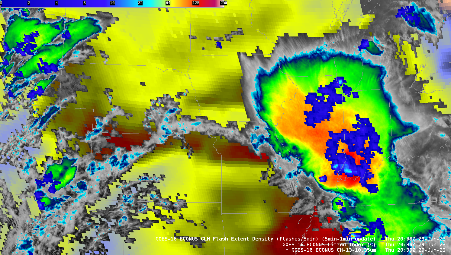
MCS with Derecho moves through the central United States
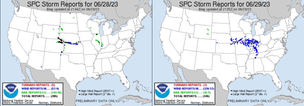
A long-lived mesoscale convective system (MCS) accompanied by strong winds at its leading edge, i.e., a Derecho, moved through the central US on 29 June 2023. The animation above shows GOES-16 Clean Window Infrared (10.3 µm) imagery at 15-minute intervals from 0100 UTC through 19 UTC on 29 June 2023. The imagery also includes 5-minute accumulations of Flash Extend Density from the Geostationary Lightning Mapper (GLM), and GOES-derived Lifted Indices. Of particular note is the corridor of instability over northern Kansas/southern Nebraska, and the large pool of instability of Illinois, that helped sustain the thunderstorms within the MCS as the feature propagated eastward. The system started as a supercell with a pronounced enhanced V as well (shown below) before evolving into an MCS overnight. Numerous reports of severe weather occurred on both 28 June and 29 June, as shown below.
The high winds caused blow-over in some cornfields in central Illinois (near Farmer City in DeWitt County) to the west of Champaign-Urbana, as shown in this tweet from Andrew Pritchard. He also showed damage in Farmer City.
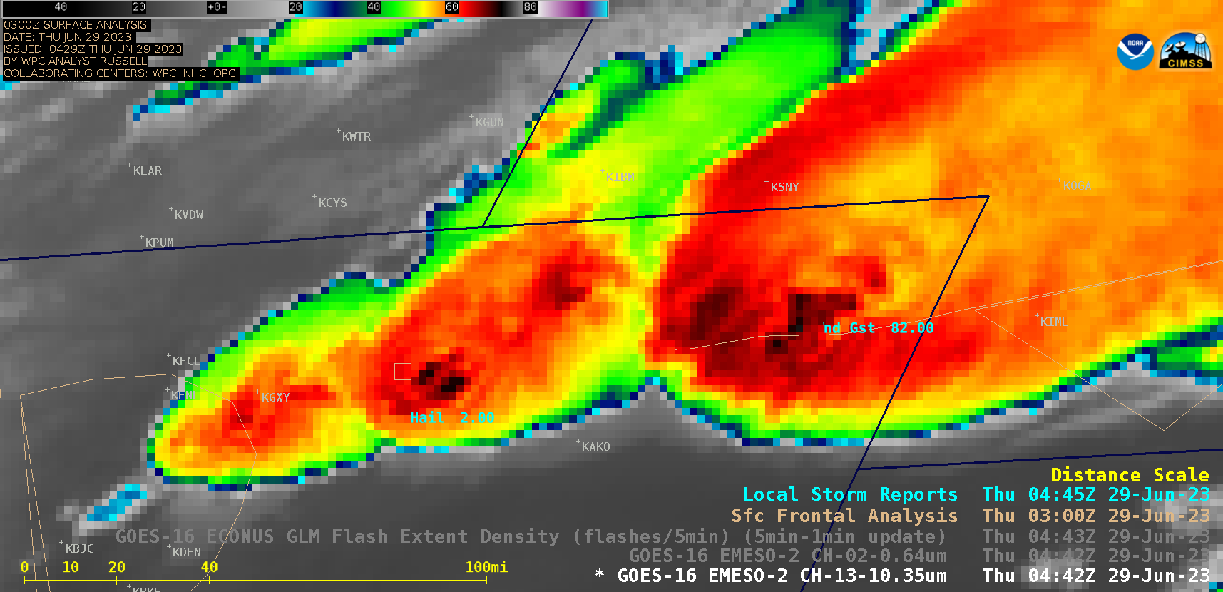
GOES-16 “Clean” Infrared Window (10.3 µm) images, with Local Storm Reports plotted in cyan (courtesy Scott Bachmeier, CIMSS) [click to play animated GIF | MP4]
1-minute Mesoscale Domain Sector GOES-16 “Clean” Infrared Window (10.3 µm) images around the beginning period (above) and the end period of the derecho event (below) include time-matched plots of Local Storm Reports. The earlier thunderstorms produced a few tornadoes in Nebraska/Colorado, hail as large as 4.00 inches in diameter in Wyoming/Colorado and wind gusts exceeding 80 mph in Colorado — while the later thunderstorms exhibited an impressive display of overshooting tops across Illinois (having cloud-top infrared brightness temperatures in the -80 to -86ºC range, shades of white embedded within darker black areas) as the MCS produced several wind gusts of 80 mph and higher.
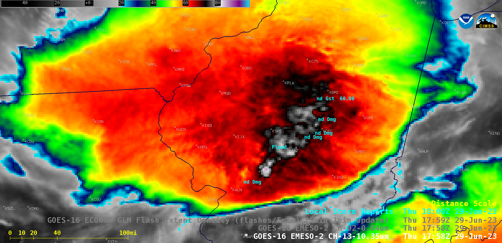
GOES-16 “Clean” Infrared Window (10.3 µm) images, with Local Storm Reports plotted in cyan (courtesy Scott Bachmeier, CIMSS) [click to play animated GIF | MP4]
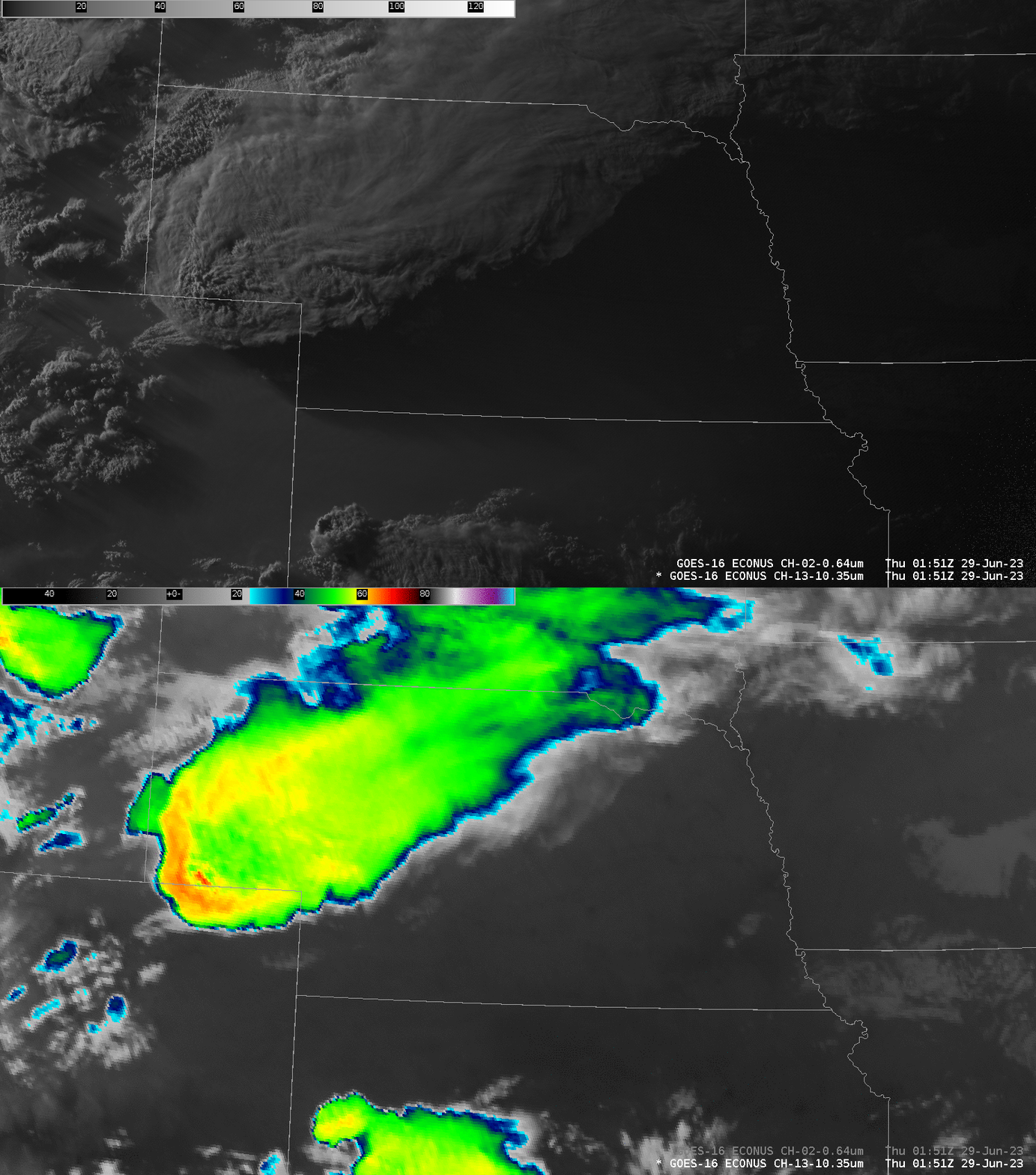
The storm that grew into this MCS had both an Enchanced-V structure, the accompanying warm trench, and an obvious Above-Anvil Cirrus Plume, all hallmarks of severity, as shown in the toggle below.
Note that a corridor of instability remains along the Kansas/Nebraska border at the end of the animation up top, and as shown below. Convection is forming over the high plains of Colorado. Will convection follow a similar path on the 29th into the 30th?
