British Columbia wildfire produces a pyrocumulonimbus cloud
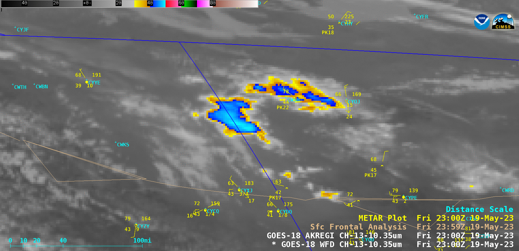
GOES-18 “Clean” Infrared Window (10.3 µm) images [click to play animated GIF | MP4]
GOES-18 True Color RGB and Nighttime Microphysics RGB images from the CSPP GeoSphere site (below) showed the late-day pyroCb formation and its subsequent eastward motion after sunset.
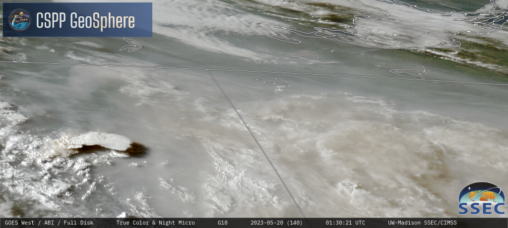
GOES-18 True Color RGB and Nighttime Microphysics RGB images [click to play MP4 animation]
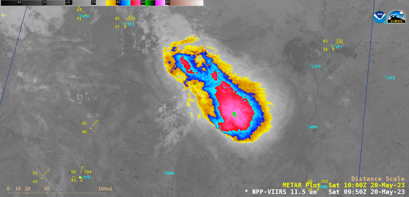
VIIRS Infrared Window (11.45 µm) images from Suomi-NPP (valid at 0952 UTC) and NOAA-20 (valid at 1042 UTC) [click to enlarge]