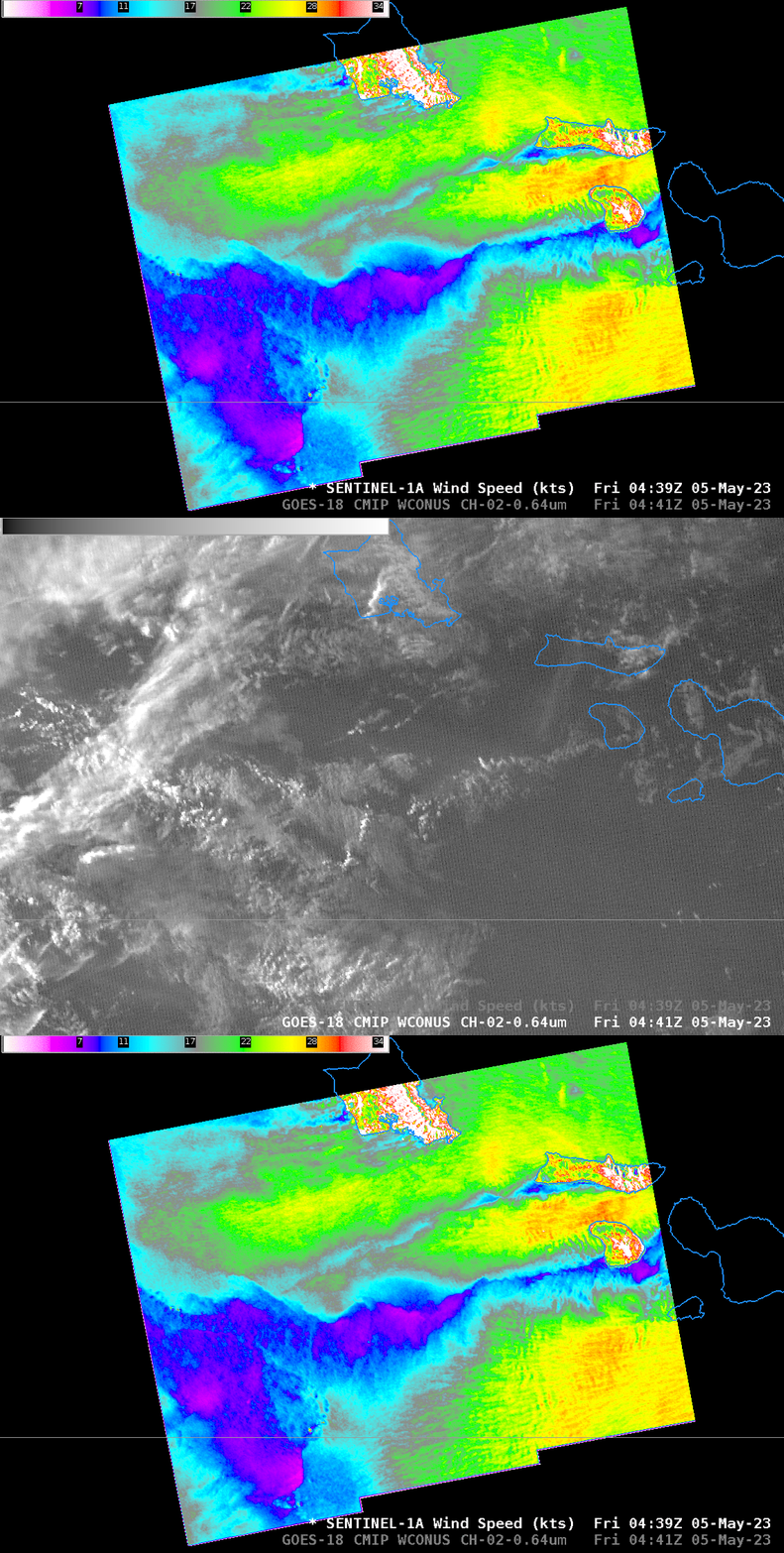
Gap Winds west of the Hawai’ian Islands

Sentinel-1A overflew the Hawai’ian Islands near sunset on 4 May, as shown above (Sentinel-1A SAR Imagery is available online here and here). The toggle above compares the derived winds with GOES-18 Visible imagery (Band 2, 0.64 µm); the visible data enhancement has been changed (that is, brightened) from the default range of 0 to 130 to just 0 to 5 for this post-sunset scene. Winds approaching 30 knots (orange/red in the enhancement used) are common in the bands of wind between the islands. The regions of relatively calm winds (purple and blue in the enhancement used) in between the strong wind bands are where cloud bands exist, as shown both in the toggle above and the side-by-side image below.

The presence of the cloud bands suggests that surface convergence is occurring in between the bands of strong winds.

