Blowing dust causes multiple-vehicle accidents along I-55 in Illiniois

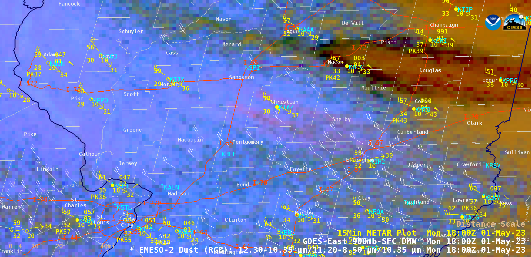
GOES-16 Dust RGB images, with GOES-16 Derived Motion Winds plotted in white and 15-minute METAR surface reports plotted in yellow [click to play animated GIF | MP4]
1-minute Mesoscale Domain Sector GOES-16 (GOES-East) Dust RGB images (above) showed areas of blowing dust (shades of magenta/pink) that reduced visibility to near zero along Interstate 55 south of Springfield, Illinois (station identifier KSPI) on 01 May 2023 — which caused multiple-vehicle accidents that resulted in dozens of injuries and several fatalities. As a result, parts of I-55 in southern Sangamon and northern Montgomery County were closed in both directions. Surface reports showed wind gusts as high as 54 mph, with some GOES-16 Derived Motion Winds in the 35-40 knot (40-46 mph) range across the region. The source of this blowing dust was nearby agricultural fields that had recently been plowed during Spring planting activities.
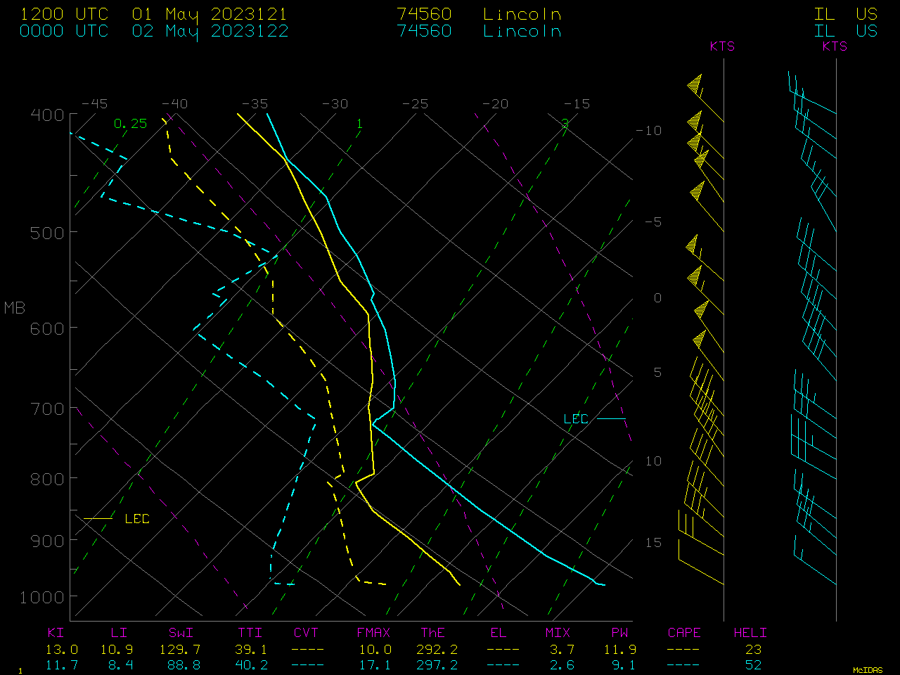
In plots of rawinsonde data from Lincoln, Illinois (METAR station identifier KAAA, near the top-center of the Dust RGB images) shown below, a deep boundary layer adiabatic-to-superadiabatic temperature lapse rate was evident, which increased in maximum height from 806 hPa (1748 m) at 1200 UTC to 714 hPa (2743 m) at 0000 UTC. This steep boundary layer lapse rate aided the downward transfer of momentum, bringing the stronger 35-45 knot wind speeds that existed at higher altitudes down to the surface. During the time period between these 2 Lincoln IL rawinsonde launches, steep boundary layer lapse rates were also seen in sounding profiles derived from NOAA-20 and GOES-16 (as shown in this blog post).


