Using AMSR-2 ice products in between SAR scans of Sea Ice

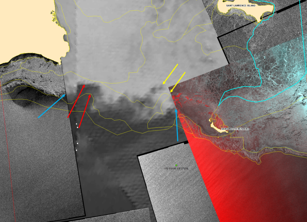
What products are available in the Arctic in between SAR observations? Consider the composite image above, showing RADARSAT-2 SAR ice concentration at 0453 UTC on 22 February 2023 over/around Saint Matthew Island (direct link to footprint here at the STAR SAR Wind site*) and an RADARSAT Constellation Mission-3 (RCM3) image at at 0546 UTC on 22 February 2023 south of Russia (direct link to footprint here at the STAR SAR Wind site*). The background image is Level 2 AMSR-2 imagery with high spatial resolution: around 3-km pixel size!
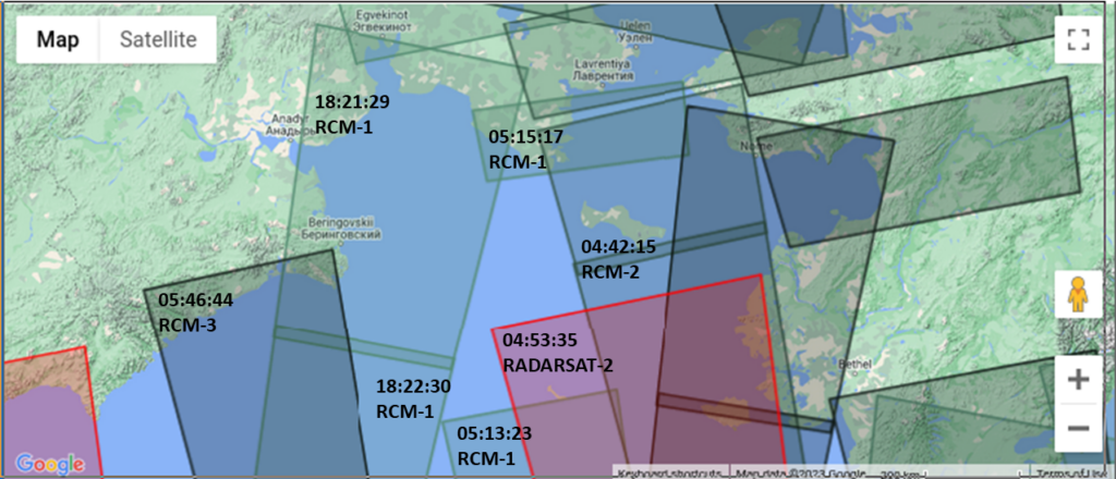
The SAR orbits for 22 February that are shown below. There is a cluster of orbits over this part of the Gulf of Alaska from 0442 – 0546 UTC, but then few observations until after 1800 UTC. One could rely on Geostationary data to fill in that gap — but the Sun does not rise over this part of the Gulf of Alaska on 22 February until after 1800 UTC. This is when microwave data can be useful.

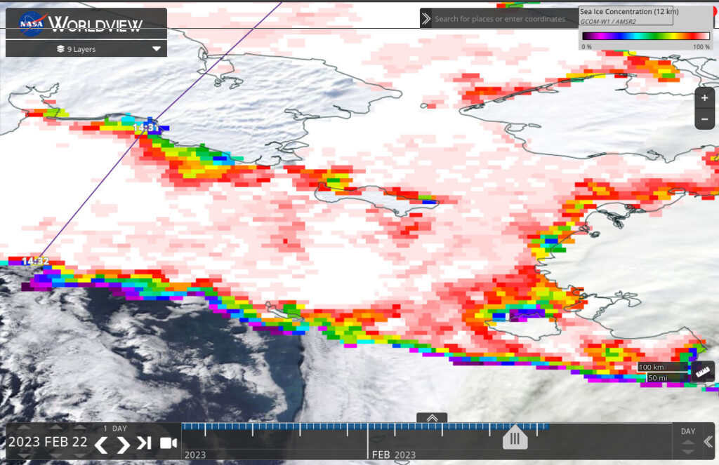
This image of GCOM-W orbits on 22 February 2023 (from this website) show a GCOM-W overpass over the Gulf of Alaska near 1430 UTC. GCOM-W AMSR-2 Ice Concentration product from that overpass are available at NASA Worldview (direct link) , as shown below. If this image information is included in the SAR image above (it is!), then ice forecasters can view ice edge information — albeit at resolutions that are grosser than SAR data provides. This Level 2 AMSR-2 imagery has 3-km resolution. This microwave resolution allows forecasters to track the sea ice edge in between SAR overpasses.

How do forecasters view this blending of information with different horizontal scales? Mike Lawson from the Sea Ice had this comment on the imagery at the top (and it also explains the colored arrows!)
.... In my opinion this is the best case scenario to use this imagery in there is a cloudy gap between SAR images. The red and yellow arrows are features that can clearly be tracked based on our previous analysis (yellow lines). The blue arrows highlight the boundary of the pack ice vs. marginal ice, which I think AMSR handles quite well in most cases.
Another situation I didn't get a good screenshot example of happened during this event. You can grab both the morning and evening images for the day then use them to estimate how fast the ice edge is advancing/retreating. In this case, it looks to be around 8 nm between images or an avg of 16nm of retreat per day. These estimates can really help us get a handle on what to forecast for certain wind regimes or what estimate to give customers when they call and ask for an update.
Thanks to Mike for sending along these images to Tom Greenwald, SSEC/CIMSS. Thanks also to NSIDC.
*Note: The retrieved winds at those links are invalid over ice, but the patterns in the retrieved winds will show where the ice sits.

