Linear Mesoscale Convective System in the Upper Midwest
GOES-12 visible channel images (above; Java animation) showed a linear mesoscale convective system developing across parts of Iowa, Minnesota, and Wisconsin on 28 August 2007. Note the picturesque shadows cast by the individual cumulonimbus towers building in northeastern Iowa between 21:00 and 22:00 UTC. The larger cluster of thunderstorms in north-central/northeastern Wisconsin produced several reports of hail (up to 1.0 inch in diameter) and wind gusts of 60-80 mph (SPC storm reports). An AWIPS image of the MODIS 11.0µm IR channel around 19:09 UTC depicted cloud top brightness temperatures as cold as -79º C (-110º F) in north-central Wisconsin, with numerous cloud to ground lightning strikes.
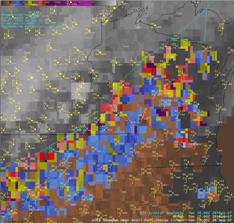
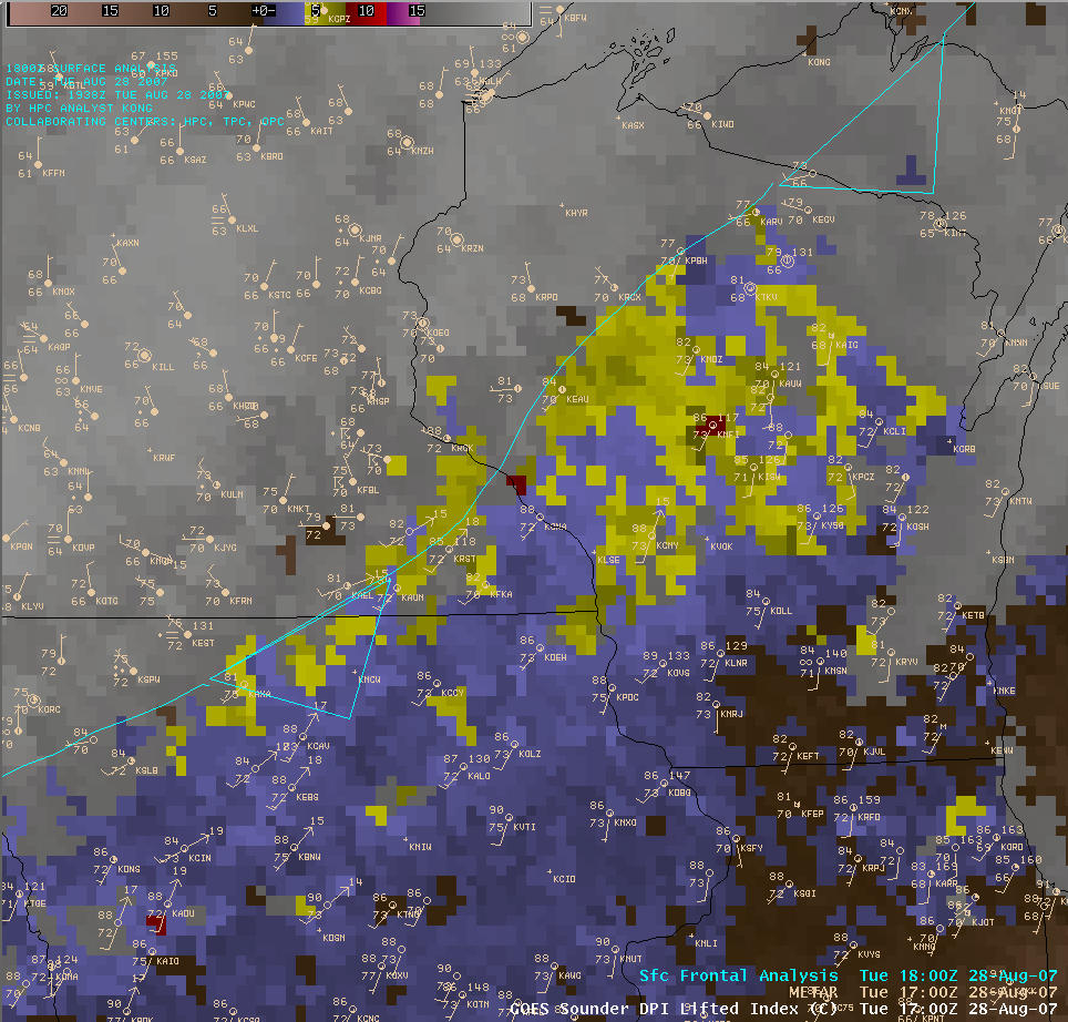
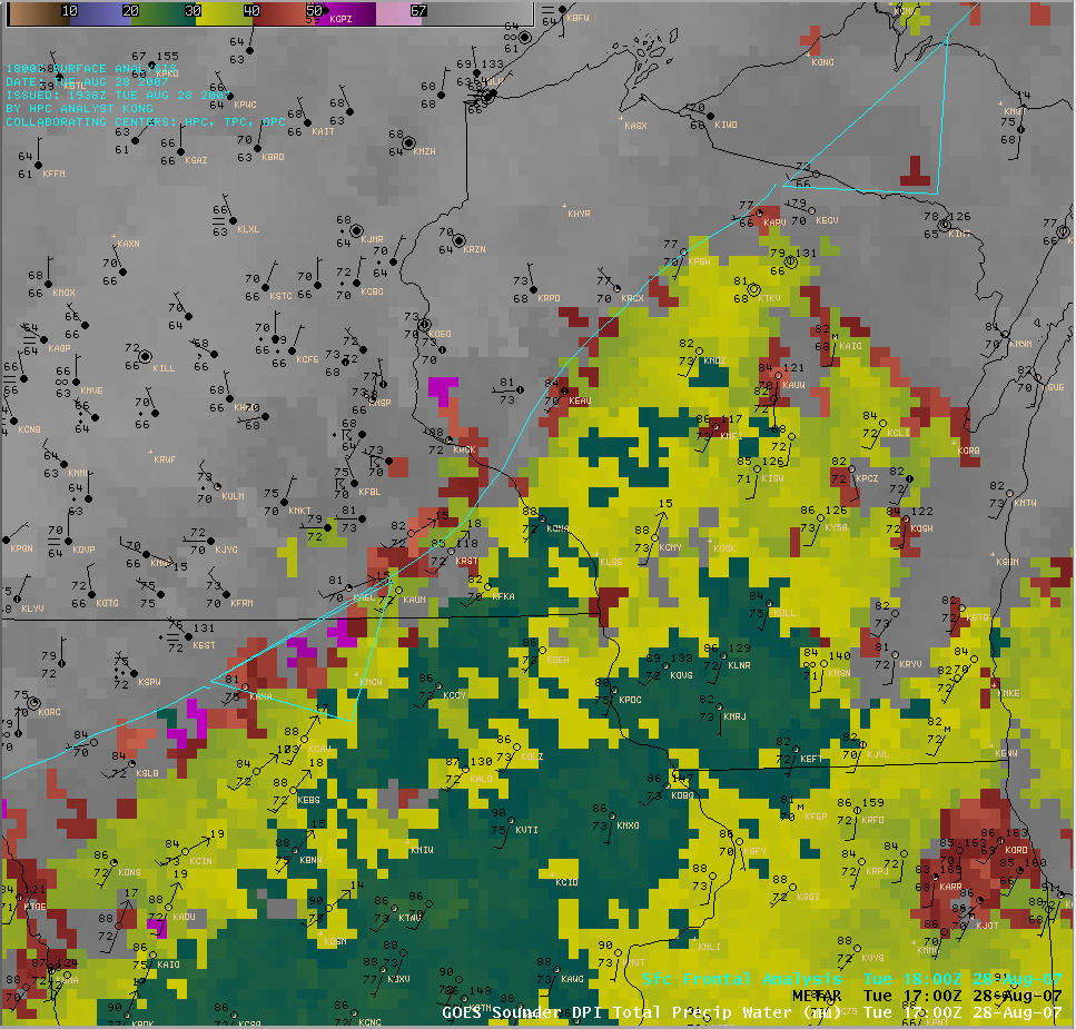
AWIPS GOES-12 sounder Derived Product Images (DPI) of Convective Available Potential Energy (CAPE), Lifted Index (LI), and Total Precipitable Water (TPW) at 17:00 UTC (below) indicated that instability and moisture were increasing within a narrow zone along and just ahead of a wavy frontal boundary that was advancing slowly southeastward through the region. Isolated CAPE values were in excess of 4000 J/kg, LI values were less than -8º C, and TPW values were greater than 50 mm (2.0 inches) in the general area where new convection was seen to develop rapidly in north-central Iowa about 4 hours later on the GOES-12 visible images above.


