Use of the Gálvez-Davison Index in operations at American Samoa
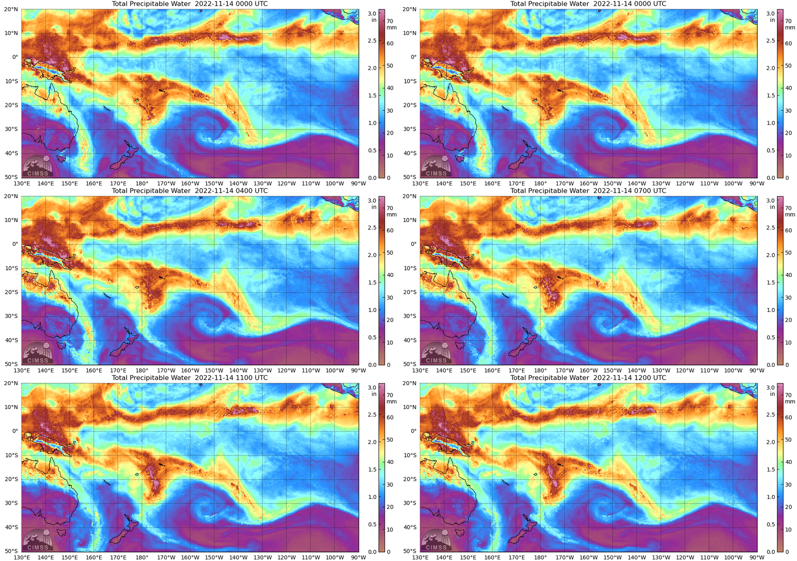
On 14 November 2022, American Samoa (indeed, all the Samoan Islands) were withing deep moisture associated with the South Pacific Convergence Zone, a common occurrence. The animation of MIMIC Total Precipitable Water, above, shows the evolution of the moisture hourly from 0000 to 1200 UTC on 14 November. (MIMIC fields in various domains are available in real time at this website; archived imagery is here). Note that 1200 UTC is 1 AM in American Samoa.
A forecaster in the morning might look at GDI (Gálvez-Davison Index, also discussed on this blog here) that is created from the GFS, as available at this NCEP link. (one can also search on ‘GDI NCEP’). The forecast fields from the 1200 UTC/14 November run are shown below (courtesy Jose Galvez and Bonnie Acosta, NOAA). The GDI shows an increase in values over Samoa first, then those large values overspread Tutuila (the largest of the islands of American Samoa) by 0000 UTC; by 0600 UTC, the back edge of the larger values is approaching Tutuila from the west. (For reference, Click here to see a map of the Samoan Islands; from west to east the main islands are Savai’i and Upola (the country of Samoa), then Tutuila, Ofu, Olosega and Ta’u, the four main islands of American Samoa).
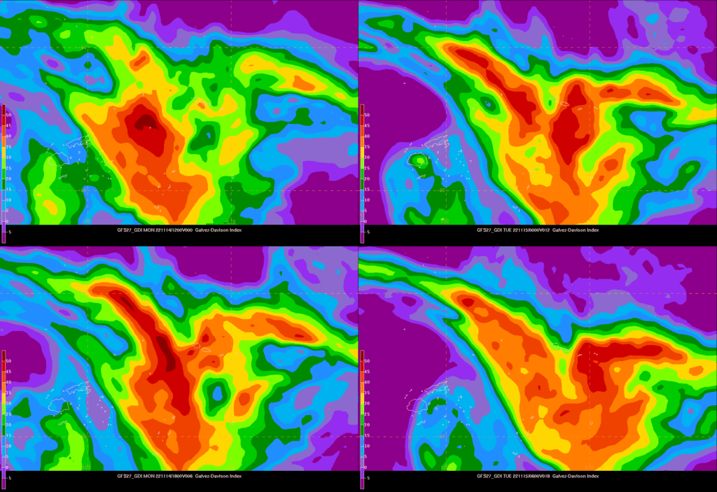
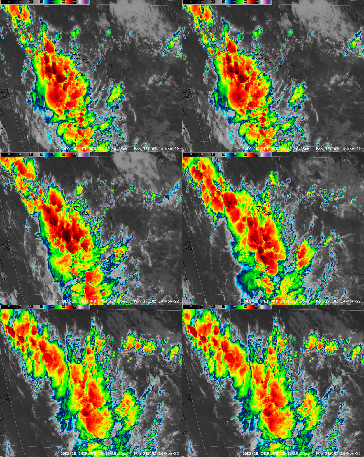
Bearing the GDI fields above in mind, consider the evolution of Band 13 imagery shown below from GOES-18. Deep convection is persistent to the south of the Samoan Islands in a band that is roughly aligned with the largest forecast GDI values at 1200 and 1800 UTC. A region of stronger convection with an axis south-southwest to north-northeast develops across Savai’i and Upola. This development in the infrared imagery is very much in line with the forecast evolution of GDI fields that shows increasing values of the GDI in a line stretching southwest to northeast of Samoa.
The evolution of the Band 13 imagery from 2110 UTC to 0610 UTC is also consistent with the GDI predictions — a back edge to the convection is approaching Tutuila by 0610 UTC. This edge is apparent in the infrared imagery, but also in the MIMIC Total Precipitable water (here is the 0600 UTC image).
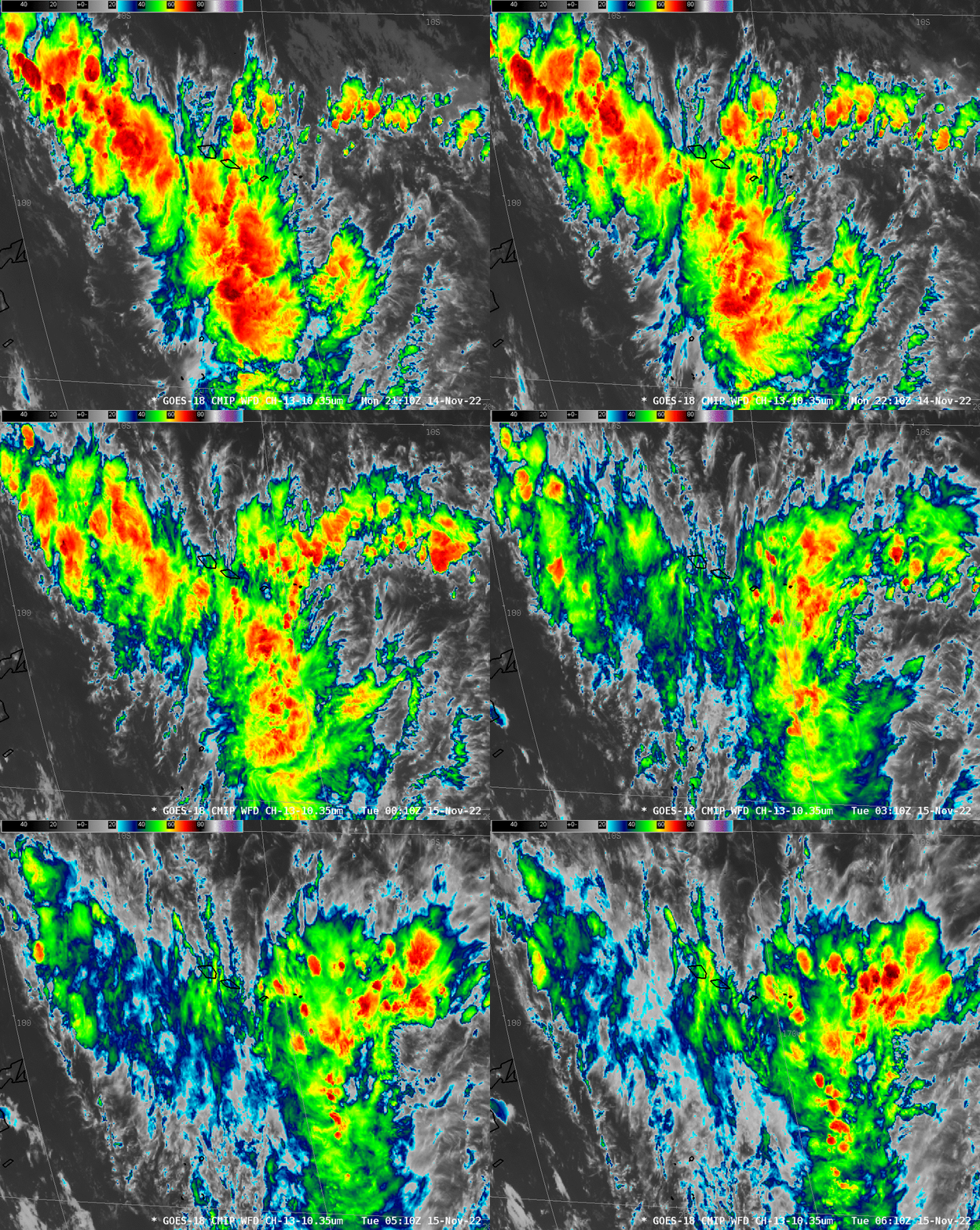
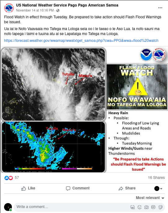
The Weather Office in Pago Pago issued a Flood Watch at around 4 PM Samoa Time on 14 November (that is, around 0300 UTC on 15 November). Trends in the satellite imagery, and in total Precipitable Water fields, and in the GDI forecast were all used to help decide on whether extra staffing would be needed after sunset to deal with flooding-related work. (Extra staff were not called in).
GDI forecasts and satellite-based trends in infrared imagery and microwave estimates of total precipitable water can help with staffing decisions at forecast offices.

