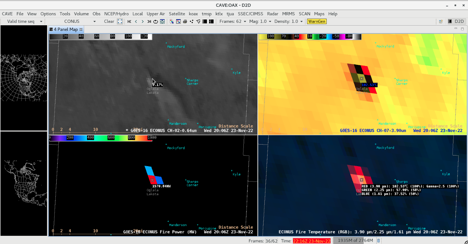
Grassland fire in South Dakota
GOES-16 “Red” Visible (0.64 µm, top left), Shortwave Infrared (3.9 µm, top right), Fire Power (bottom left) and Fire Temperature RGB (bottom right) images [click to play animated GIF | MP4]
A toggle between Suomi-NPP VIIRS True Color RGB and False Color RGB images valid at 2016 UTC (below) provided a higher-resolution view of the narrow, dark burn scar as well as the smoke plume; in the False Color image, the hottest signature at the leading (southern) edge of the fire showed up as brighter shades of pink. Note how the fire’s burn scar initially moved eastward about 1 mile, but then jogged toward the southeast as surface winds with gusts in the 20-26 knot range (Pine Ridge SD observations) abruptly shifted from westerly to northwesterly (in the wake of a cold frontal passage). The data to produce these VIIRS images were downloaded and processed using the SSEC/CIMSS Direct Broadcast ground station.

Suomi-NPP VIIRS True Color RGB and False Color RGB images, valid at 2016 UTC [click to enlarge]