Grassland fire in South Dakota

GOES-16 Fire Temperature RGB (top left), Shortwave Infrared (3.9 µm, top right), Fire Power (bottom left) and Fire Temperature (bottom right) images [click to play animated GIF | MP4]
GOES-16 True Color RGB images from the CSPP GeoSphere site (below) displayed the smoke plume as it drifted southeastward and eventually crossed the South Dakota / Minnesota border — and a dark burn scar became apparent at the fire source region.
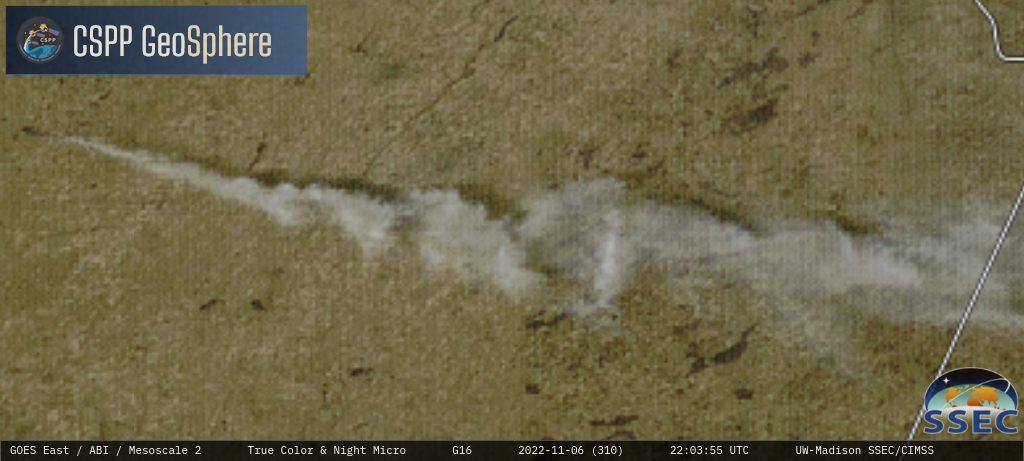
GOES-16 True Color RGB images [click to play MP4 animation]
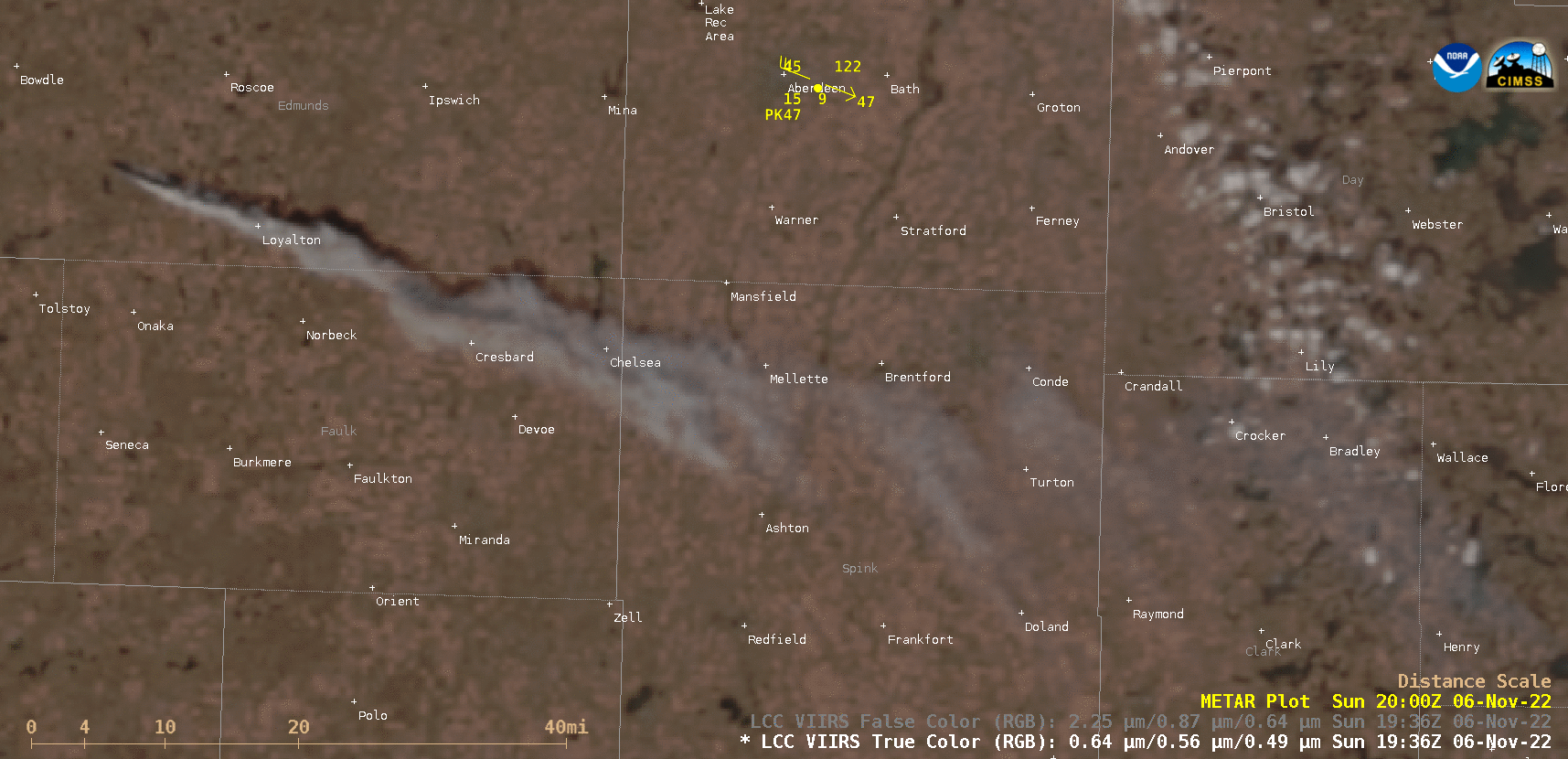
VIIRS True Color and False Color RGB images, valid at 1944 UTC [click to enlarge]
===== 07 November Update =====
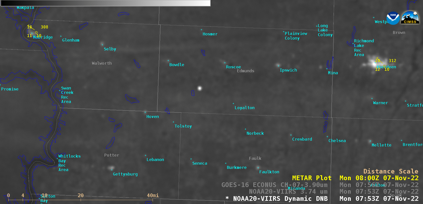
NOAA-20 VIIRS Day/Night Band (0.7 µm) and Shortwave Infrared (3.74 µm) images valid at 0759 UTC, along with the GOES-16 Shortwave Infrared (3.9 µm) image at 0756 UTC [click to enlarge]
This small fire was not evident in a later Suomi-NPP VIIRS Day/Night Band image valid at 0852 UTC (below) — but the 7-8 mile long dark burn scar was easily seen between Bowdle and Loyalton.

Suomi-NPP VIIRS Day/Night Band (0.7 µm) image, valid at 0852 UTC [click to enlarge]