Clear Skies over the Great Lakes
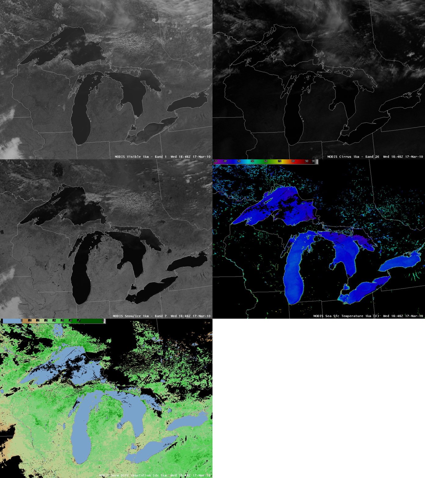
Saint Patrick’s Day over the Midwest was unusually clear, affording great images of the Great Lakes from the MODIS instrument aboard the Terra and Aqua satellites. The loop above includes the Visible imagery, the cirrus detection channel (1.38 micrometers), the snow-ice detection channel (2.1 micrometers), the derived lake-surface temperatures and the normalized difference vegetation index (NDVI).
Close-up views of the individual lake basins: Ontario, Erie, Michigan-Huron and Superior show mostly uniform surface temperatures in the upper 30s (Fahrenheit) as is normal in early Spring. There are warm thermal plumes in Lake Erie, however, emerging from Sandusky Bay and from the Maumee River at Toledo. MODIS-derived Lake surface temperatures in those regions are in the upper 40s. (True-color imagery for that time (here) show great turbidity over Lake Erie; perhaps the warm temperatures are a result of enhanced run-off from the Maumee and Sandusky Rivers) Temperatures over Lake Michigan are slightly warmer in the middle of the lake — near 40 F — than along the perimeter where lake temperatures are still in the mid-30s. This might be a signature of recently melted near-shore ice.
High-resolution imagery such as these will be routinely available when GOES-R is launched and becomes the operational GOES satellite over the United States.


