Hurricane Ian makes landfall in South Carolina

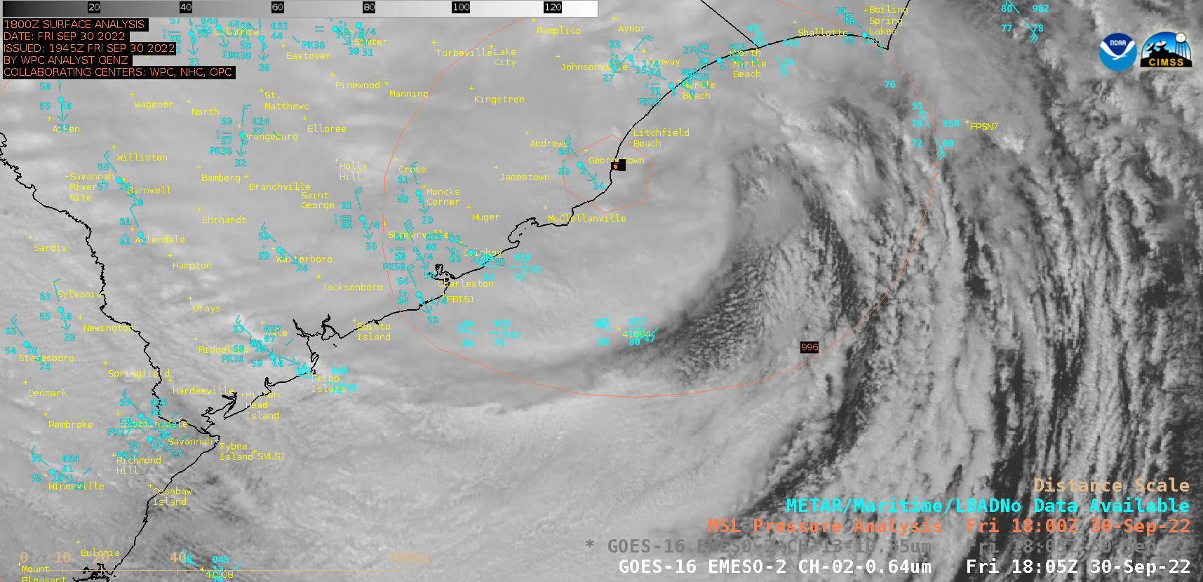
GOES-16 “Red” Visible (0.64 µm) images [click to play animated GIF | MP4]
The hurricane center moved just east of Buoy 41004, where a wind gust to 64 knots / 74 mph was recorded several hours prior to the closest passage. The Buoy 41004 sea surface temperature as Ian moved through was 80ºF, with a cooling trend seen during the following 4 days (due to the upwelling of cooler sub-surface water, caused by wind-driven high waves).
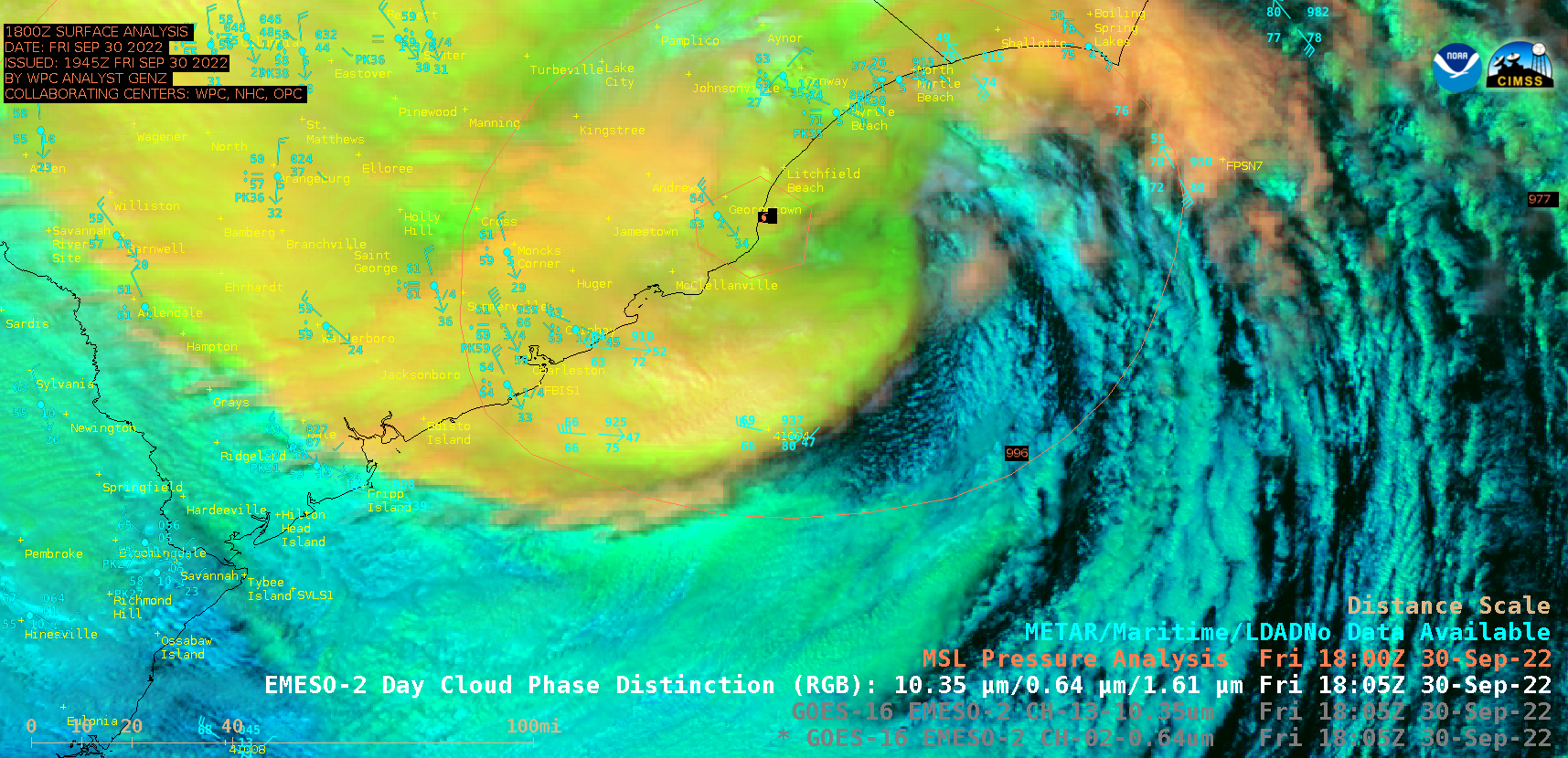
GOES-16 Day Cloud Phase Distinction RGB images (below) helped to discriminate between the low-level clouds (shades of cyan) and mid to high-level clouds (shades of green to yellow).

GOES-16 Day Cloud Phase Distinction RGB images [click to play animated GIF | MP4]

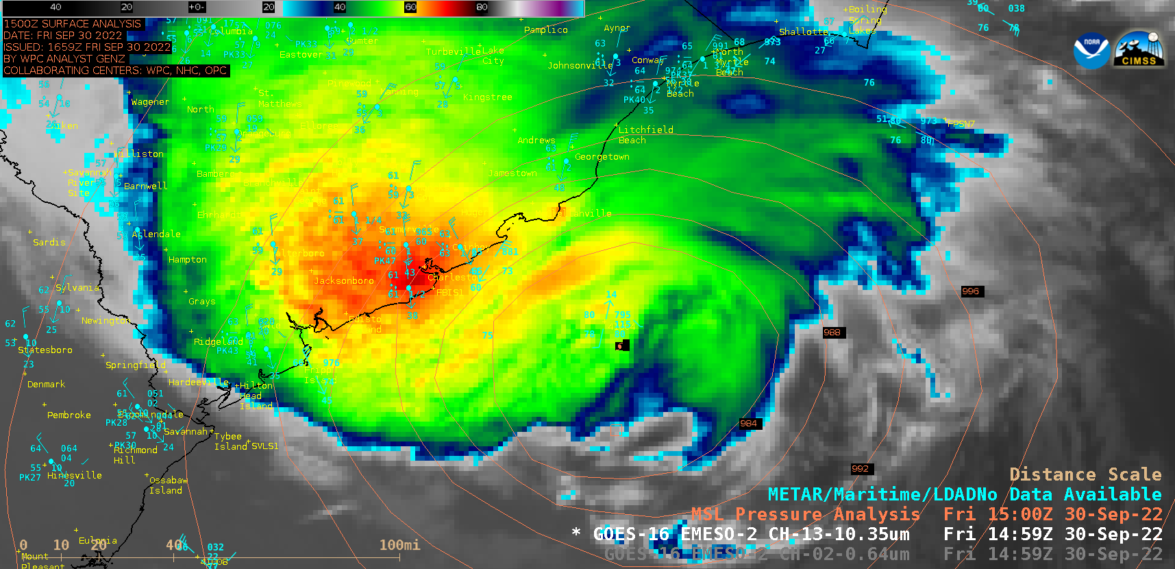
GOES-16 “Clean” Infrared Window (10.3 µm) images [click to play animated GIF | MP4]

