Tornado in metropolitan DC
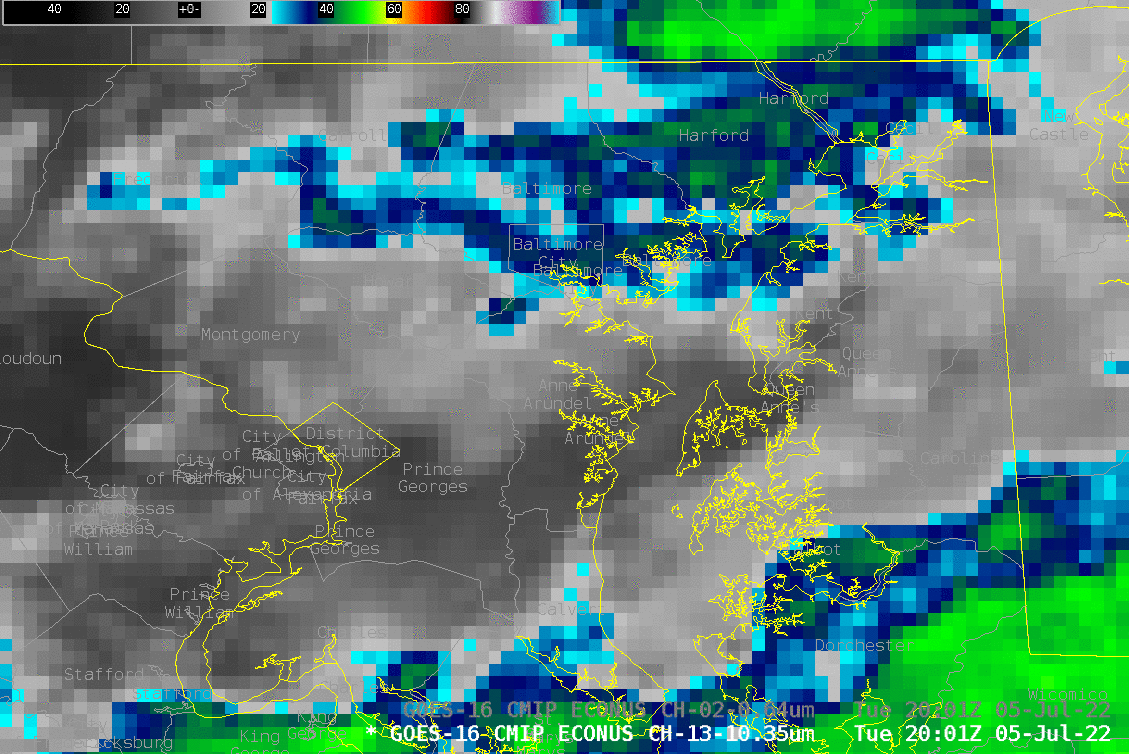
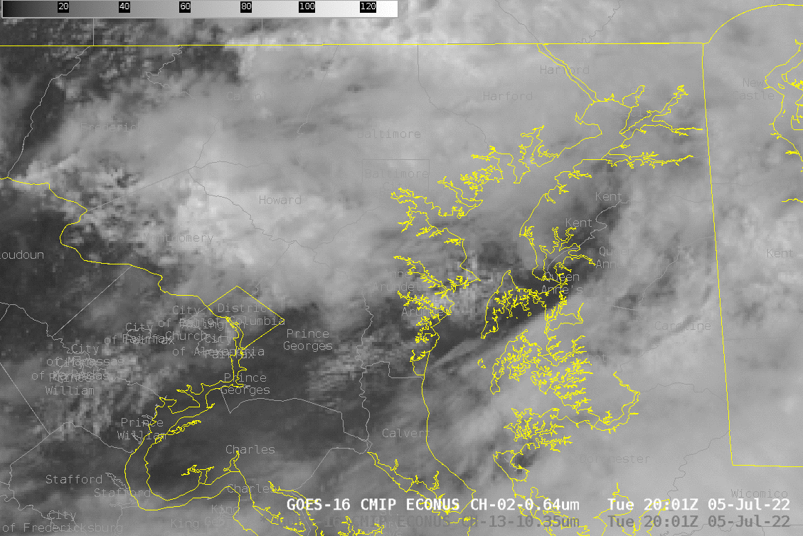
GOES-16 infrared (above) and visible (below) imagery late in the afternoon of 5 July 2022 show the development of convection in between Baltimore and the District of Columbia. Tornadoes occurred in both Prince George County, just east and north of the District of Columbia, and over Anne Arundel county, just south of Baltimore (SPC Storm reports from 5 July). The storms that spawned these tornadoes (between 2130 UTC and 2200 UTC) developed quickly between DC and Baltimore, with tops cooling to about -55oC. Note that a parallax shift (to the south-southeast, towards the GOES-16 sub-satellite point at 0o N, 75.2o W) should be applied to these images to georeference them properly to the Earth’s surface. The repetitive re-development of cooler cloud tops between DC and Baltimore from 2100 – 2300 UTC suggests some kind of boundary to focus development in that region.
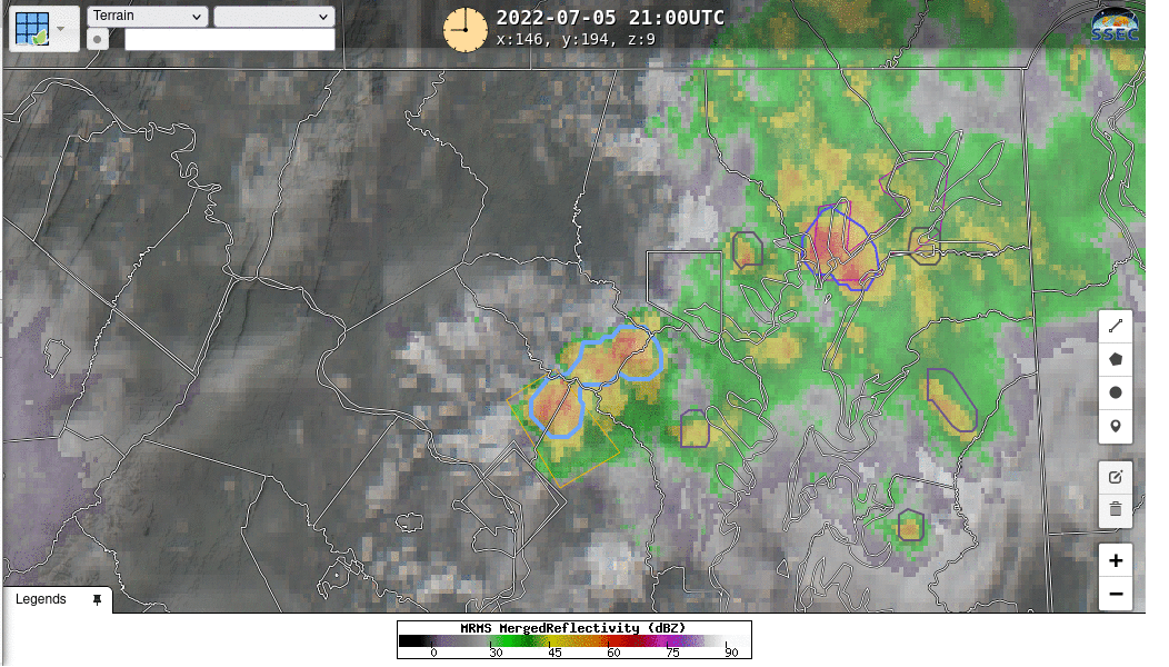
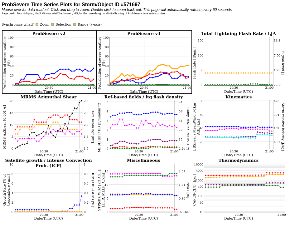
NOAA/CIMSS ProbSevere (v. 3) — available at this website (and in AWIPS at select NWS Offices) was useful for this storm in that it showed highest values with the radar object associated with the tornado, thus conveying information to a forecaster (or radar operator) on which cell to investigate most thoroughly. The radar cell that spawned the tornado consistently had ProbSevere values exceeding 40%, compared to values in the 10-20% range for other radar objects.
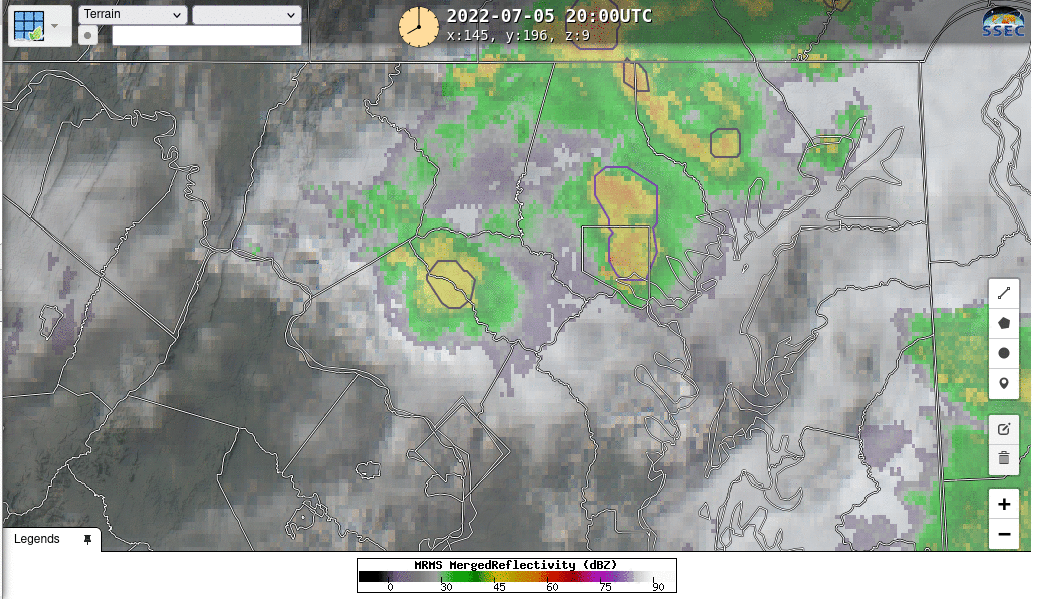
The ProbSevere website includes links to print out time series plots of particular radar objects. For this event, analysis is a bit complicated because the radar object was assigned a new ID value between 2100 and 2105 UTC, perhaps associated with the radar object splitting, as shown in this 2100/2105 UTC toggle, when the radar object was northeast of DC and southwest of Baltimore.
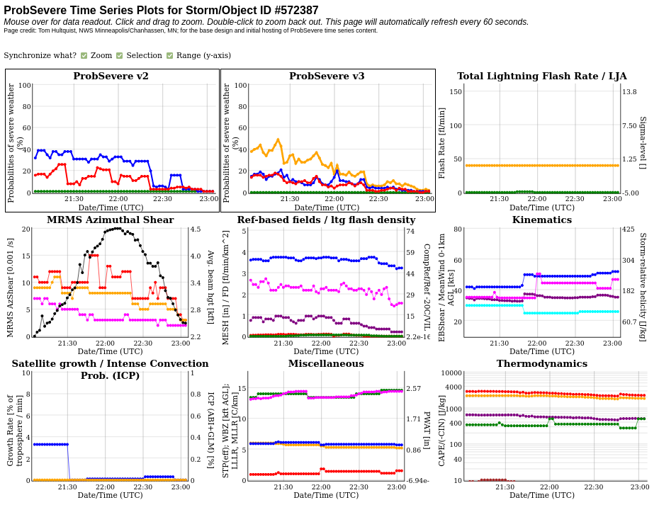
ProbSevere (v. 3) on this data gave useful information in highlighting the advanced threat with this particular cell compared to surrounding radar cells.
This event was also written up in the Washington Post (link). (Thanks to my sister for sending me the link!) Severe Thunderstorm warnings with the severe cell were issued at 2055 UTC (expiring at 2145 UTC), and at 2118 UTC (expiring at 2215 UTC); the first tornado warning was issued at 2121 UTC (expiring at 2145 UTC). The cell that produced the tornadoes had a long warning history.