Using the Night Microphysics RGB and LightningCast probabilities to anticipate nighttime convection and Lightning
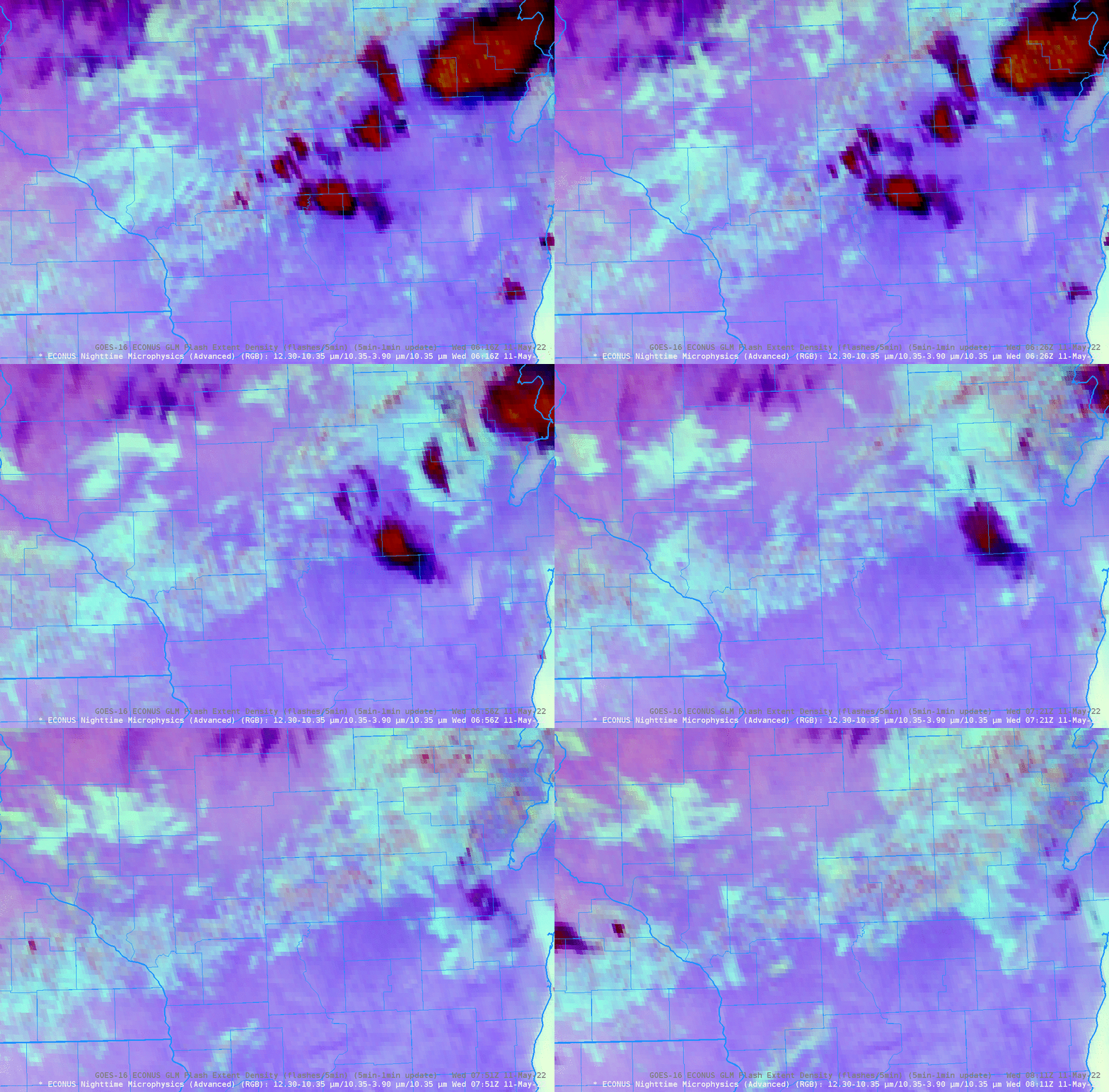
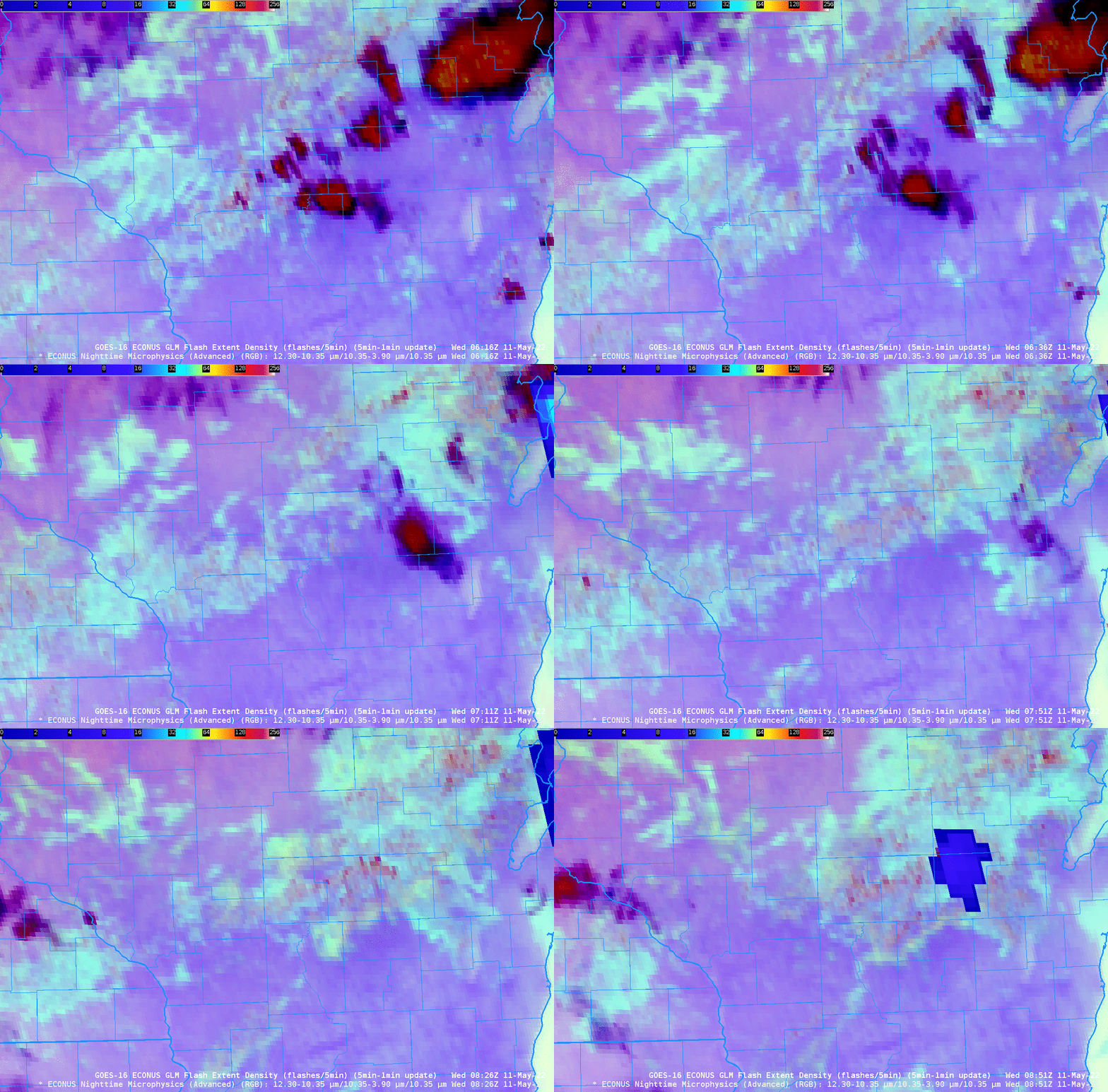
The Nighttime Microphysics RGB, above, over central Wisconsin (that’s Green Bay at the northeastern edge, and southeast Minnesota/northeast Iowa over the southwestern part, of the animation), shows a field of low clouds stretching west-southwest to east-northeast. Note however, the occasional appearance of redder pixels within the field (as shown in this annotated image from 0806 UTC), especially in Wood and Portage counties (Click here for a map of Wisconsin counties). That kind of signal suggests that vertical cloud growth is occurring. Do you think convection will occur shortly? What about lightning?
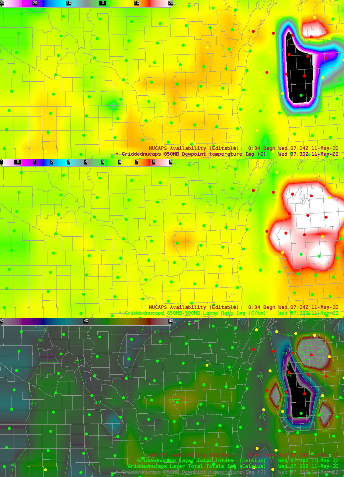
NOAA-20 overflew this region shortly after 0730 UTC, and NUCAPS profiles would have become available in AWIPS at about the time of the end of the animation. What do they show? The image below shows 850-mb Temperature and the 850-500 mb lapse rates computed from gridded NUCAPS fields. The steepest lapse rates and strongest instability is centered on a NUCAPS profiles in central WI (in Adams County) which is just south of the band of clouds identifiable in the Night Microphysics RGB shown above: NUCAPS profiles show ample instability just south of this line (and winds are southerly: 0000 UTC Green Bay sounding).
The individual NUCAPS soundings in Adams County and Green Lake County, below, show very steep mid-level lapse rates.

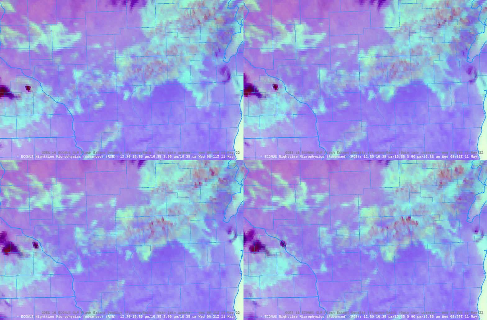
The GOES animation of Nighttime Microphysics above ended at 0811 UTC. What happened in the next 15 minutes? Note a continued development in the amount of reddish pixels! During these 15 minutes, radar is also showing increasing returns.
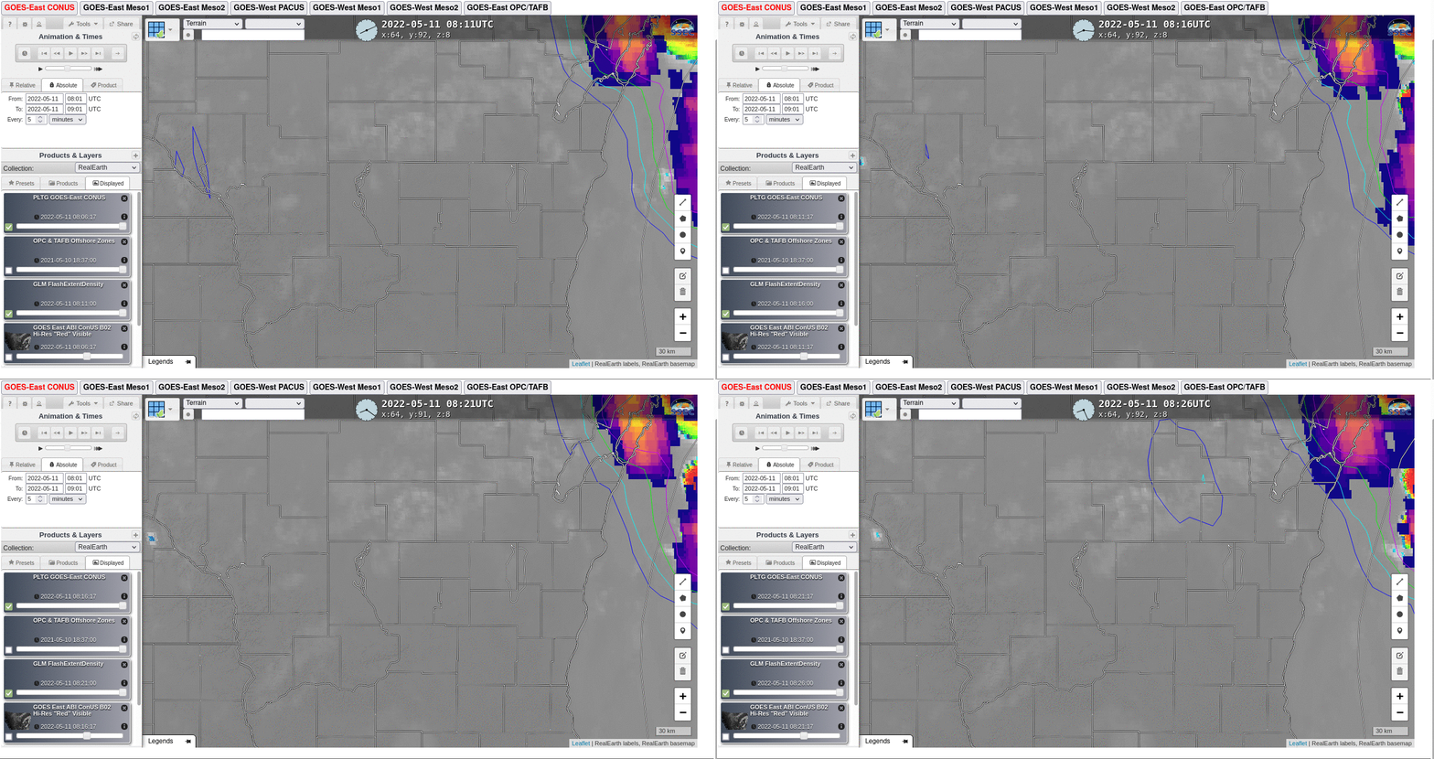
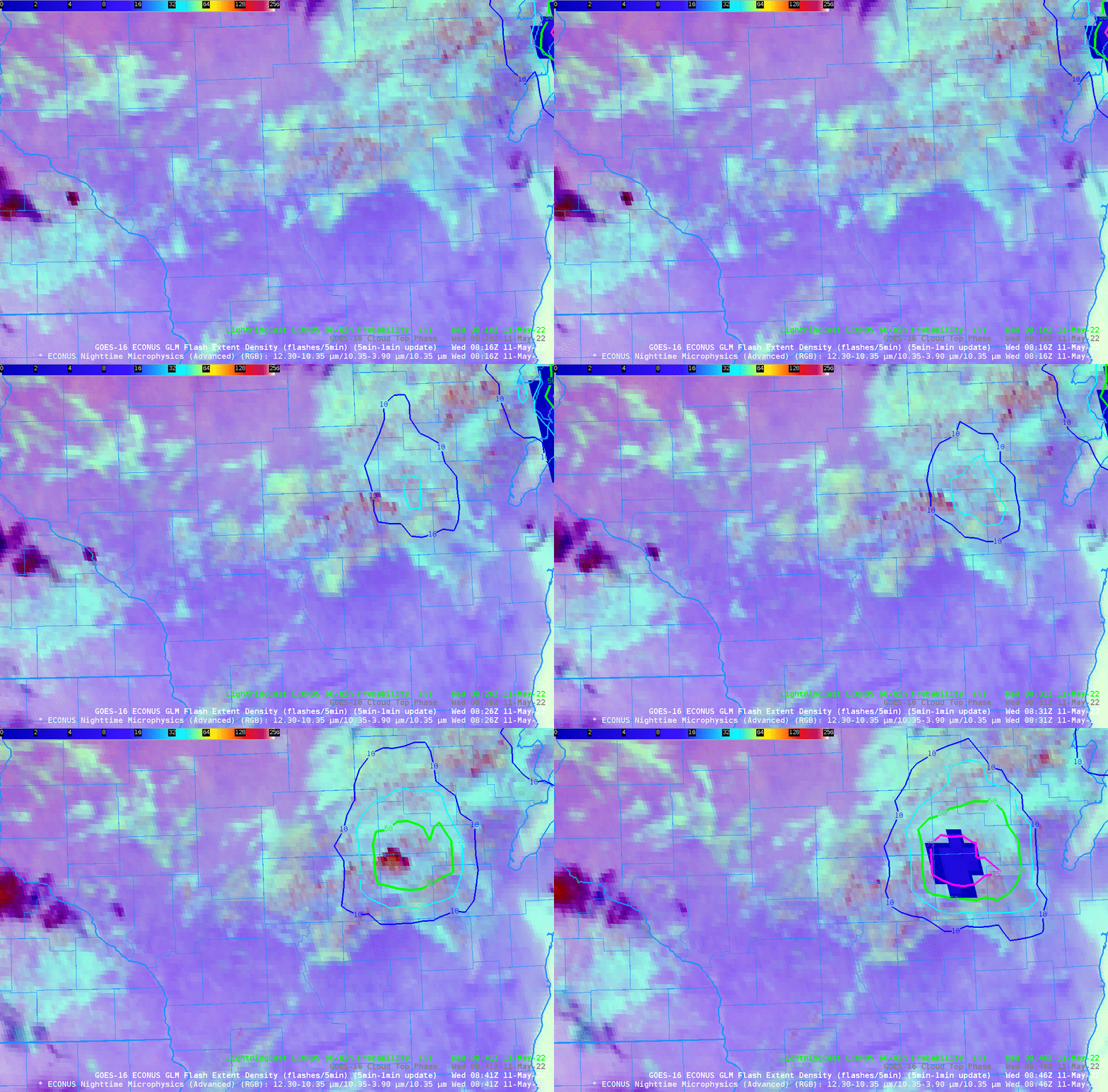
If convection is expected, lightning might also occur. Lightning Cast is a product in the NOAA/CIMSS ProbSevere portfolio, and it’s available online here, and a short training video is here. LightningCast probabilities for the same 15-minute span as above are shown below. Low probabilites are present until 0826 UTC. When do you think lightning might occur with this developing line?
The animation below follows the developing cells through the next 15 minutes — from 0826 to 0841 UTC. Nighttime Microphysics (overlain by radar: note the parallax shift, and also note the continued reddening of pixels in the RGB where convection is occurring) is on the left, and LightningCast Probabilities are on the right. Do you think lightning is imminent?

The first GLM observations (with a CONUS time cadence of every 5 minutes) of lightning occurred at 0846 UTC, as shown in the animation of the Nighttime Microphysics RGB below. (Here is LightningCast at 0846 UTC).
The animation below shows the NightMicrophysics RGB overlain with LightningCast Probabilities, from 0816 to 0846 UTC.
Gridded NUCAPS fields for this blog post were created using the NOAA/TOWR-S Cloud Instance of AWIPS. Thank you! And here is a link to a presentation detailing how the Nighttime Microphysics RGB can be used in winter!

