First thunderstorm of the season in the Anchorage, Alaska area
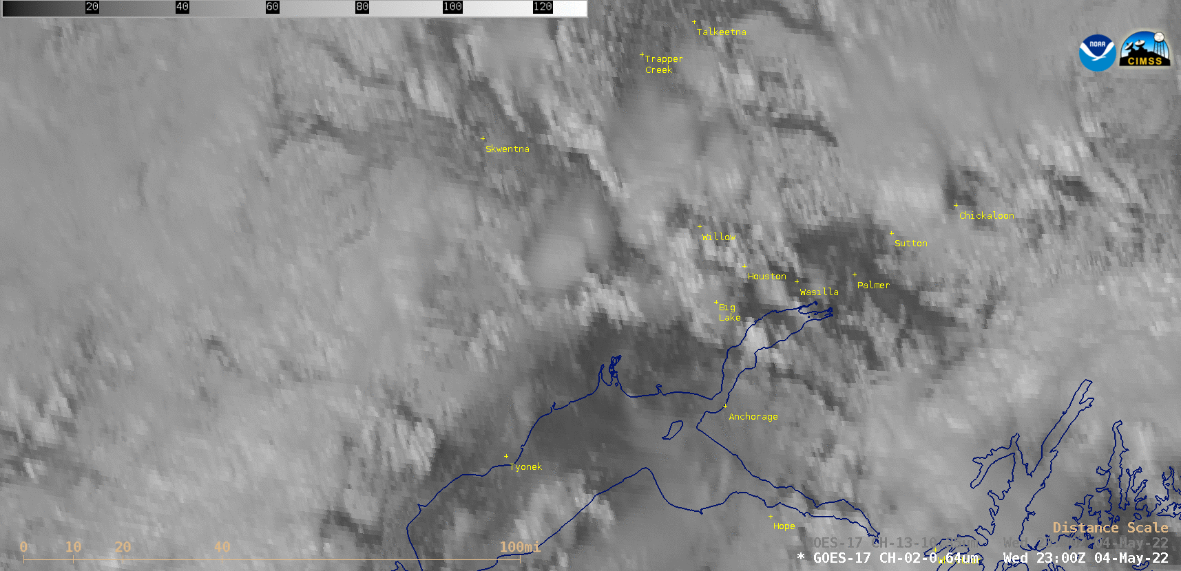
GOES-17 “Red” Visible (0.64 µm) images [click to play animated GIF | MP4]
1-minute Mesoscale Domain Sector GOES-17 (GOES-West) “Red” Visible (0.64 µm) images (above) showed these isolated thunderstorms as they moved north-northwestward up the Susitna Valley (northwest of Anchorage).
In the corresponding 1-minute GOES-17 “Clean” Infrared Window (10.35 µm) images (below), the coldest cloud-top infrared brightness temperatures of the thunderstorms were around -35ºC (darker blue enhancement).
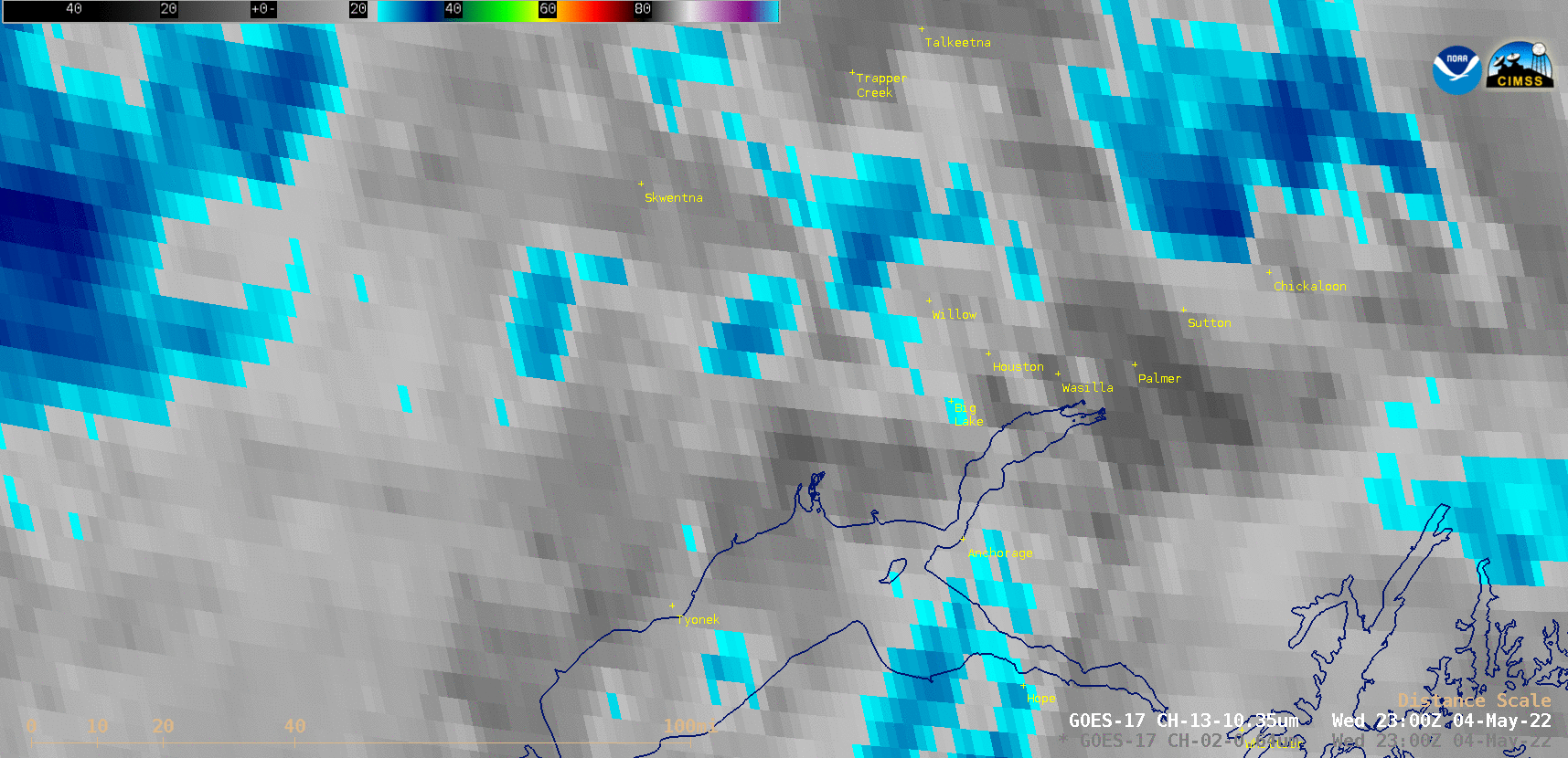
GOES-17 “Clean” Infrared Window (10.35 µm) images [click to play animated GIF | MP4]
A toggle between Suomi-NPP VIIRS Visible (0.64 µm) and Infrared Window (11.45 µm) images around 2201 UTC (below) included a plot of available NUCAPS sounding points from NOAA-20.
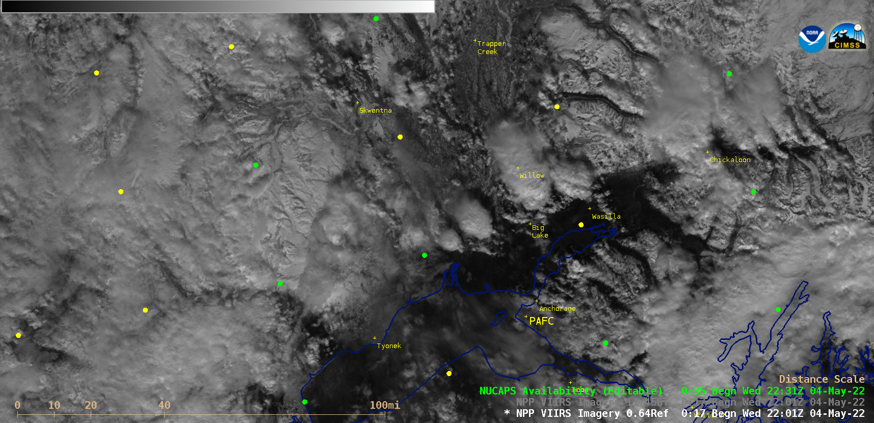
Suomi-NPP VIIRS Visible (0.64 µm) and Infrared Window (11.45 µm) images and 2201 UTC [click to enlarge]
The NOAA-20 NUCAPS profile for the green (infrared + microwave) sounding point 25 miles WSW of Big Lake (below) diagnosed a surface parcel CAPE value of 616 J/kg, with a Lifted Index of -3.
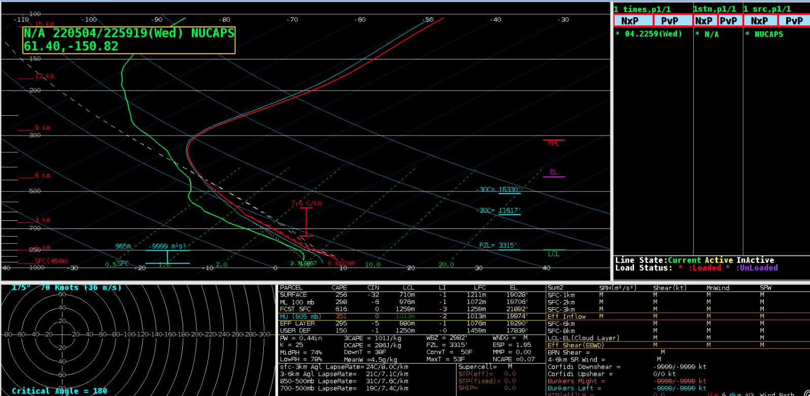
NOAA-20 NUCAPS profile for the sounding point 25 miles WSW of Big Lake [click to enlarge]
A later toggle between Suomi-NPP VIIRS Visible (0.64 µm) and Infrared Window (11.45 µm) images and 2345 UTC is shown below; the coldest cloud-top infrared brightness temperature of the thunderstorms was -38ºC (near Big Lake), which closely corresponded to the altitude of the Equilibrium Level on the NUCAPS profile.

Suomi-NPP VIIRS Visible (0.64 µm) and Infrared Window (11.45 µm) images and 2345 UTC [click to enlarge]