Severe weather in South Carolina

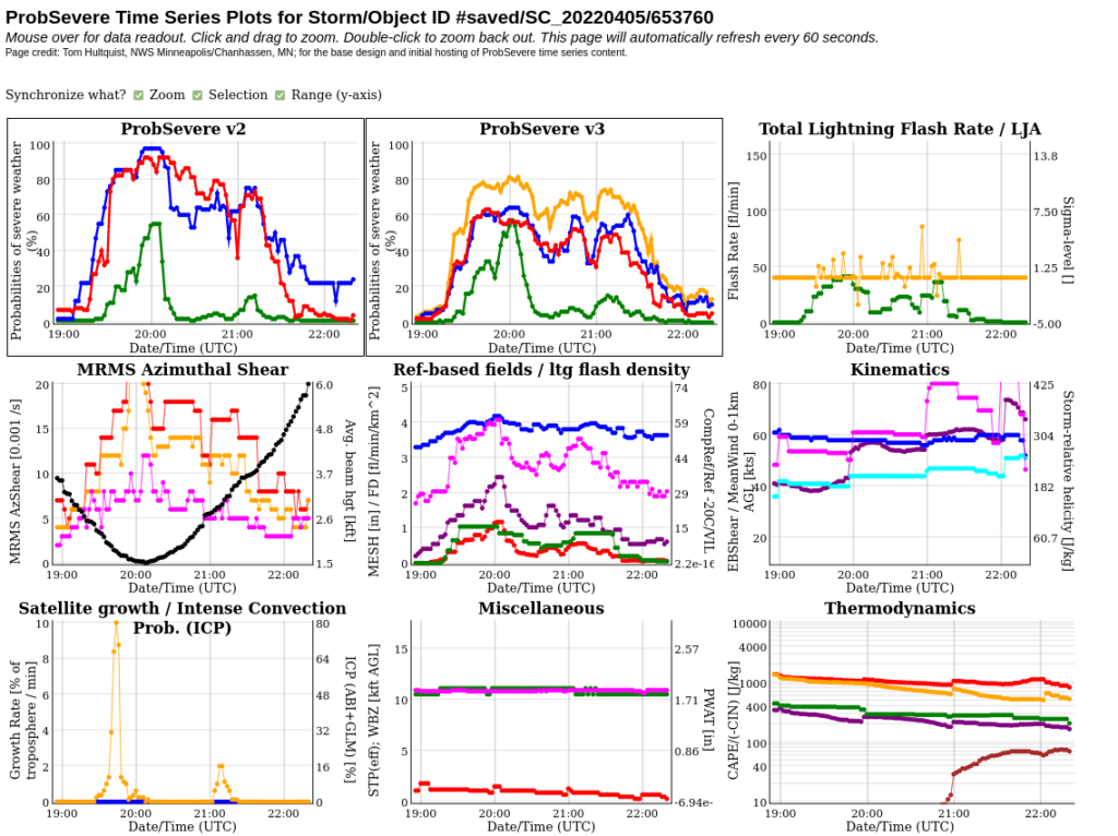
SPC Storm Reports from 5 April 2022 note a Tornado hit Allendale SC shortly before 2000 UTC. The animation above shows the ProbSevere (version 2 — available online here) display prior to and just after the tornado. NOAA/CIMSS ProbSevere identifies and tracks the radar feature associated with this tornadic storm. ProbSevere is designed to give forecasters more confidence in warning issuance. ProbSevere in this case highlights the radar object associated with model fields and satellite/radar observations that are most suggestive of a storm supporting tornadogenesis — note that ProbSevere values in adjacent cells are smaller. A meteorogram of this radar object, shown below (and available here), shows the ProbSevere components, and also ProbHail/ProbWind/ProbTor/Probsevere values, for both versions 2 and 3. ProbSevere values increased at around 1930 UTC. ProbSevere v3 values generally are smaller than ProbSevere v2 values; ProbSevere v3 will be demonstrated this year at the Hazardous Weather Testbed (HWT) this year. (Click here to view the Charleston, SC (KCLX) radar at 1958 UTC; a pronounced hook is apparent)

This tornadic cell stood out in the visible imagery. GOES-16 Mesoscale Sector #2 on 5 April included portions of South Carolina. The mp4 animation below, from the CSPP Geosphere site, (this direct link to the animation will be valid for a bit less than a week) shows the tornadic cell erupting at around 1930 UTC near the Georgia/South Carolina border.
Observations — satellite and radar — both showed the obvious storm. How did short-range guidance perform? A Polar Hyperspectral modeling system — also to be demonstrated at the Hazardous Weather Testbed — produces hourly 18-hour forecasts with initial fields influenced by Sounder Data from the Polar Orbiting satellites Suomi-NPP, NOAA-20, Metop-B and Metop-C. Infrared sounder (CrIS on Suomi/NPP and IASI on Metop) and Microwave sounder (ATMS on Suomi/NPP, AMSU/MHS on Metop) data can produce a more accurate initialization of the moisture distribution in atmosphere. The forecast initialized at 1200 UTC for Lifted Index and Significant Tornado Parameter, valid at 18, 19 and 20 UTC — that is, 6-h, 7-h and 8-h forecasts, below, shows increasing instability before the tornado in Allendale.

The model runs initialized at 1700, 1800 and 1900 UTC, showing fields from initialization through 0000 UTC on 6 April 2022, are shown below. Note that the area with a Significant Tornado Parameter signal is mostly confined to southeastern South Carolina — that is, near the coast. Storm reports show that severe weather was mostly near the coast as well.


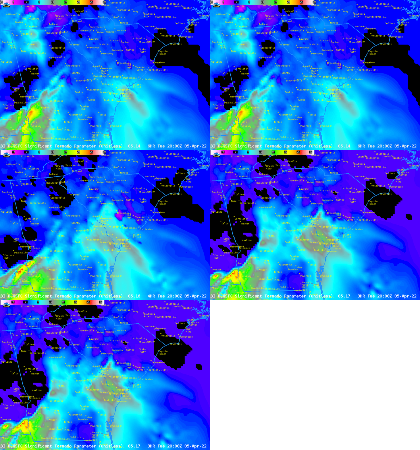
These fields are also available in AWIPS via an LDM feed (in preparation for HWT). The 3 images below show changes in the 2000 UTC forecast (from the model initialized at 1400, 1600 and 1700 UTC). The trend towards higher Significant Tornado Parameter over southeastern South Carolina is obvious. Note that Allendale’s location is shown.

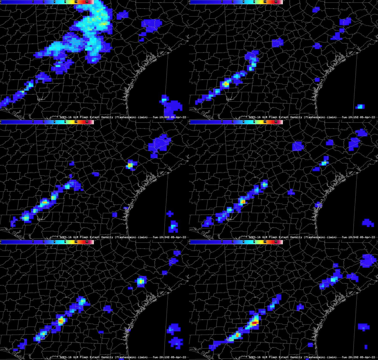
Added: the GLM on GOES-16 saw a dramatic increase in Flash Extent Density with the tornadic storm starting around 1925 UTC on 5 April. (Click here to see a slower animation from 1920 – 1930 UTC)


