Strong potential vorticity anomaly off the California coast
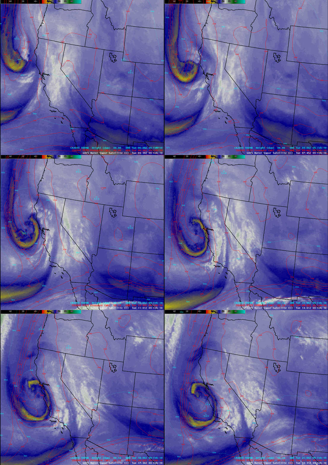
A strong potential vorticity (PV) anomaly was propagating southeastward just off the California coast on 09 February 2010 — and this feature had a striking presentation on AWIPS images of GOES-11 water vapor channel data (above), with a pronounced arc of very dry air (yellow color enhancement) seen around the periphery of the circulation. According to the CRAS model fields, the tropopause (taken to be the pressure of the PV1.5 surface) was being brought downward as low as the 600 hPa pressure level within the core of the PV anomaly.
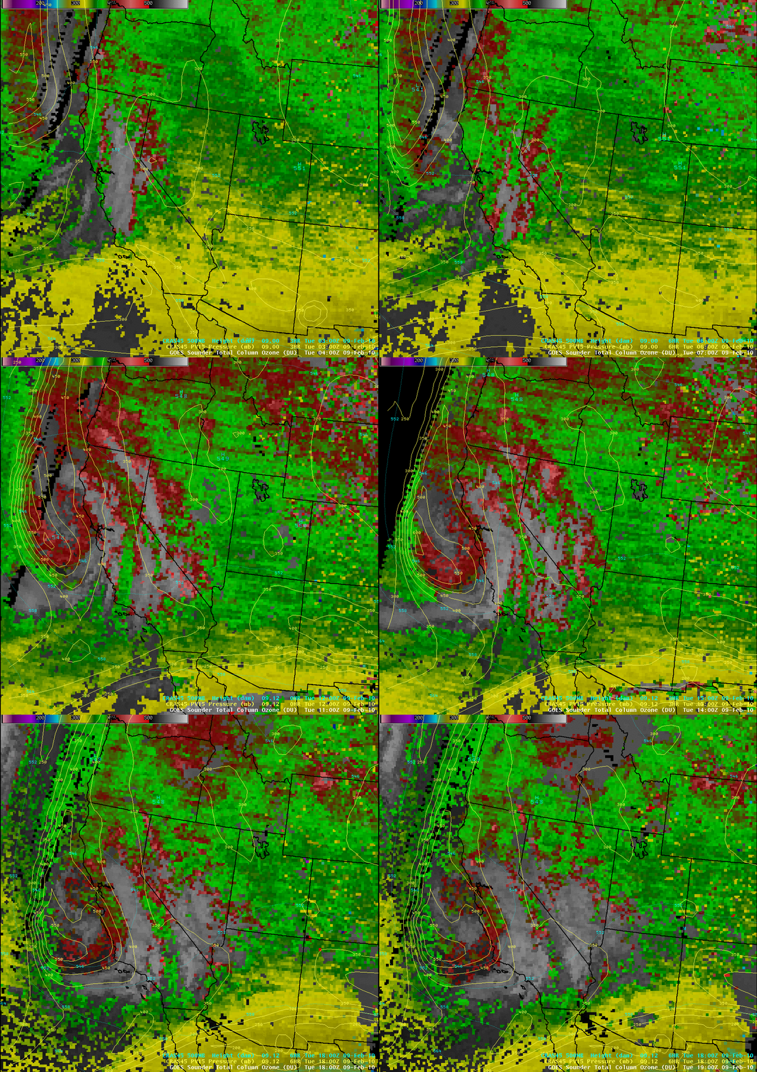
Images of the GOES-11 sounder Total Column Ozone derived product (below) depicted ozone values as high as 430 Dobson Units (red color enhancement) in the vicinity of the PV anomaly, supporting the idea that the tropopause height was very depressed within the circulation feature.
=================================
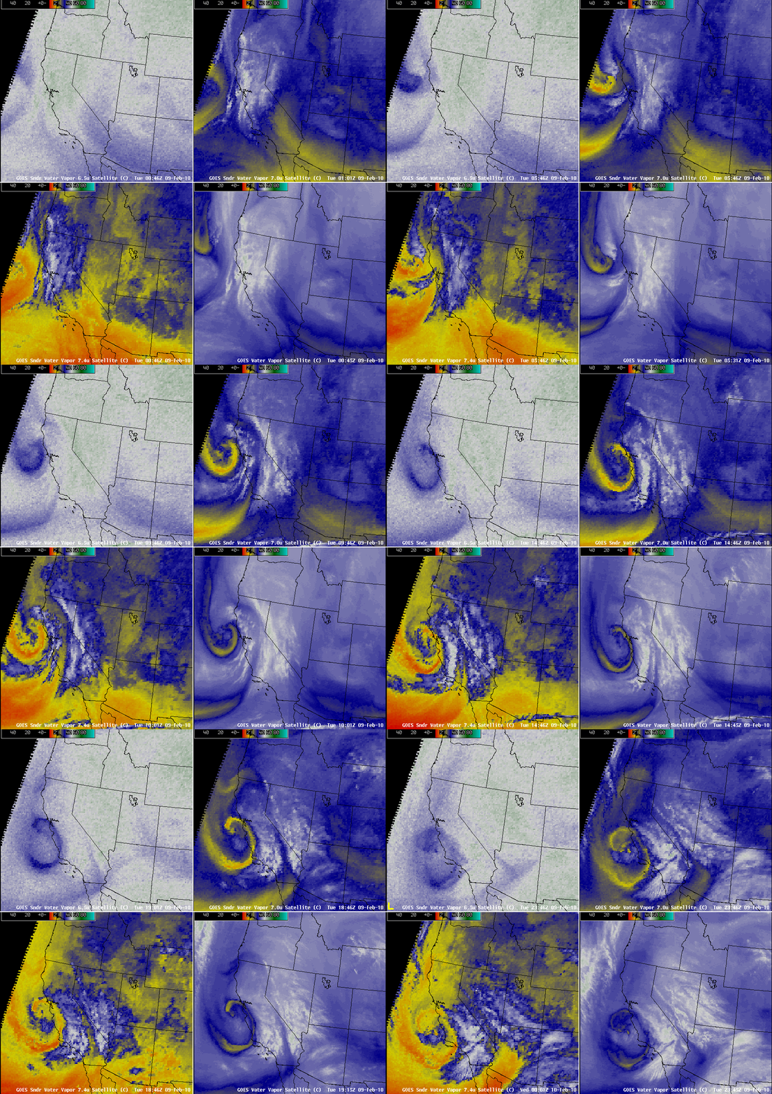
A 4-panel comparison of the three water vapor channels on the GOES-11 Sounder (6.5 µm, 7.0 µm, and 7.4 µm) and the GOES-11 Imager 6.7 µm water vapor channel (above) showed that the dry air signature was even quite evident on the Sounder 6.5 µm channel (darker blue color enhancement, upper left panels) — this particular water vapor channel weighting function normally peaks quite high in the atmosphere (around 325 hPa), where these types of water vapor gradients and signatures are usually not as well-defined.
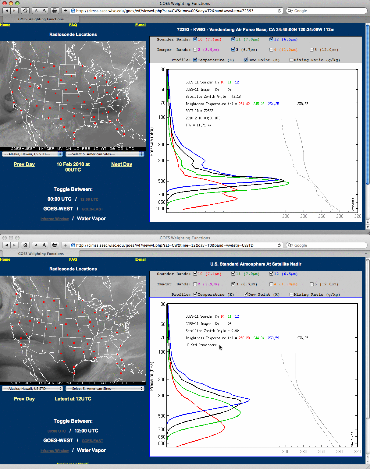
However, due to the dry air within the middle to upper troposphere associated with the PV anomaly, the weighting functions of all 4 of the GOES-11 water vapor channels (calculated using rawinsonde data from Vandenberg Air Force Base) peaked at altitudes that were quite a bit lower compared to the more “normal” conditions that would be seen in a US Standard Atmosphere or USSA environment (below). Convection moving onshore across southern California that day was responsible for at least one sighting of a waterspout in the San Diego area, and inland precipitation amounts of 1.0 to 1.5 inch were widespread.


