Increasing ice along the western and southern nearshore waters of Lake Michigan
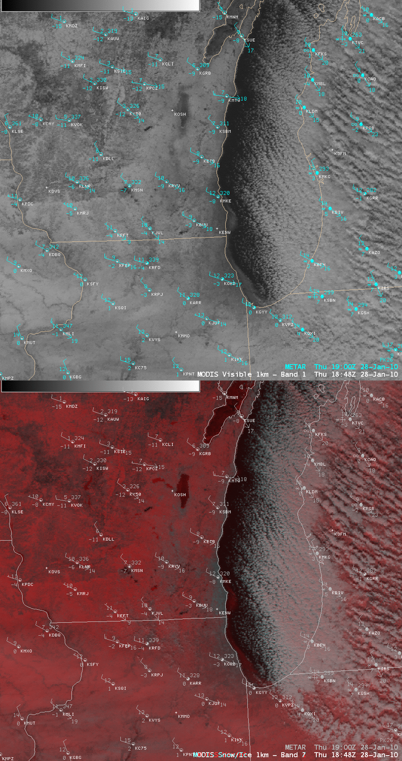
A story on the National Weather Service Milwaukee/Sullivan website highlighted the appearance of ice on Lake Michigan on MODIS imagery on 28 January 2010. A comparison of AWIPS images of the 1-km resolution MODIS visible channel and a false color Red/Green/Blue (RGB) image (above) confirms that the brighter features seen on the visible image over the nearshore waters (from Milwaukee, Wisconsin to Chicago, Illinois to Gary, Indiana) were indeed lake ice (snow cover and ice appear as darker red features on the MODIS false color RGB image). This example offers a glimpse at the type of RGB image capability that should be available with the upcoming AWIPS II software.
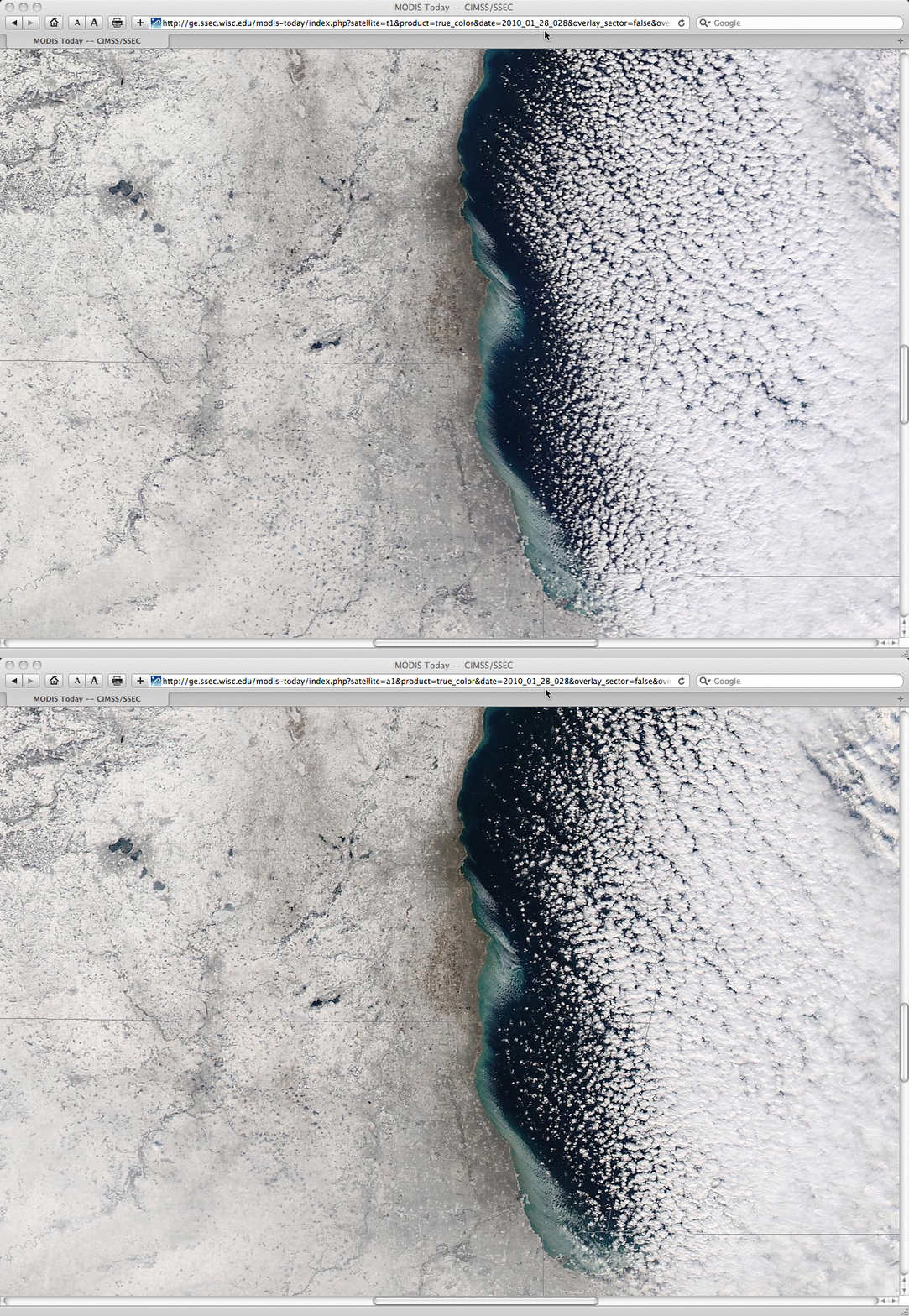
A closer view using 250-meter resolution true color images from the SSEC MODIS Today site (below) revealed that the northwesterly surface winds were causing a small amount of motion of the ice field between the time of the Terra satellite overpass (17:11 UTC or 11:11 am local time) and the Aqua satellite overpass (18:54 UTC or 12:54 pm local time).
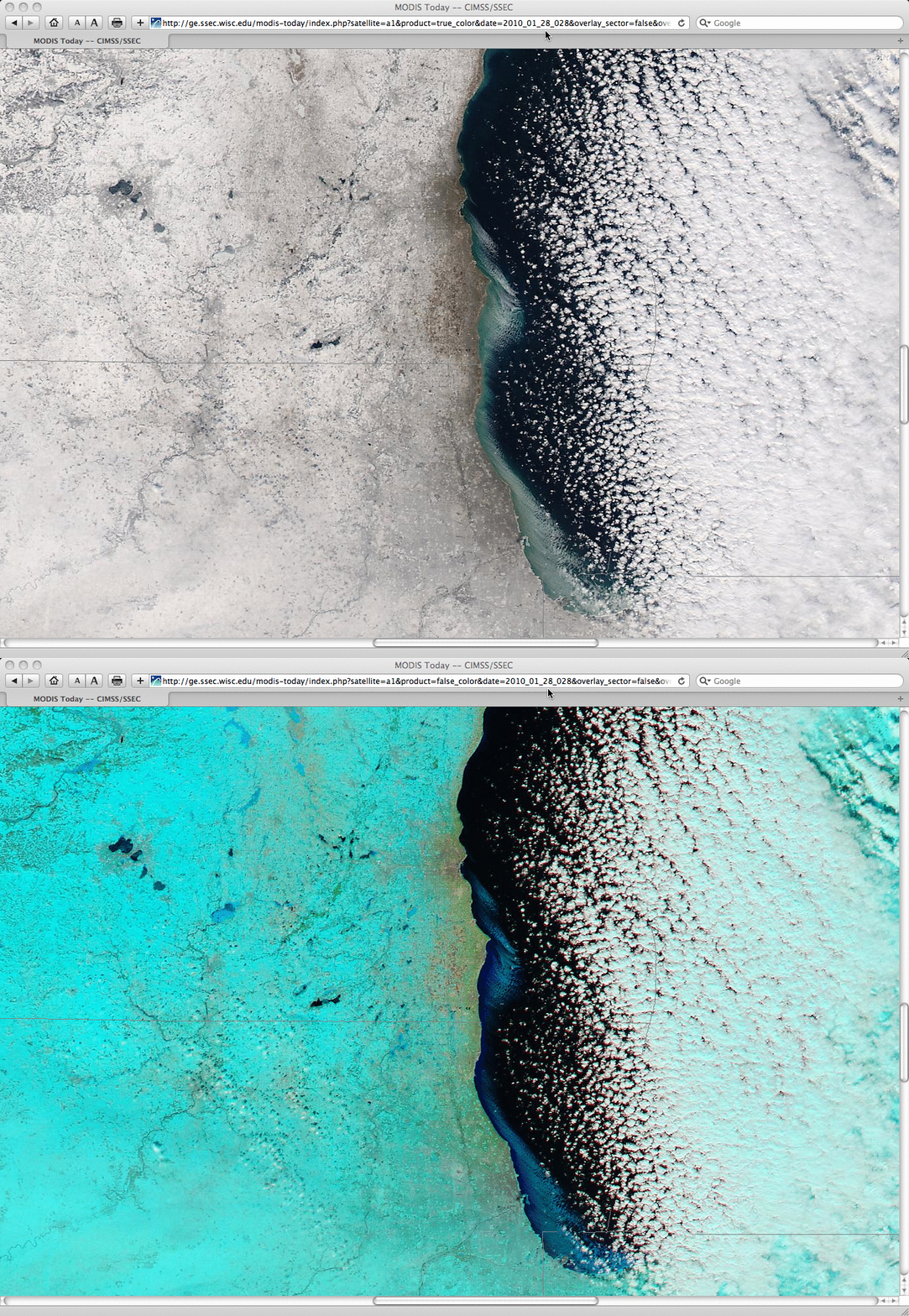
A comparison of the 18:54 UTC Aqua MODIS true color and false color images (below) again confirms that the features seen over the nearshore waters were indeed lake ice — snow cover and ice appear as cyan-colored features on this particular false color imagery.


