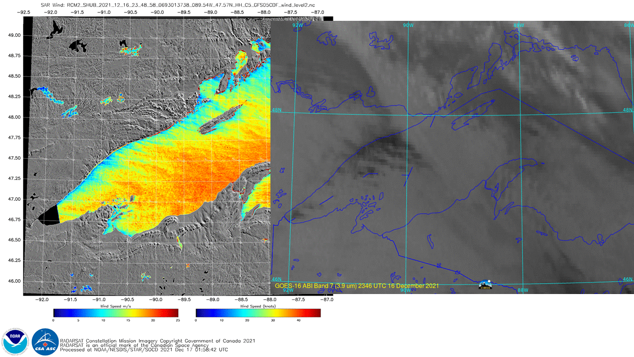
SAR winds and Lake-Effect cloud bands

Synthetic Aperture Radar (SAR) winds in select small domains are routinely available (with good latency, i.e., within 2 or 2-1/2 hours) at this website. Coverage over the Great Lakes typically occurs within an hour of 0000 UTC and 1200 UTC on each day. The image above (direct link) shows derived SAR winds (from the RCM2 satellite) over Lake Superior at 2348 UTC on 16 December 2021. Winds over Lake Superior are around 40 knots; weaker wind speeds are indicated in the lee of Isle Royale, the various Apostle Islands, Upper Michigan’s Keewenaw Peninsula, near Marquette Bay, and right offshore Minnesota. Fingers of stronger winds extend east-southeastward from just off the Minnesota shoreline. This small horizontal variability in the wind speeds is too small to be detected by other microwave detectors (such as ASCAT on Metop-B and Metop-C).
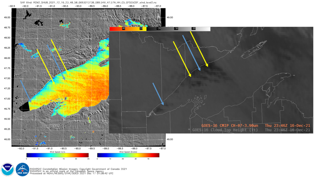
The toggle above shows the winds with a time-matched image of GOES-16 Band 7 (3.9 µm) data (created using Geo2Grid), stretched to enhance low-level clouds. The second toggle includes best-guess location-matched arrows of features in the SAR winds and the GOES-16 ABI brightness temperature. That figure is reproduced below with an AWIPS display of GOES-16 3.9 µm imagery at 2346 UTC (again with a stretched colortable to emphasize low-level temperature contrast).
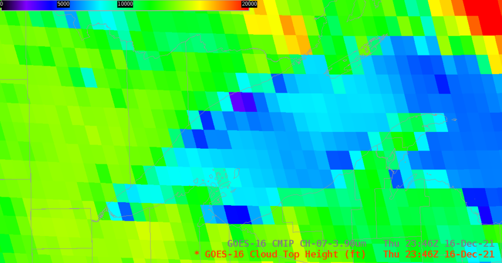
GOES-16 satellite imagery over Lake Superior will have a parallax shift because the location is far from satellite nadir. Parallax shift is related to cloud-top heights, and derived Cloud-Top Heights (a Level 2 product) over the region show cloud tops between 3000 and 5000 feet near Minnesota, rising to about 7000 feet over Lake Superior in between Minnesota and the Keewenaw Peninsula. This parallax shift means that features will be displayed to the north and a bit to the west of their true location, displaced away from the GOES-16 sub-satellite point at 0oN, 75.2o W.
These images suggest that lake-effect clouds are regions of enhanced wind speeds. The inferred convective roll vortices present in the satellite imagery are also regions of enhanced convergence and upward moisture transport.