GOES-17 Fog/Low Stratus (FLS) product availability in AWIPS
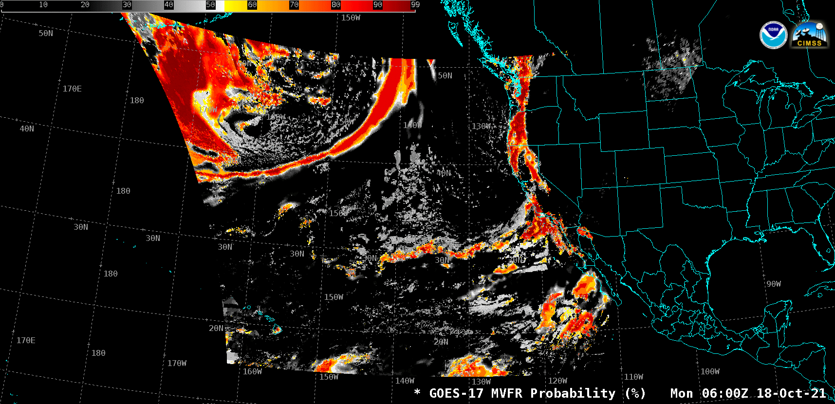
GOES-17 MVFR Probability over the PACUS Sector [click to play animation]
The suite of Fog/Low Stratus (FLS) products derived using GOES-17 (GOES-West) data within the PACUS Sector (above) became available via the Satellite Broadcast Network (SBN) for AWIPS on 18 October 2021. Two examples are shown below: one centered over Oregon, and the other centered over the Big Island of Hawai’i. The 4 products are Marginal Visual Flight Rules (MVFR, cloud ceiling 1000 to 3000 feet above ground level and/or visibility 3 to 5 miles) Probability, Instrument Flight Rules (IFR, cloud ceiling 500 feet to less than 1000 feet and/or visibility 1 to less than 3 miles) Probability, Low Instrument Flight Rules (LIFR, cloud ceiling less than 500 feet and/or visibility less than 1 mile) Probability and Cloud Thickness.
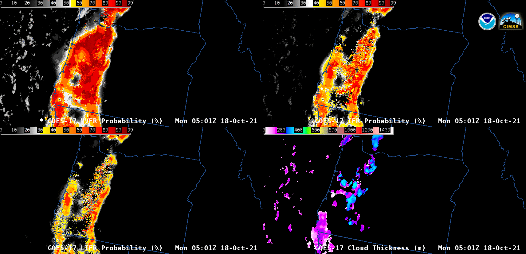
GOES-17 MVFR Probability (top left), IFR Probability (top right), Low IFR Probability (bottom left) and Low Cloud Thickness (bottom right) [click to play animation]
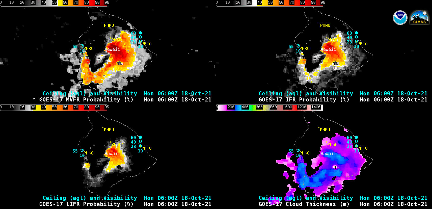
GOES-17 MVFR Probability (top left), IFR Probability (top right), Low IFR Probability (bottom left) and Low Cloud Thickness (bottom right) [click to play animation]
GOES-17 FLS products are also being produced by CIMSS over the Alaska region (below) — which are being distributed via an LDM feed.
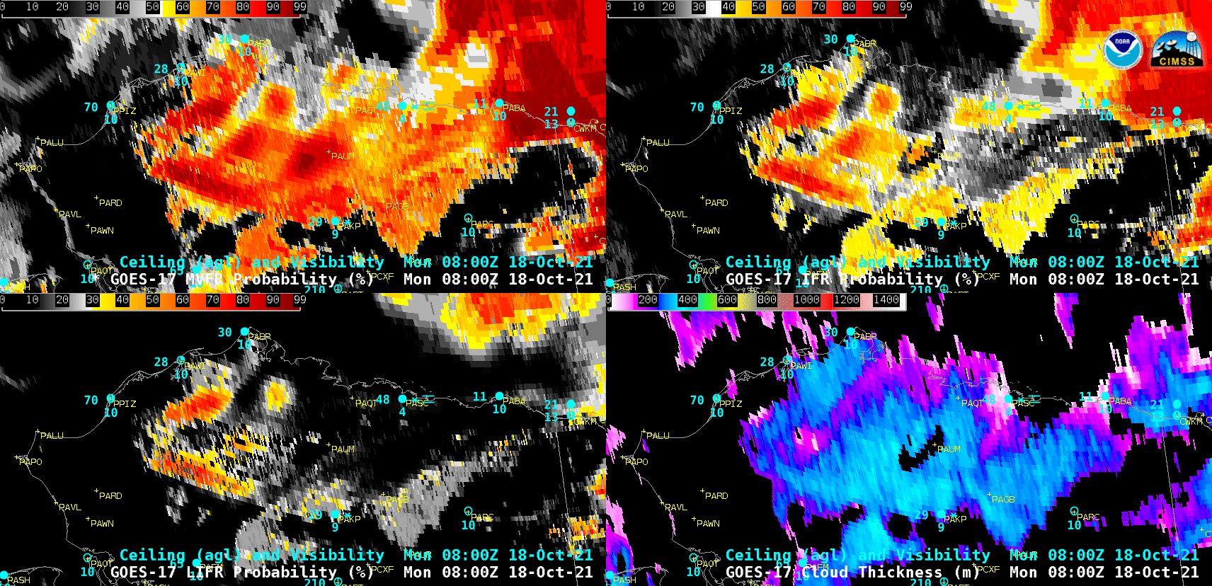
GOES-17 MVFR Probability (top left), IFR Probability (top right), Low IFR Probability (bottom left) and Low Cloud Thickness (bottom right) [click to play animation]
A library of FLS applications can be found on the GOES-R Fog Product Examples site, and FLS Forecaster Training is available here.