Tropical Storm Bill in the Atlantic Ocean

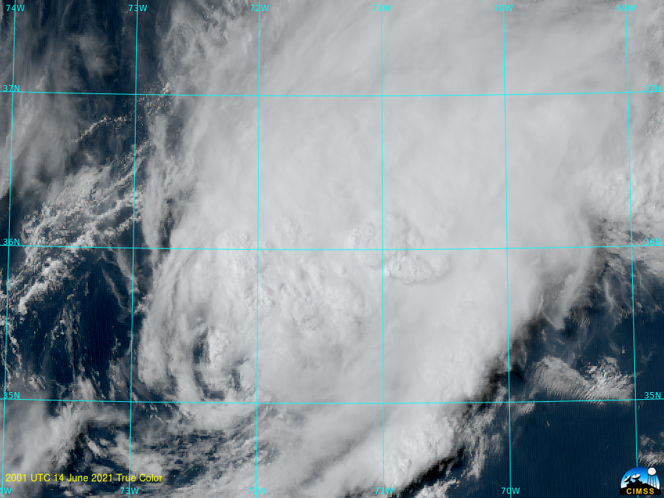
GOES-16 True-Color imagery showing Tropical Depression #2 over the western Atlantic Ocean, 2001 – 2331 UTC on 14 June 2021 (Click to animate)
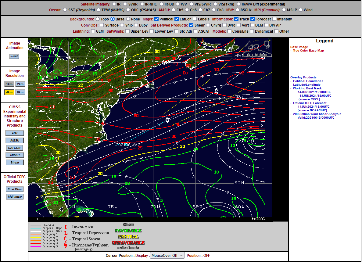
True-color imagery derived from GOES-16, above, shows a low-level cyclonic circulation associated with then Tropical Depression #2 to the east of Cape Hatteras over the western Tropical Atlantic. The satellite imagery suggests strong southwesterly shear: ongoing deep and vigorous convection is far removed to the east and northeast of the near-surface circulation visible in the imagery. Indeed, a shear analysis from the CIMSS Tropical page, below, shows values in excess of 50 knots over the storm. Despite the strong shear, this depression was upgraded to Tropical Storm Bill at 0300 UTC on 15 June 2021.
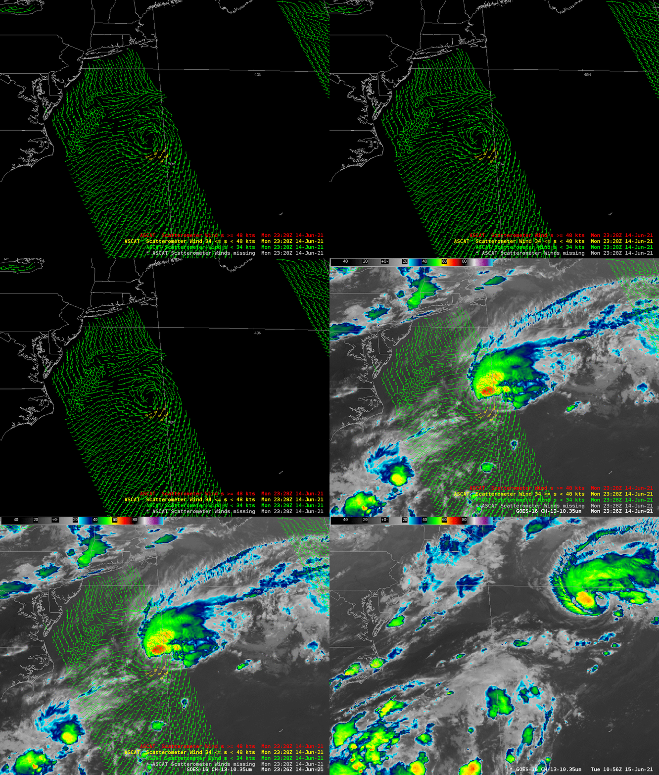
Scatterometry winds helped with the intensity determination. The 2328 UTC 14 June overpass, below, shown in a toggle with the ABI Band 13 infrared imagery, shows the circulation with 40-knot winds on the south side. Included in the image is the 1056 UTC 15 June image, showing the quick northeastward progress of the storm, and also showing the degradation in the storm’s symmetry.

Scatterometry winds, 2328 UTC on 14 June and GOES-16 ABI clean window infrared (Band 13, 10.35 µm) imagery, along with the 1056 UTC 15 June clean window infrared imagery (click to enlarge)
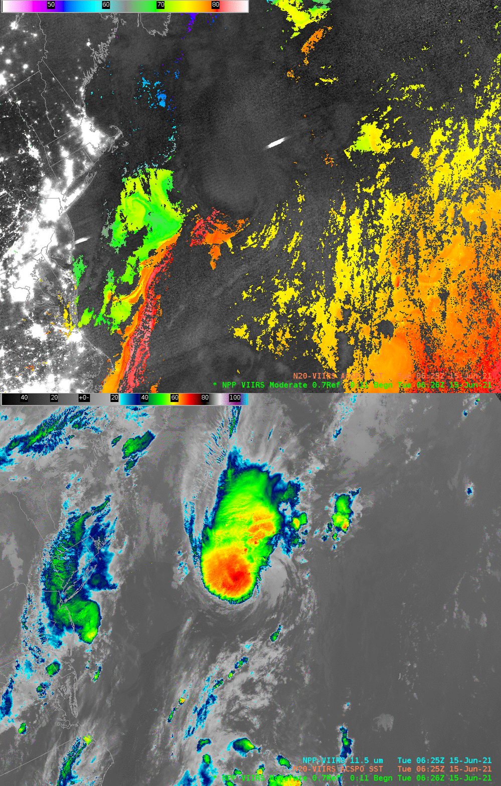
Suomi-NPP overflew the storm at 0626 UTC on 15 June. The Day Night Band imagery, below, overlain on top of derived ACSPO SSTs and toggled with the VIIRS I05 11.45 µm window channel imagery (obtained from the Direct Broadcast site at the University of Wisconsin-Madison), show evidence of lightning northeast of the storm center. SSTs within the core of the Gulf Stream are 81 F. The core of the storm at 0626 UTC as depicted in the infrared imagery below is far more symmetric than in either of the two times, 2326 UTC on 14 June, and 1056 UTC 15 June, in the toggle above.

Suomi-NPP VIIRS Day Night Band visible (0.70 µm) imagery overlain on top of ACSPO SSTs toggled with VIIRS I05 (11.45 µm) infrared imagery, 0626 UTC on 15 June 2021 (Click to enlarge)
Refer to the National Hurricane Center website for more information on Bill.


