SAR winds over Lake Superior (part II)
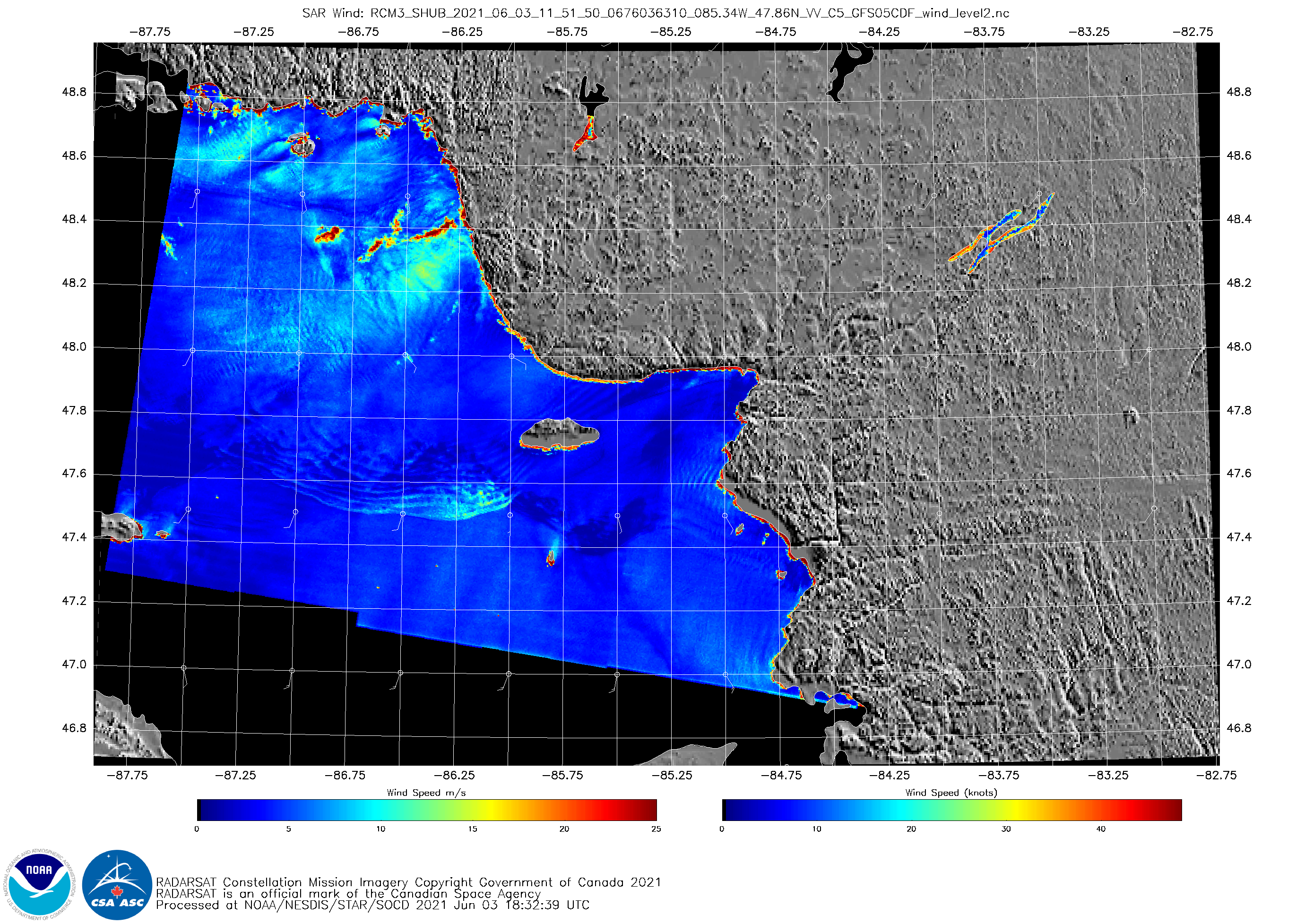
SAR Wind Speeds from RCM3 over Lake Superior at 1152 UTC on 3 June 2021 (Click to enlarge)
This past CIMSS Blog Post showed a region of very strong bowing winds diagnosed by Synthetic Aperture Radar (SAR) data and associated with a convective complex over Lake Superior before sunset on 25 May 2021. On 3 June 2021, shortly after sunrise (SAR overpasses over the Great Lakes typically occur around 0000 and 1200 UTC), SAR winds from RCM3 (RADARSat Constellation Mission 3) (as shown at this website), showed isolated patches over northern Lake Superior of very strong winds — in excess of 25 m/s! (SAR wind imagery is from this website)
GOES-16 visible imagery (0.64 µm), below, from 1120 – 1200 UTC, visualized using CSPP Geosphere, shows the modest convection associated with these winds.
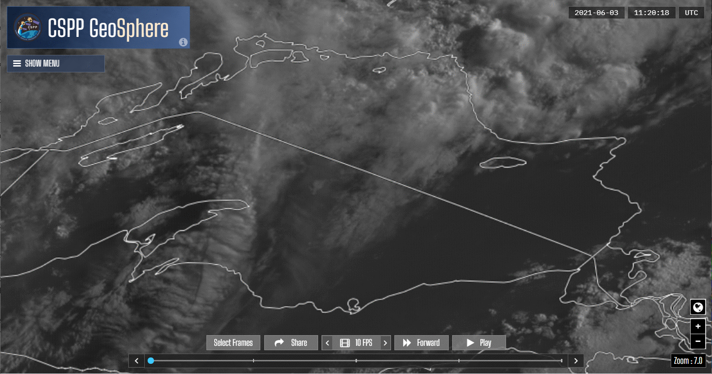
GOES-16 visible (0.64 µm) imagery, 1120-1200 UTC on 3 June 2021 (Click to enlarge)