Severe weather across much of the Southeast US
![GOES-16 “Red” Visible (0.64 µm) images, with SPC Storm Reports plotted in red [click to play animation | MP4]](https://cimss.ssec.wisc.edu/satellite-blog/images/2021/05/210504_goes16_visble_spcStormReports_Deep_South_anim.gif)
GOES-16 “Red” Visible (0.64 µm) images, with SPC Storm Reports plotted in red [click to play animation | MP4]
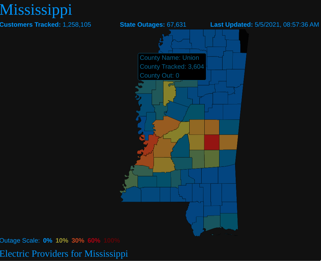
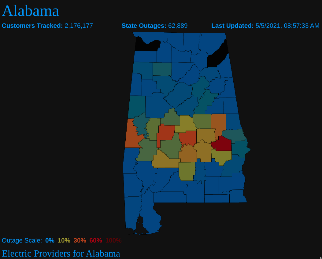
The corresponding 1-minute GOES-16 “Clean” Infrared Window (10.35 µm) images (below) showed numerous overshooting tops that exhibited infrared brightness temperatures in the -75 to -70ºC range (white pixels embedded within black areas). The MCS also produced heavy rainfall and flooding in parts of northern Alabama.
![GOES-16 “Clean” Infrared Window (10.35 µm) images, with SPC Storm Reports plotted in cyan [click to play animation | MP4]](https://cimss.ssec.wisc.edu/satellite-blog/images/2021/05/210504_goes16_infrared_spcStormReports_Deep_South_anim.gif)
GOES-16 “Clean” Infrared Window (10.35 µm) images, with SPC Storm Reports plotted in cyan [click to play animation | MP4]
? It rained a little yesterday…
Rainfall totals of 5-7″ (locally higher) fell across parts of the Birmingham metro & much of Shelby Counties. This lead to significant flooding in many areas. Thankfully, there were no fatalities. #alwx pic.twitter.com/ko0TmYhNUo
— NWS Birmingham (@NWSBirmingham) May 5, 2021
Larger-scale views of 5-minute CONUS Sector GOES-16 Visible and Infrared images are shown below. Several additional MCSs produced a variety of severe weather across other parts of the Southeast US.
![GOES-16 “Red” Visible (0.64 µm) images, with SPC Storm Reports plotted in red [click to play animation | MP4]](https://cimss.ssec.wisc.edu/satellite-blog/images/2021/05/210504_goes16_visible_spcStormReports_Southeast_US_anim.gif)
GOES-16 “Red” Visible (0.64 µm) images, with SPC Storm Reports plotted in red [click to play animation | MP4]
![GOES-16 “Clean” Infrared Window (10.35 µm) images, with SPC Storm Reports plotted in cyan [click to play animation | MP4]](https://cimss.ssec.wisc.edu/satellite-blog/images/2021/05/210504_goes16_infrared_spcStormReports_Southeast_US_anim.gif)
GOES-16 “Clean” Infrared Window (10.35 µm) images, with SPC Storm Reports plotted in cyan [click to play animation | MP4]