Tropical Depression (update: Tropical Storm Surigae) over the western Pacific

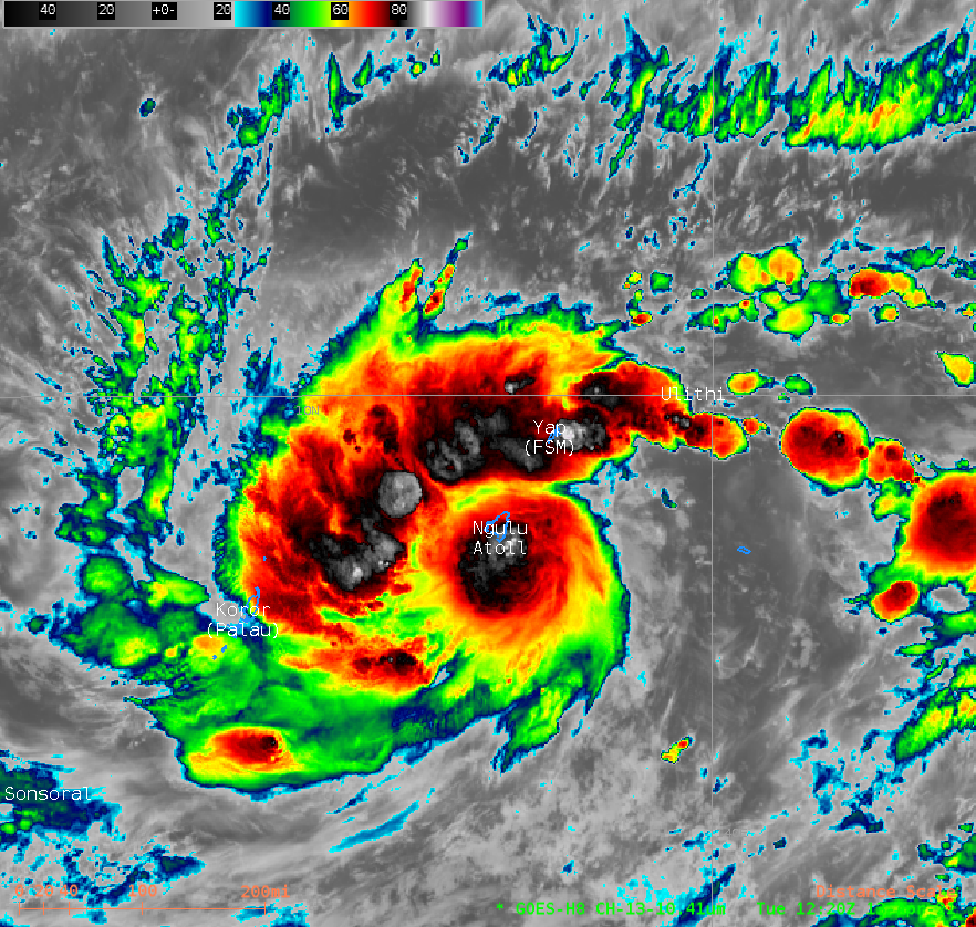
Himwari-8 Clean Window (10.41 µm) Band 13 Infrared imagery, 1220 – 2050 UTC on 13 April 2021 (Click to animate)
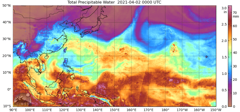
Himawari-8 Window Channel infrared imagery (10.41 µm), above, shows a well-defined tropical disturbance (Tropical Depression #2 has become become Tropical Storm Surigae by 0900 UTC on 14 April; this website shows Pacific basin names and includes audio pronunciation examples) moving between Yap and Palau in the western Pacific to the southwest of Guam. The disturbed weather in this region has persisted for many days as it has moved towards the west-northwest, as shown in the rocking MIMIC Total Precipitable Water animation below.

10-day animation of MIMIC Total Precipitable Water over the western Pacific Ocean, 2-12 April 2021 (Click to animate)
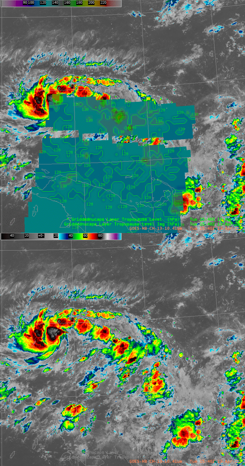
NOAA-20 NUCAPS estimates of tropopause Heights, below, show the storm in a region with a very high tropopause, around 120 hPa. The system is moving towards a region with similarly high tropopauses.

Himawari-8 Clean Window (10.41 µm) infrared imagery overlain with NUCAPS estimates of Tropopause Heights, 1540 UTC on 13 April 2021 (Click to enlarge)
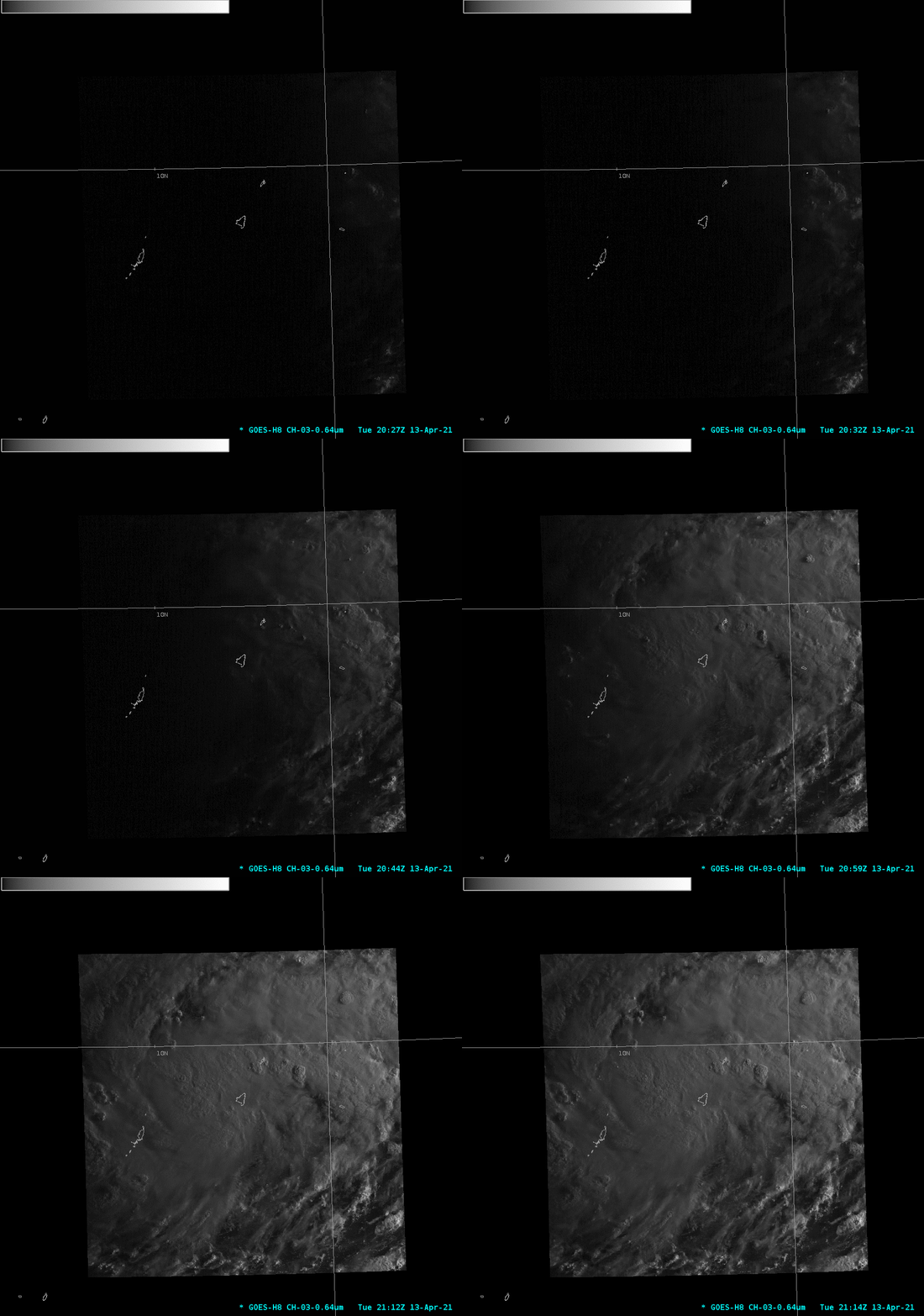
Water Vapor imagery (6.24 µm and 7.3 µm) from near sunrise of 14 April show moist air in the immediate environment surrounding the storm (Link). Visible imagery at sunrise on 14 April, below, show strong and persistent deep convection.
——————————————————————————————————————————————————-
It is interesting to note that during the ~12 hours prior to the disturbance (dubbed Tropical Invest 94W) being named Tropical Depression 02W at 12 UTC on 13 April, 2.5-minute interval Himawari-8 Visible (0.64 µm) images from 0002-0802 UTC (below) revealed a trio of low-level vorticies circulating around the incipient storm center. The northernmost vortex appeared to play a role in the initiation of a small cluster of sheared convection. While an exposed low-level circulation center is common in deteriorating highly-sheared tropical cyclones, the presence of 3 vortices during the formative stages of development is rather unusual.
![Himawari-8 Visible (0.64 µm) images [click to play animation | MP4]](https://cimss.ssec.wisc.edu/satellite-blog/images/2021/04/HIM08_VIS_TD02W_VORTICES_13APR2021_B3_2021103_050709_HIMAWARI-8_0001PANEL_FRAME0000123.GIF)
Himawari-8 Visible (0.64 µm) images [click to play animation | MP4]
——————————————————————————————————————————————————-
Imagery from the CIMSS Tropical Weather Site (link), below, shows the system in a region of very warm Sea Surface Temperatures and modest shear. Strengthening is forecast as it moves towards the Philippines.

Screencaptures from the CIMSS Tropical Weather Website ca. 2100 UTC on 13 April 2021 (Click to enlarge)
Himawari-8 Imagery courtesy of JMA, the Japan Meteorological Agency.


