CSPP GeoSphere views of the Soufriere Eruption on 11 April 2021
GOES-16 True Color Imagery, 1210-1600 UTC on 11 April 2021 (click to animate)
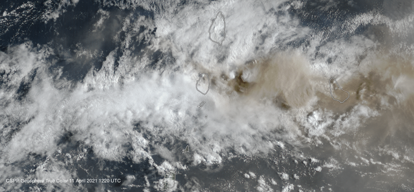
CSPP GeoSphere allows a user to view True Color imagery (and individual GOES-16 bands) in real time using data from the four GOES-16 domains: Full Disk, CONUS, and Mesoscale Sectors 1 and 2. The animation above shows the 1330 UTC eruption (11 April 2021) of Soufriere, one of a series of eruptions from that volcano (as discussed here and elsewhere). The ash emitted by the short (duration) eruption then moves westward towards Barbados, following upper-level winds. (Low-level winds are easterly). The rapid ascent of the ash cloud is documented below, showing 4 images from the Full Disk imagery at 1320, 1330, 1340 and 1350 UTC.

GOES-16 True Color Imagery, at 1320, 1330, 1340 and 1350 UTC on 11 April 2021 (click to animate)
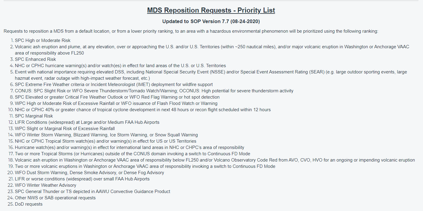
Rapid changes suggest Mesoscale imagery would be useful. Indeed, volcanic events area ranked #2 on the GOES-R MDS Priority List, after only a SPC High/Moderate Risk for Severe weather. Thus, mesoscale Sector 2 imagery was available over the area. That is shown below and it better captures the time of the eruption and better resolves the ascent through the troposphere.

GOES-16 Mesoscale sector 2 True Color Imagery, 1320-1347 UTC (Click to animate)
Seven consecutive zoomed-in 1-minute images are shown below, from 1329 through 1336 UTC on 11 April (with the map removed; CSPPGeo link used here; a similar animation from the CIRA Slider is here.) They show the initial stages of this particular eruption. A Pileus cap is obvious at the top of the eruption at 1329 UTC. (Animation available here as an mp4).

GOES-16 Mesoscale sector 2 True Color Imagery, 1329-1336 UTC (Click to enlarge)
Quantitative information on some aspects of this series of events can be found at the VOLCAT website. You can also find information at the Washington DC VAAC (Volcanic Ash Advisory Center).