Turbulence detection near Alaska

GOES-17 Upper Level Water Vapor infrared (6.19 µm) at 1310 UTC on 22 March 2021. The plot also shows pilot reports of turbulence, ISIG turbulence predictions, and Turbulence Probability fields. (Click to enlarge)
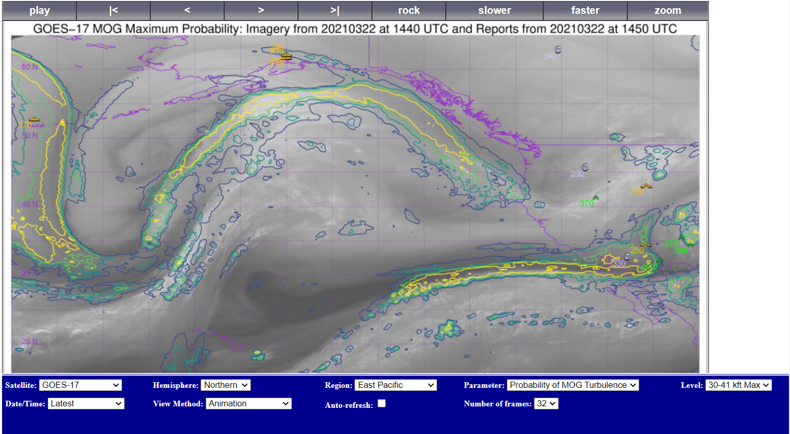
CIMSS now has a real-time product designed to warn (probabilistically) against regions where Moderate Or Greater (MOG) turbulence might occur for aircraft cruising at levels between 30- and 41,000 feet, which is the standard range for commercial airliners. This product was developed using machine learning with satellite data (water vapor and infrared data) and Global Forecast System (GFS) meteorological variables as input, and is an improvement on a previous product that used only satellite data. On 22 March, an important case of prevalent turbulence occurred across the North Pacific and the coast of Alaska. A training video on the product is available here.
The toggle above includes GOES-17 Upper-Level Water Vapor infrared imagery (6.19 µm) with and without Pilot Reports of turbulence, as well as ISIG turbulence polygons. In addition, the Turbulence Probability product is shown. The Turbulence Probability product (which uses GOES-17, GOES-16, Himawari-8, Meteosat-11 or Meteosat-8 data) is also available online here. A screen capture from the website, shown below, shows 1450 UTC data on 22 March 2021. There are many different choices available in the drop-down menus.


